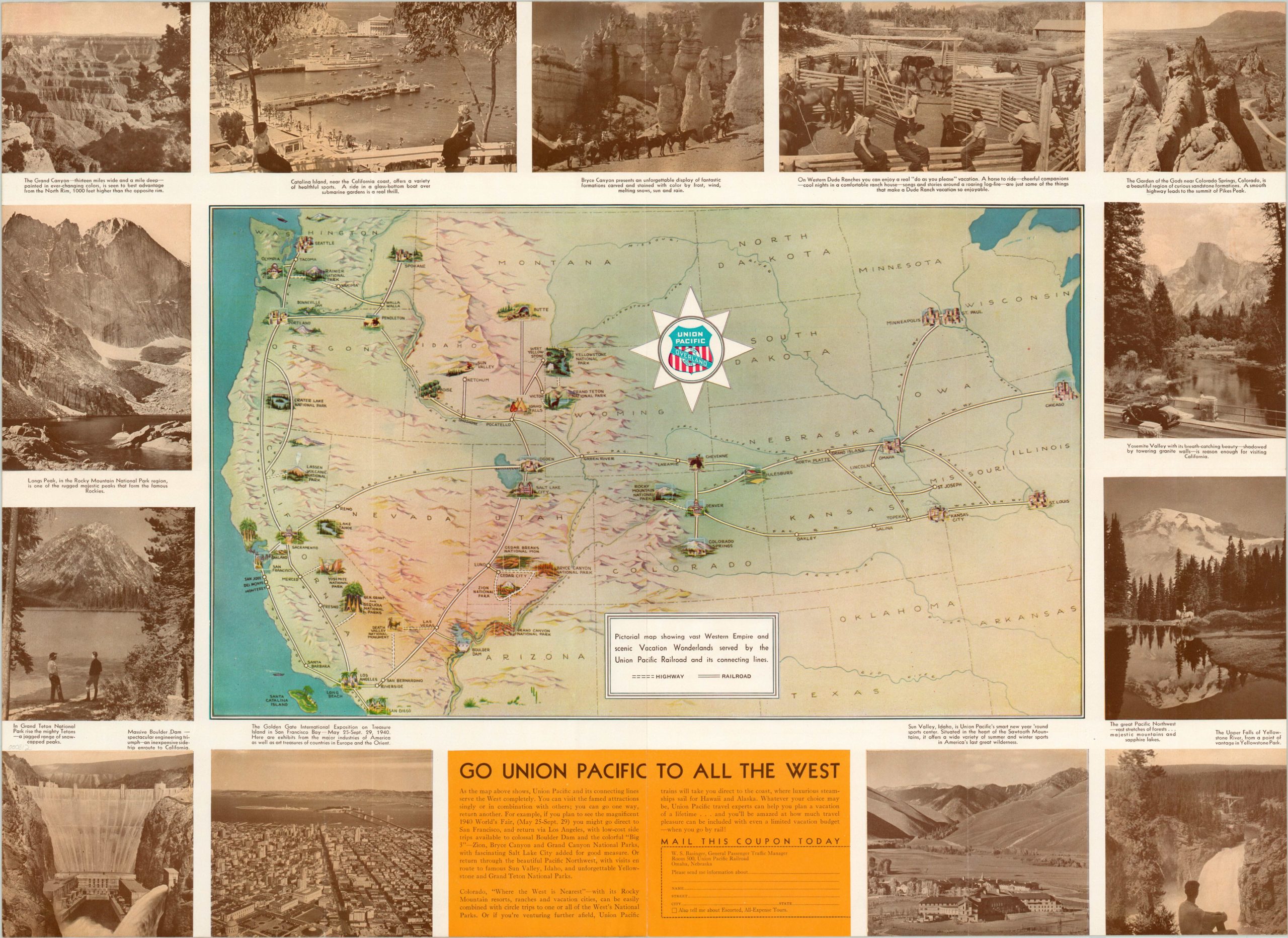
Pictorial map showing vast Western Empire and scenic Vacation Wonderlands served by the Union Pacific Railroad and its connecting lines
$95.00
Promotional pictorial map of the Overland Route of the Union Pacific Railroad.
Description
This map, issued in 1940, shows the vast Western Empire served by the extensive Union Pacific Railroad network, which stretches from Chicago to Los Angeles. Illustrations of popular tourist attractions served by the U.P. and its connections can be seen adjacent to the track’s route, though several spots such as the Grand Canyon and Rainier National Park are accessible only by road.
Photographs of several examples can be seen comprising the border, and include the newly constructed Boulder Dam (1935), Yellowstone, and Treasure Island, the site of the 1940 Golden Gate International Exposition in San Francisco. Text and additional photographs on the verso laud the comfort, speed, and low cost of the Union Pacific trains.
Map Details
Publication Date: 1940
Author: Union Pacific Railroad
Sheet Width (in): 27.50
Sheet Height (in): 19.90
Condition: A
Condition Description: Faint wear along fold lines and minor waviness visible along the bottom of the sheet.
$95.00

