Pictorial Map of the American Continent featuring the Pan American Highway
$75.00
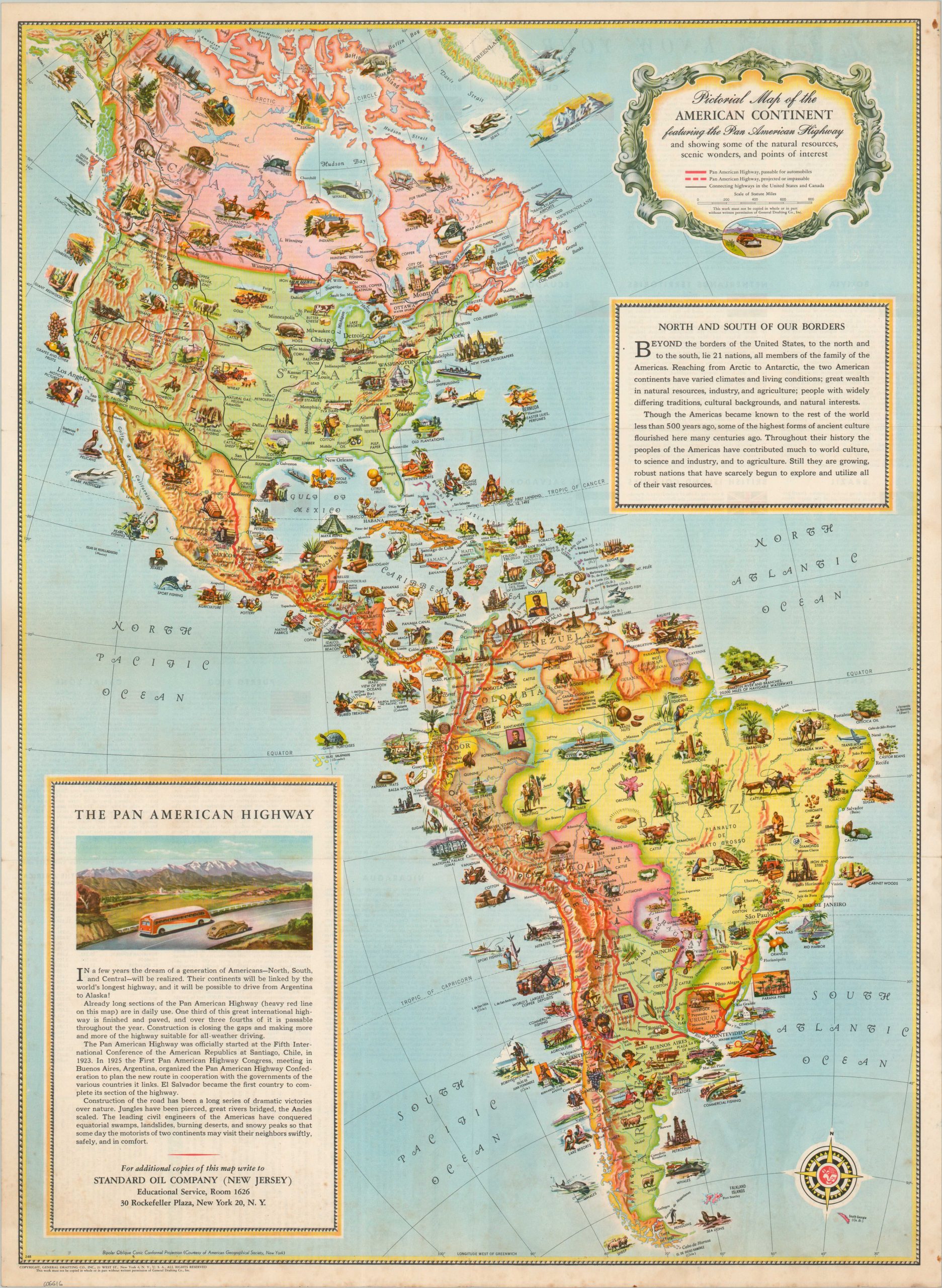
Beautiful pictorial map of the Western Hemisphere promoting Pan-American relations (and road trips).
1 in stock
Description
It’s perhaps not surprising that the General Drafting Company, a subsidiary of Standard Oil, would be interested in promoting (and heavily lobbying for) the construction of the Pan American highway. First conceived in 1923, construction by individual countries on their respective portion of the road would not begin until 1937. This map was published a few years later, likely around 1941 or 1942 based on population statistics on the verso.
Completed and projected routes are shown in solid and hashed red lines, while numerous vignettes scattered throughout the image illustrate local industries, scenery, influential figures, and landmarks. Accompanying the map is extensive text presenting the Americas as a cohesive entity, unified by miles of pavement and asphalt. “The leading civil engineers of the Americas have conquered equatorial swamps, landslides, burning deserts, and snowy peaks so that someday the motorists of two continents may visit their neighbors swiftly, safely, and in comfort.”
The threat of global war also likely contributed to these suggested feelings of Pan-American harmony.
Map Details
Publication Date: c. 1941
Author: General Drafting Company
Sheet Width (in): 18
Sheet Height (in): 24.5
Condition: B+
Condition Description: Color map/brochure printed on both sides. Scattered spotting along the outer edges of the sheet, concentrated most heavily in the lower corners and upper right margin. Soft creasing along old fold lines (as issued) and light toning on the verso that does not affect the image.
$75.00
1 in stock