Pictorial Map of Kodiak, Alaska
$225.00
“Home of the Kodiak Bears” The Largest Carnivorous Animals in the World.
1 in stock

Description
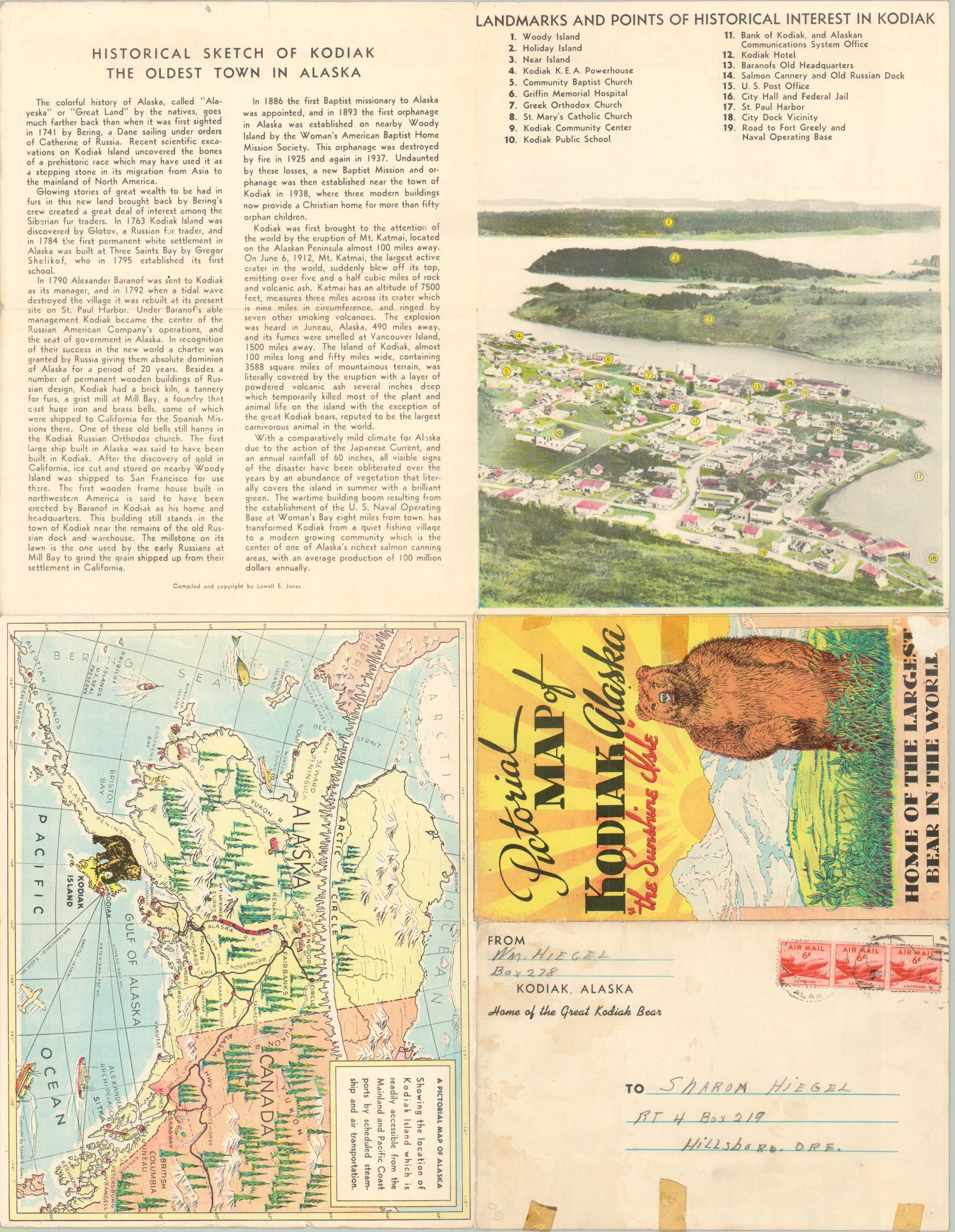
This postwar pictorial map of Alaska’s Kodiak Island was drawn, copywritten, and published by Lowell E. Jones in the late 1940s or early 1950s (sources vary). Shortly before, the opening of the Alaska Highway and Chilkoot Motorship Lines offered potential tourists new avenues to access the formerly remote island.
The map was issued as a promotional mailer to encourage visitation to ‘The Sunshine Isle.’ The welcoming image, oriented with west at the top, provides a charming illustrated overview of Kodiak Island, with its most famous residents (the bears) prominently featured throughout. A fascinating variety of locations of interest are labeled, including the first white settlement, fishing canneries, military installations, and notable geographic features. Descriptive text, a pictorial map of Alaska, and a photographic view of Kodiak (the oldest town in the state) are provided on the verso.
Map Details
Publication Date: c. 1948
Author: Lowell E. Jones
Sheet Width (in): 22
Sheet Height (in): 17.25
Condition: B+
Condition Description: Creasing and wear along originally issued fold lines, including about 10" of separation along the horizontal centerfold that has been repaired and reinforced on the verso with archival tape. A few old bits of cellophane tape repairs on the verso do not affect the image. Minor wear along the outer edges of the sheet, confined to the margins. Good to very good condition overall.
$225.00
1 in stock