Pictorial Map and Guide to Chicago
$200.00
Spectacular visual depiction of Chicago attractions in the first quarter of the 20th century.
1 in stock
Description
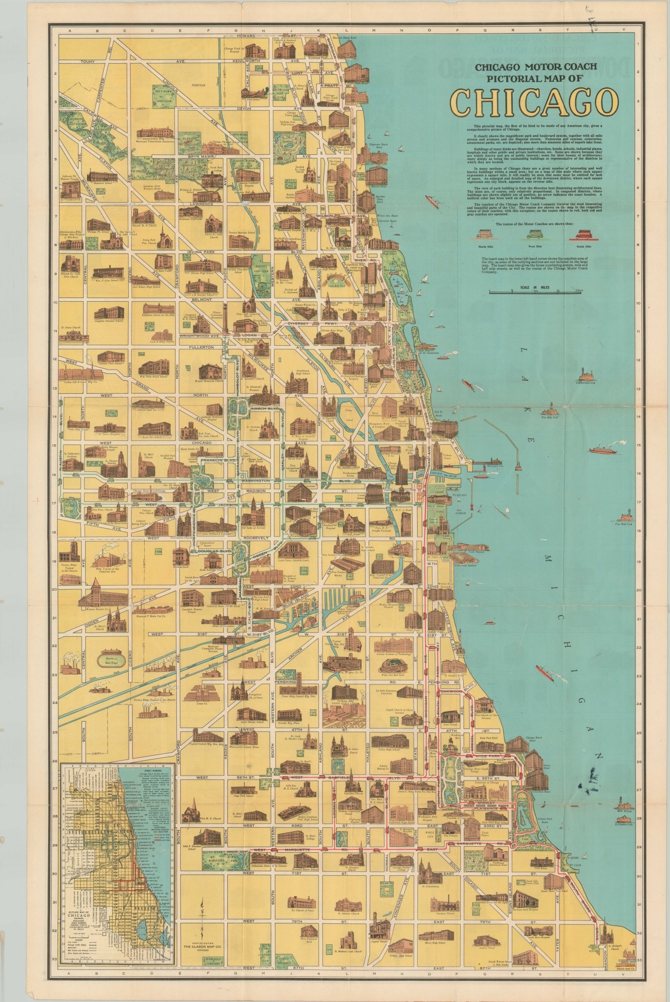
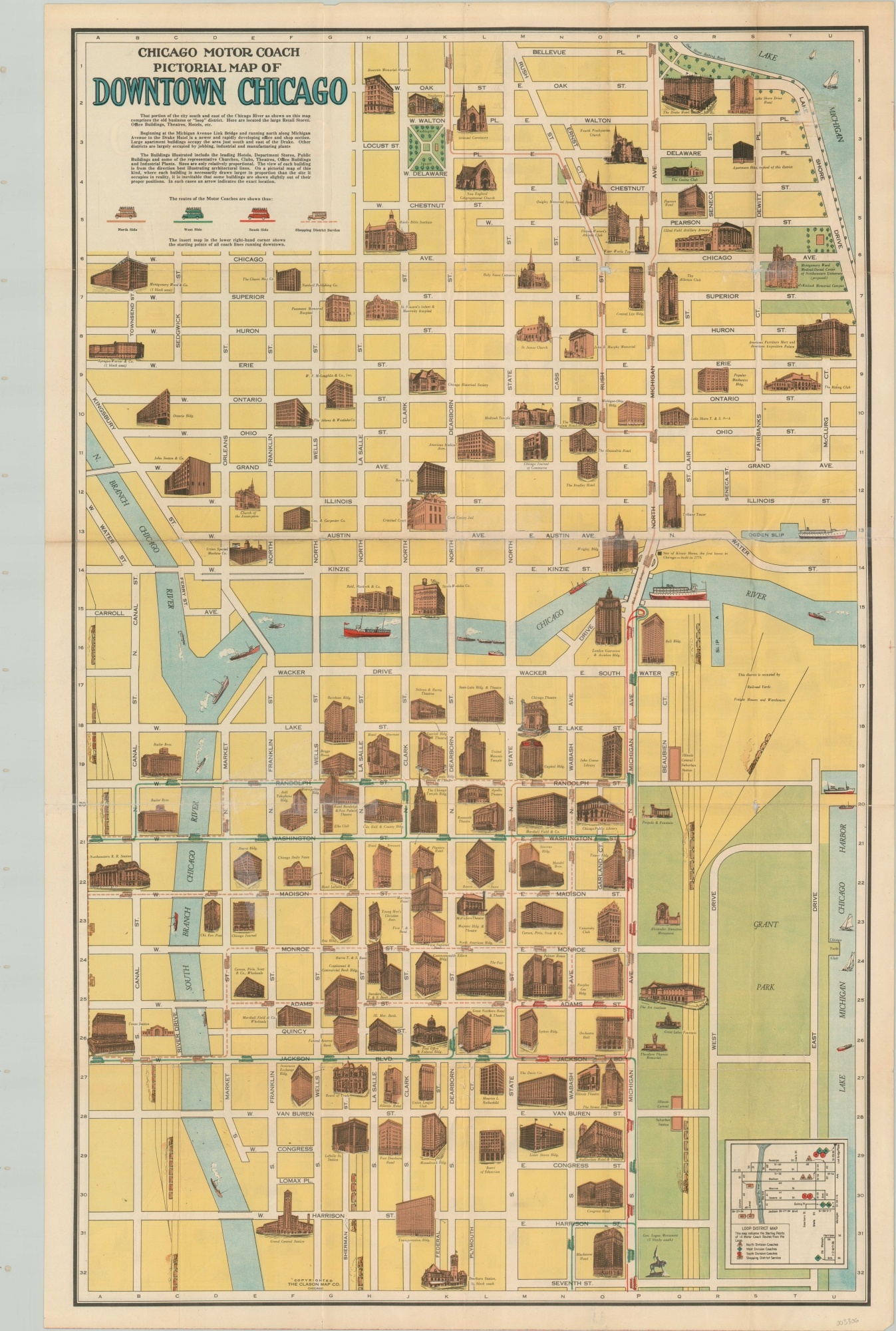
Prior to the CTA, transit in Chicago was a complex web of surface lines, buses, subways, and elevated routes, with intense competition between each for the biggest piece of the transportation pie.
This map and guide were published by the Clason Map Company on behalf of the Chicago Motor Coach Company, which operated several routes along the Lakeshore, Near North, and West Loop neighborhoods since 1917. These routes are depicted on the fold-out map alongside profile illustrations of prominent buildings and attractions throughout the city.
One side depicts the area from 87th street to Howard and the lake to Austin Blvd and includes an inset map with street numbers, while the other focuses on the Loop and River North. The map is dated using Soldier Field, as it was only known as Grant Park Stadium for a brief period between the opening in 1924 and renaming in 1925.
Map Details
Publication Date: c. 1924
Author: Clason Map Company
Sheet Width (in): 21.50
Sheet Height (in): 34
Condition: B-
Condition Description: Former pocket map has been separated from its original paper wraps. Heavy tearing along former fold lines and in several other places has been repaired with archival tape. Ink staining can be seen in the lower right of the city map, while the downtown side has lost a bit of image in the upper right corner from where it was previously affixed to the covers. Apart from the significant repairs, the map remains intact and in fair to good condition overall.
$200.00
1 in stock