Phoenix Valley of the Sun
$550.00
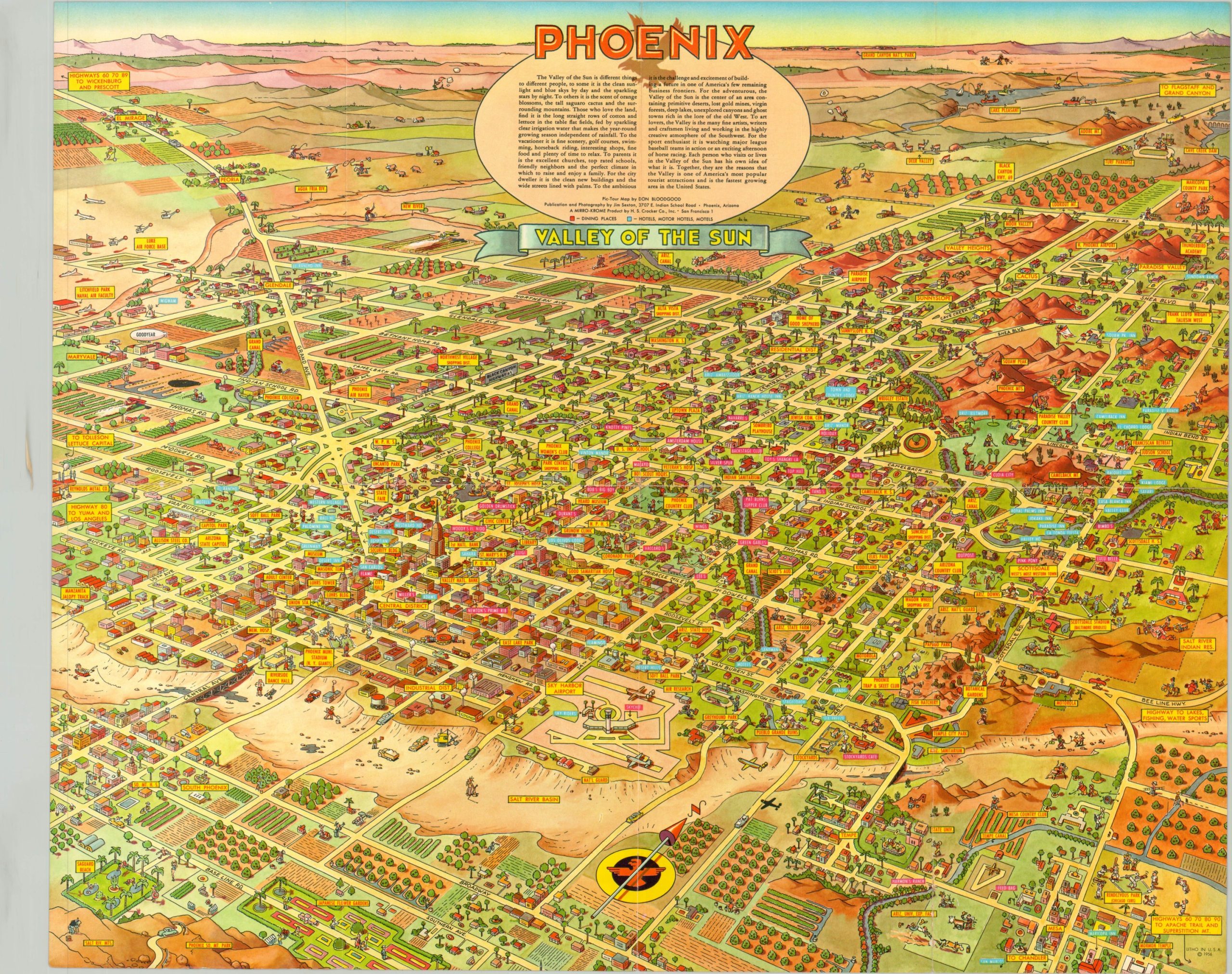
Uncommon bird’s eye view of Phoenix providing a detailed look at the city from the mid-1950’s.
1 in stock
Description
This illustrated pictorial map of Phoenix, Arizona presents a fantastic combination of humor and practical application. Issued with the local tourist in mind, the map shows the location of local restaurants, hotels, and numerous places of interest with brightly colored, easy-to-read labels. Scattered throughout the image are cartoon characters in a variety of amusing situations; from fishing in the dry Salt River Basin to an unwary golfer at the Arizona National Guard Training Grounds. The farms, deserts, and hills of the Phoenix area are also pictured, giving the audience a sense of its natural scenery.
Don Bloodgood is the skilled illustrator behind the map’s creation, and his distinctive style is immediately apparent on the numerous maps he drew of areas across the Southwest. This particular example was published in 1956 by Jim Sexton and issued as a souvenir mailer. Scarce, with no copies available in the OCLC and only one sales record found through Barry Ruderman Rare Maps.
Map Details
Publication Date: 1956
Author: Don Bloodgood
Sheet Width (in): 21.75
Sheet Height (in): 17.75
Condition: A-
Condition Description: Faint wear along former fold lines and two spots of separation have been repaired on the verso with archival tape. Very good to near fine.
$550.00
1 in stock

