
Philmont Scout Ranch and Explorer Base Cimarron New Mexico
$110.00
Philmont Scout Ranch, one of the largest youth camps in the world.
1 in stock
Description
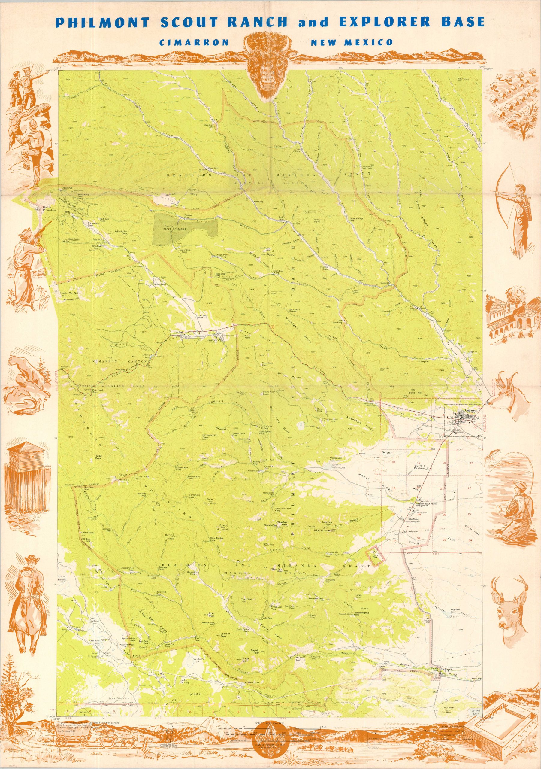
This detailed topographic map shows an expansive area in northern New Mexico under the ownership of the Boy Scouts of America known as Philmont Scout Ranch. Much of the property was donated by oil baron Waite Philips in the late 1930s and early 1940s and has since been developed into one of the largest youth camps in the world, encompassing over 140,000 acres.
The base map, designed by the United States Geological Survey, shows contoured topography and labels a variety of geographic features, important buildings, and notable landmarks. The scout ranch boundary is noted in pink, with the headquarters just a few miles away from the small town of Cimarron. Illustrated scenes reflecting the local animals, recreation, and history comprise the decorative border.
The topographic base map was provided by the United States Geological Survey. Published in 1970 by A.B. Hirschfield Press in Denver, Colorado.
Map Details
Publication Date: 1970
Author: United States Geological Survey
Sheet Width (in): 29.5
Sheet Height (in): 39.5
Condition: B+
Condition Description: Large color lithographed map printed on glossy vinyl-like paper, strongly creased and moderately wrinkled along old folds. A bit of light toning along the outer edges of the sheet and wear at fold joints, but overall in good condition. Blank on verso.
$110.00
1 in stock