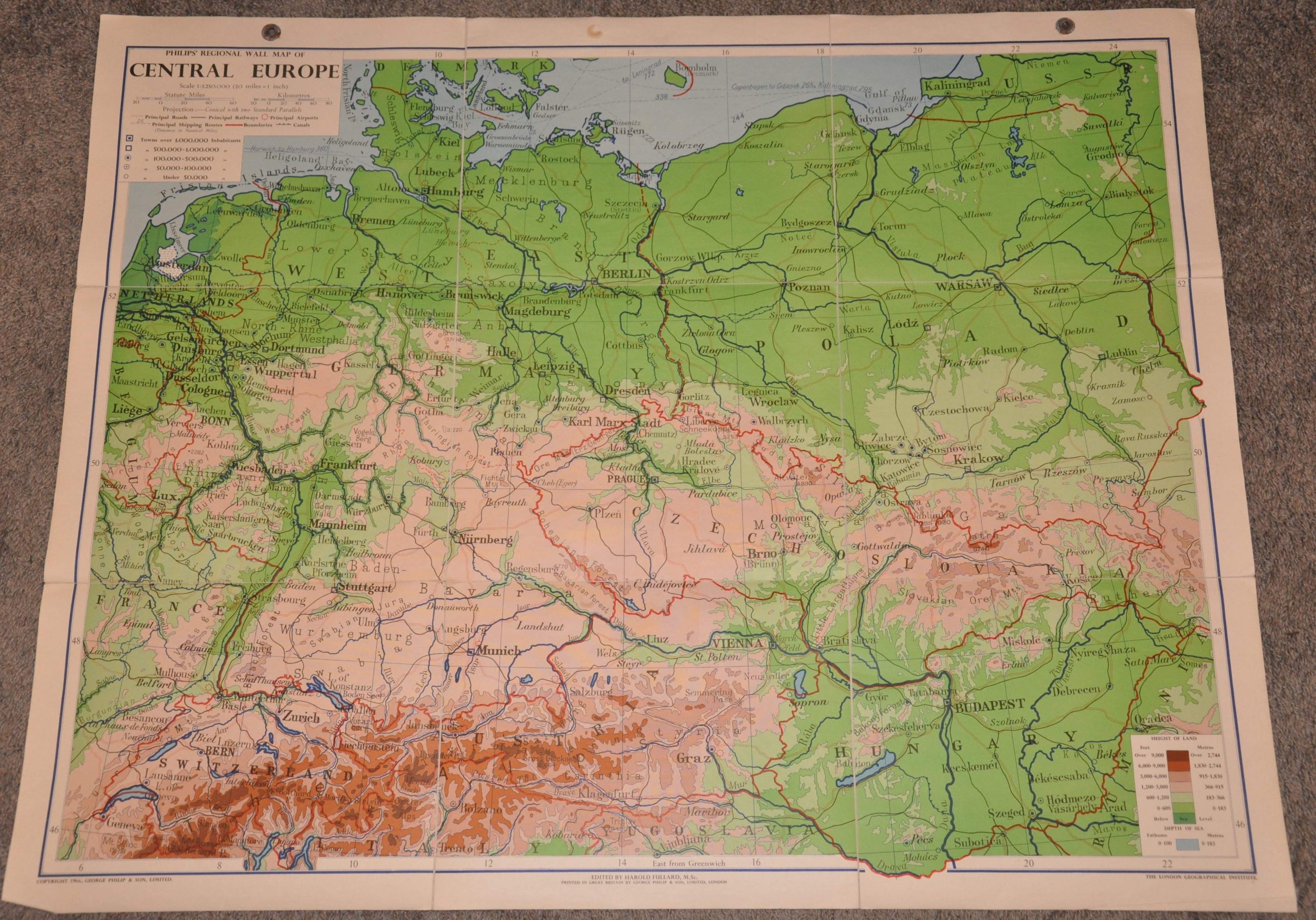
Philip’s Regional Wall Map of Central Europe
$95.00
The Iron Curtain during the mid-1960s.
1 in stock
Description
This brightly colored topographic map of Central Europe was edited by Harold Fullard of the London Geographical Institute and published in London by George Philip & Son in 1966. It presents the major settlements, geographic features, and transportation routes between Brest and Liege and Ljublana to the Baltic coast. Elevation details emphasize the height of the Alps across Austria and Switzerland. State borders are highlighted in red, with a dotted boundary separating East and West Germany.
Map Details
Publication Date: 1966
Author: Harold Fullard
Sheet Width (in): 47.75
Sheet Height (in): 36.25
Condition: A-
Condition Description: Large color printed map dissected into nine segments and mounted onto linen, as issued. Some rusting and corresponding stains visible along the upper edge from the original metal grommets. Very good condition overall.
$95.00
1 in stock