Philippine Campaign
The Liberation of the Philippines in late 1944.
Out of stock
Description
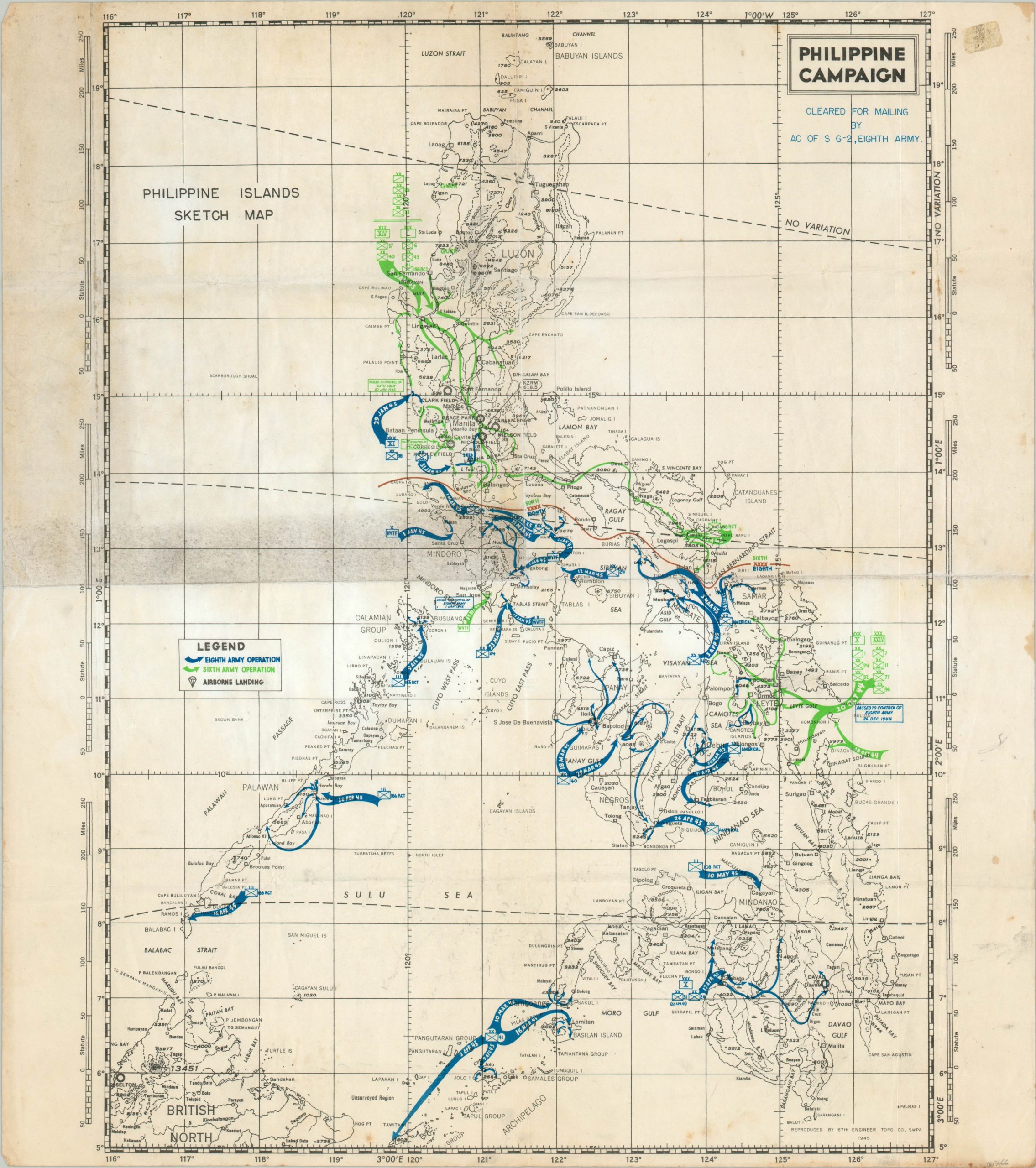
This ‘Philippine Islands Sketch map’ has been updated to commemorate the efforts of the United States’ 6th and 8th Armies during their campaign to recapture the archipelago during the Second World War. Following its initial capture by the Japanese during the first half of 1942, the Philippines had been subject to a harsh occupation for over two years prior to the amphibious and airborne invasions in the fall of 1944.
Various elements of each army group are distinguished using typical U.S. Army symbology, with combat movements indicated by arrows and the relevant dates listed therein. Eighth Army operations are shown in blue, Sixth Army operations are shown in green, and Airborne landings are noted with small parachutes.
The map is one of two to commemorate the Philippines Campaign that was issued in 1945 by the 67th Engineer Topographic Company. This is the more rudimentary of the pair, and its author is unattributed. A similar example is noted as being compiled by Sergeant James Applegate and designed by Sergeant Clyde Singer.
Alternate Example at Geographicus; Another Example at Yale
Map Details
Publication Date: 1945
Author: 67th Engineer Topographic Company
Sheet Width (in): 19.60
Sheet Height (in): 22.20
Condition: B
Condition Description: Creased and worn along former fold lines, with moderate molding (now cleaned and inert) visible in the upper left panel. Scattered soiling and discoloration also visible in the margins and in a few areas throughout the image, notably in the lower right and upper center.
Out of stock

