
Philadelphia and Camden
$125.00
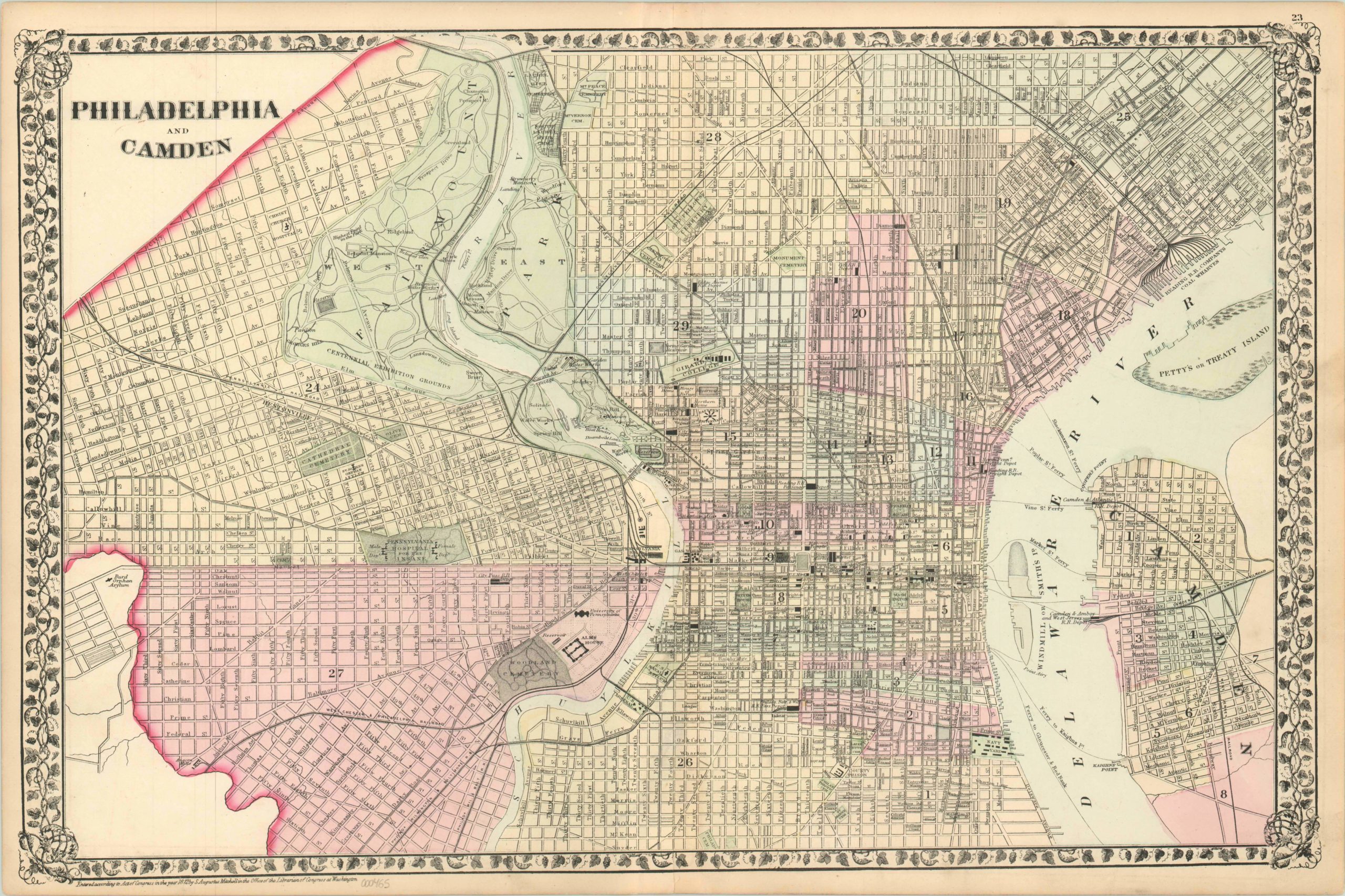
Excellent example of Mitchell’s city plan of Philadelphia and Camden.
Description
This map was published by one of the foremost American cartographers of the 19th century, Samuel Augustus Mitchell, for his New General Atlas. It covers the city limits of Philadelphia, PA and Camden, NJ; offering large scale street details on both sides of the Delaware and Schuylkill Rivers. Locations of parks, important buildings, prominent businesses, schools, churches, and transportation centers are listed, offering an interesting perspective into the city’s layout in the early 1870’s.
Planning for the upcoming Centennial Exposition is underway, as evidenced by the grounds labeled on the west bank of the Schuylkill. Rail lines provide the primary arteries for freight and passenger transportation, with a huge number of depots, stations, and yards identified throughout the city. Urban cemeteries provide much of the available greenspace in the otherwise crowded downtown and surrounding areas.
Map Details
Publication Date: 1872
Author: S.A. Mitchell
Sheet Width (in): 22.75
Sheet Height (in): 15
Condition: A-
Condition Description: The map is in excellent condition. Some edge wear and minor surface smudges are present, but otherwise fine condition.
$125.00