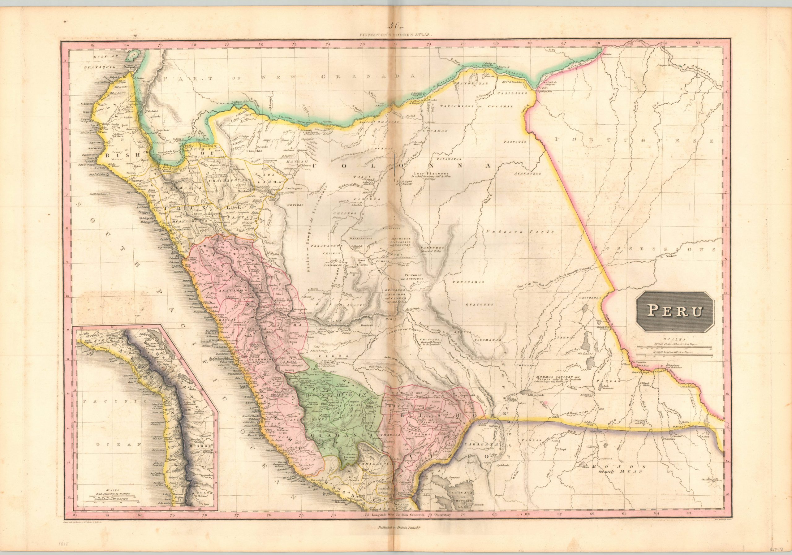
Peru
$125.00
Fascinating map of Peru issued at a period of significant political turmoil.
1 in stock
Description
In the first two decades of the 19th century, waves of independence movements swept across Spanish America, fueled by revolutionary ideas from France. The Spanish Crown was slow to react, with severe domestic problems of their own, and one by one various countries across Central and South America gained nation sovereignty. Peru would eventually attain the same, but only through the application of force, as it remained one of the few remaining Royalist bastions on the continent.
This map depicts the outline of the Viceroyalty of Peru, which remained ostensibly under Spanish Control until formal independence in 1824. The rugged terrain is shown in hachure, and various annotations throughout the image directly reference the ongoing political conflicts. Tribes are labeled as “implacable enemies to the Spanish” or described as revolted or rebels.
The map was originally designed by Scottish cartographer John Pinkerton. As part of the Edinburgh School of Cartography (which included the likes of John Cary and John Thomson), Pinkerton was responsible for creating some of the most highly detailed and precise atlas maps of the early 19th century.
Today, his maps are prized for their size, color, and wealth of information. This particular example was included in the American edition of Pinkerton’s Modern Atlas, published in Philadelphia by Thomas Dobson in 1818.
Map Details
Publication Date: 1818
Author: John Pinkerton
Sheet Width (in): 32.40
Sheet Height (in):
Condition: B-
Condition Description: Heavy discoloration and wear, including small image loss, along the vertical centerfold. Abrasion and some offsetting from the title block visible within the image.
$125.00
1 in stock

