Peoria & Eastern Ry.
Out of stock
Description
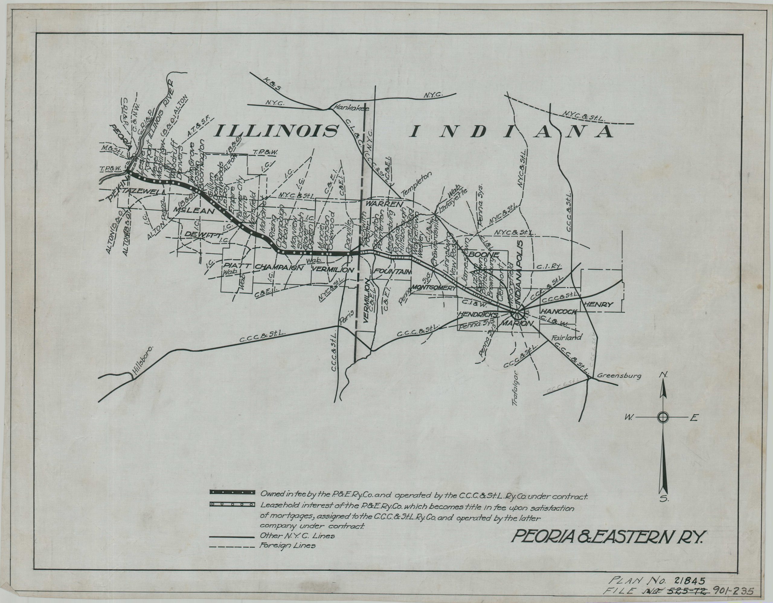
The Peoria and Eastern Railway was incorporated on February 21, 1890, for the purpose of building a railroad between Pekin, Illinois, and Indianapolis, Indiana. The following day, the newly established company surrendered total operational control to the Cleveland, Cincinnati, Chicago and St. Louis Railway; essentially becoming an official subsidiary of ‘The Big Four.’ In 1906, the CCC&StL was acquired by the New York Central System. It was likely in that capacity that this manuscript route plan was created, as it was acquired as part of a larger archive of New York Central material.
The image presents the legacy operations of the Peoria & Eastern across Illinois and Indiana, with a noticeable legal distinction at the state line. Other New York Central lines are shown in black. Also of interest is a penciled extension of the Central Indiana Railway to connect with the Pennsylvania Railroad system near Montgomery (Indiana).
Map Details
Publication Date: c. 1930?
Author: New York Central Railroad?
Sheet Width (in): 28
Sheet Height (in): 18.75
Condition: A
Condition Description: Handwritten route map in black ink on linen blueprint paper. A few spots and small stains, mostly confined to the outer edges of the sheet. Faintly wrinkled where previously rolled and other sights of light wear and use. Very good condition overall.
Out of stock