Pennsylvania System of Railroads and Connections
$60.00
“The Best Way Any Day Between East-West North-South. Look at the Map!”
1 in stock

Description
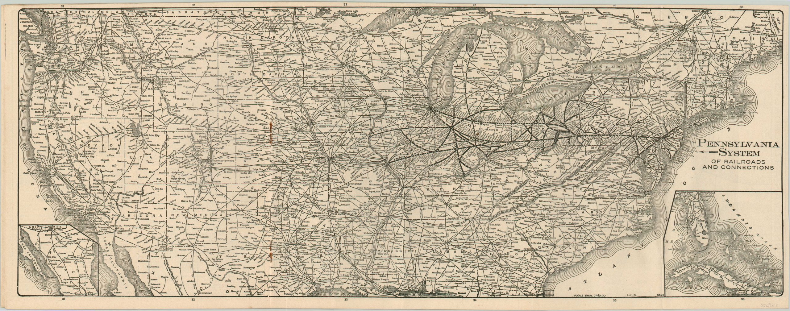
Ride the lines of the Pennsylvania Railroad with this lovely brochure from 1916. It contains everything you need to know including timetables, passenger stations, fares, route descriptions and company advertisements. A centerfold map shows the lines of the ‘Pennsy’ and its connections across a grossly distorted map of the United States – note how Philadelphia to St. Louis occupies nearly the same space as St. Louis to San Francisco!
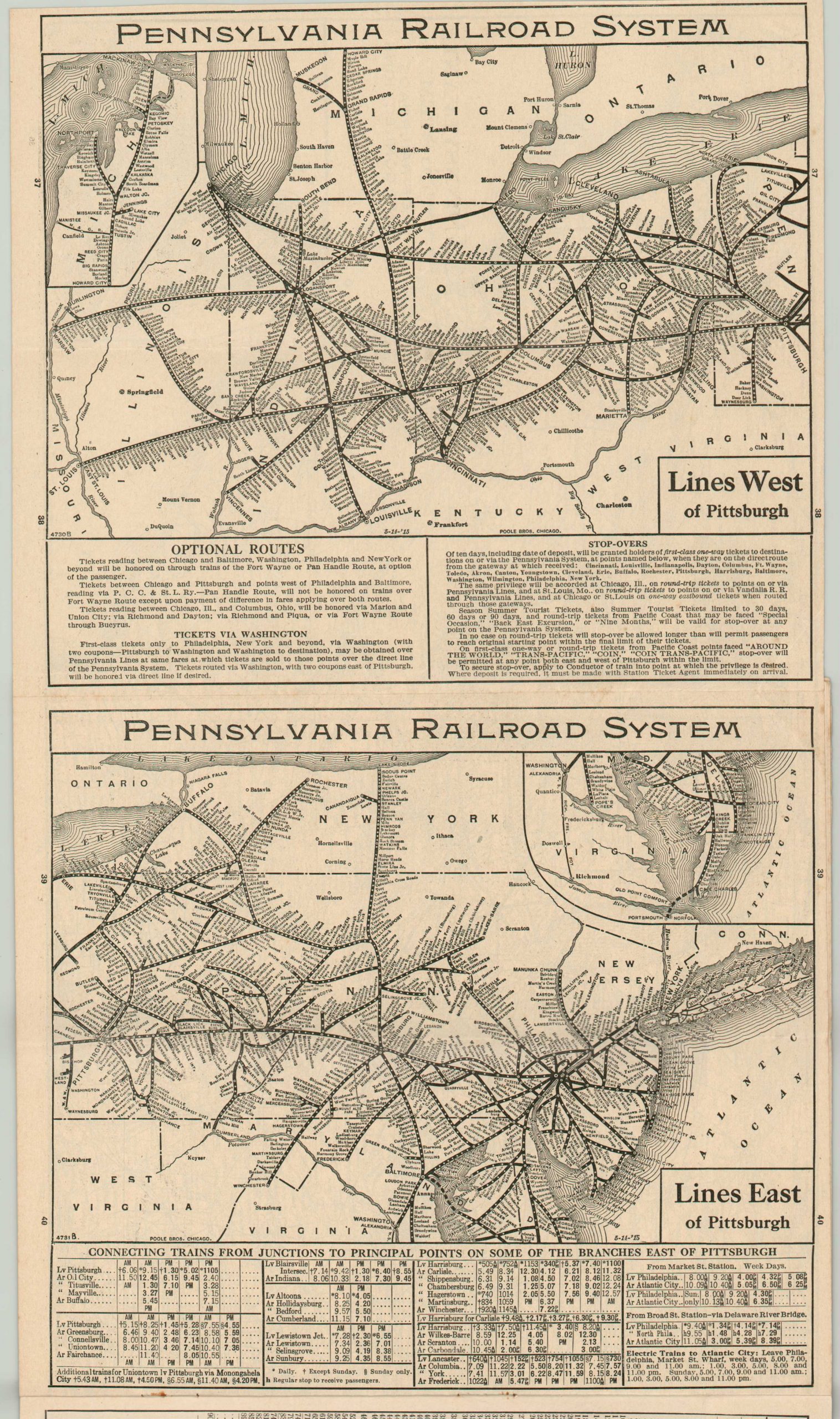
A second map, issued on the verso of the first, shows the lines east and west of Pittsburgh, with each stop crammed into the image. Don’t fear for your safety – an advertisement on the back assures the reader that “the passing of the first half of 1916 completes two and one-half consecutive years in which no passenger has been killed on any part of the Pennsylvania Railroad System in a train accident.” That’s good, right?
Map Details
Publication Date: 1916
Author: Poole Brothers
Sheet Width (in): 23.00
Sheet Height (in): 9.00
Condition: A-
Condition Description: Centerfold map in a 16 pp. time table brochure with stapled binding that shows a bit of rusting. Folds down to measure approximately 4" x 9". Covers are slightly spotted and worn, but overall quite good.
$60.00
1 in stock