
Pennsylvania Lines West of Pittsburgh Flood of March 1913
Mapping the devastation of the Great Flood of 1913.
Out of stock


Description
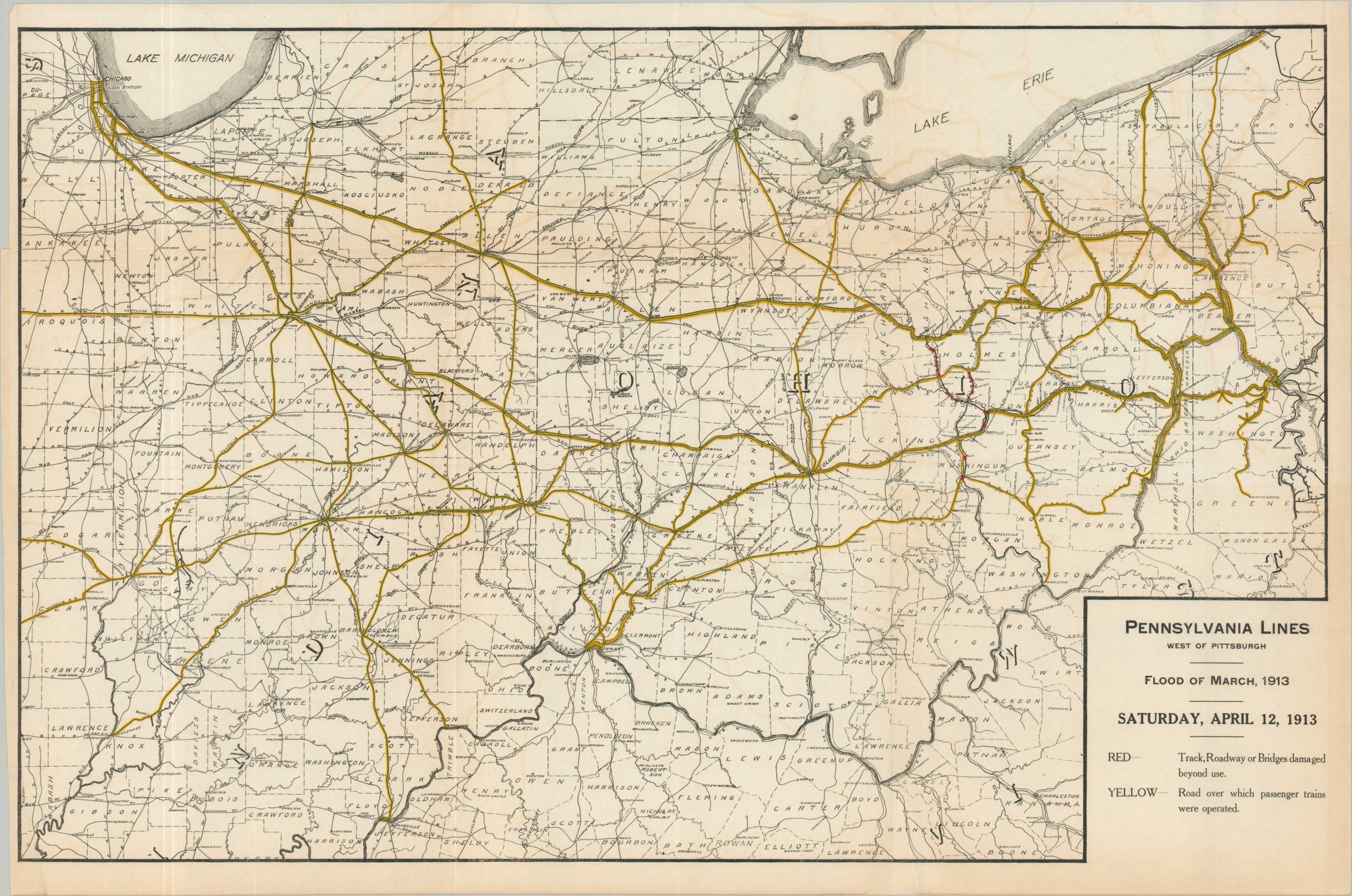
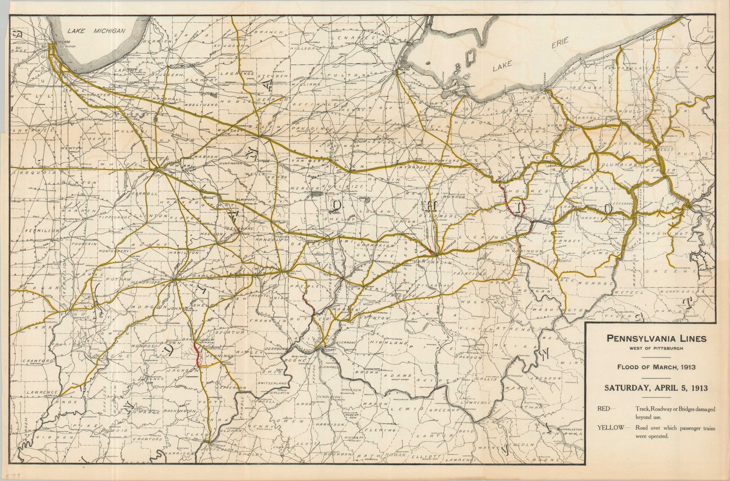
Four days of heavy rainfall during late March 1913 resulted in extensive flooding across the eastern and central United States. The death toll across over a dozen states exceeded 600 people, with over $300 million in property damage resulting in a quarter million (or more) homeless.
This series of maps cataloging the extensive devastation was originally published as a supplement to C.W. Garrett’s A History of the Flood of March, 1913. Emphasis is on the operational lines of the Pennsylvania Railroad between Pittsburgh in the east and Chicago and the Wabash River in the west. One map highlights large areas of extensive precipitation in bright red, showing large areas across northern Ohio that received more than 10 inches of rain. Ten additional sheets provide chronological snapshots of the destruction between March 25th and April 12th. These each show operational lines (yellow), submerged tracks (green), and infrastructure damaged beyond repair (red).
Map Details
Publication Date: 1913
Author: C. W. Garrett
Sheet Width (in): 24.6
Sheet Height (in): 16.25
Condition: B+
Condition Description: Series of 11 color lithographed sheets, printed on thin paper that has moderately toned along folds and from the printed color. Irregular margins from where previously bound and a bit of wear along the outer edges. Good to very good condition overall.
Out of stock