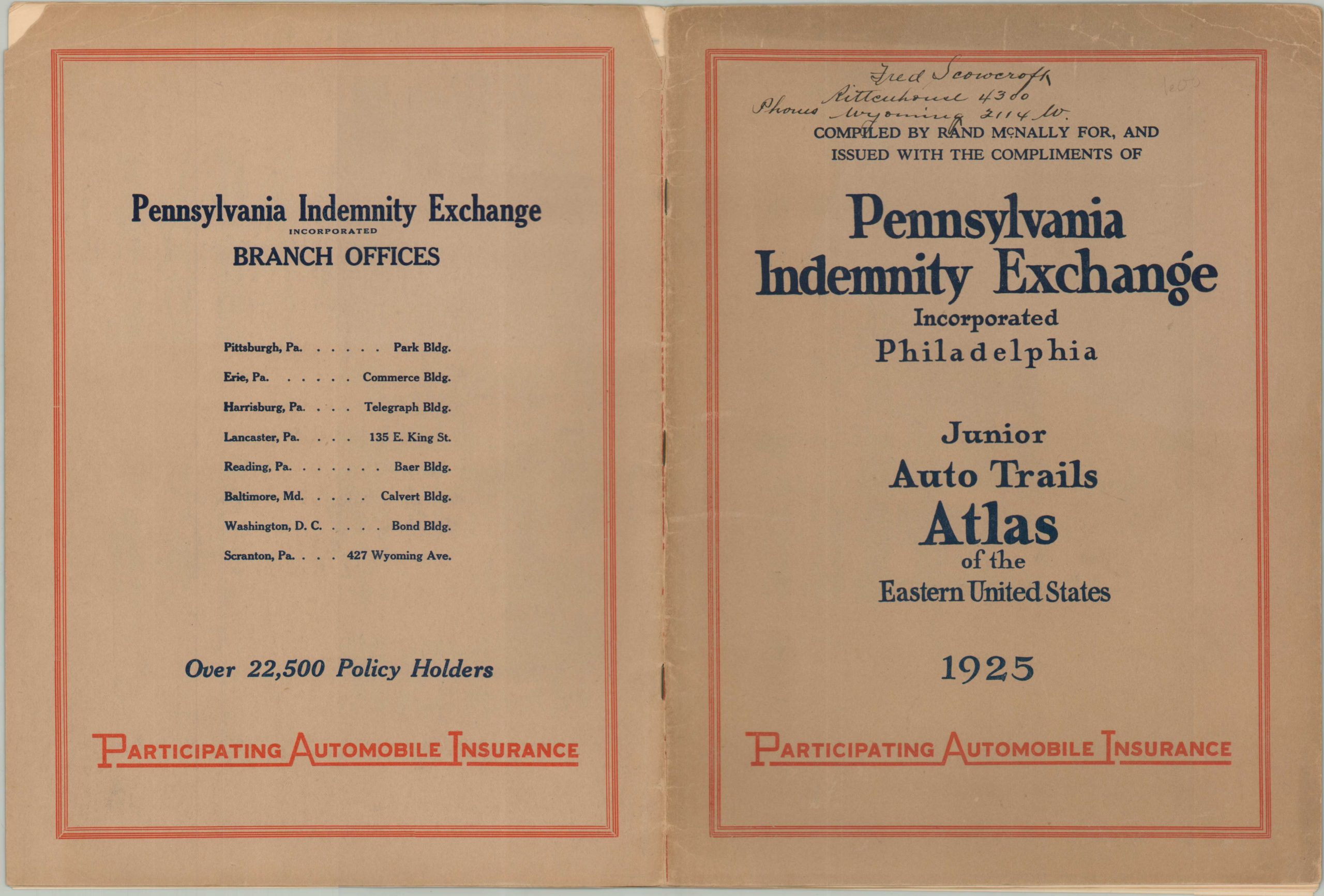
Pennsylvania Indemnity Exchange Junior Auto Trails Atlas of the Eastern United States
$95.00
“A Much Improved Volume of Recently Drawn Road Maps.” – pg. 1
1 in stock


Description
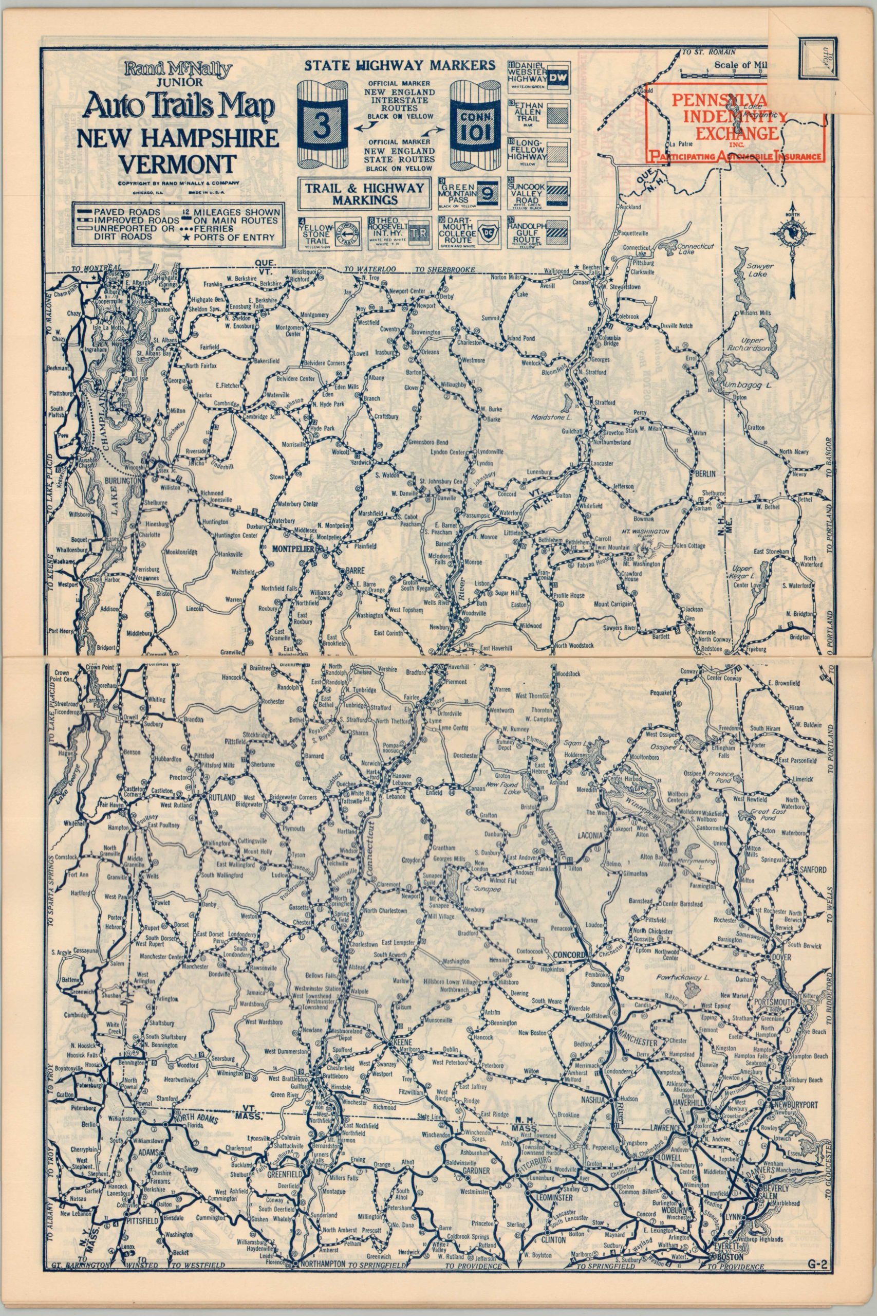
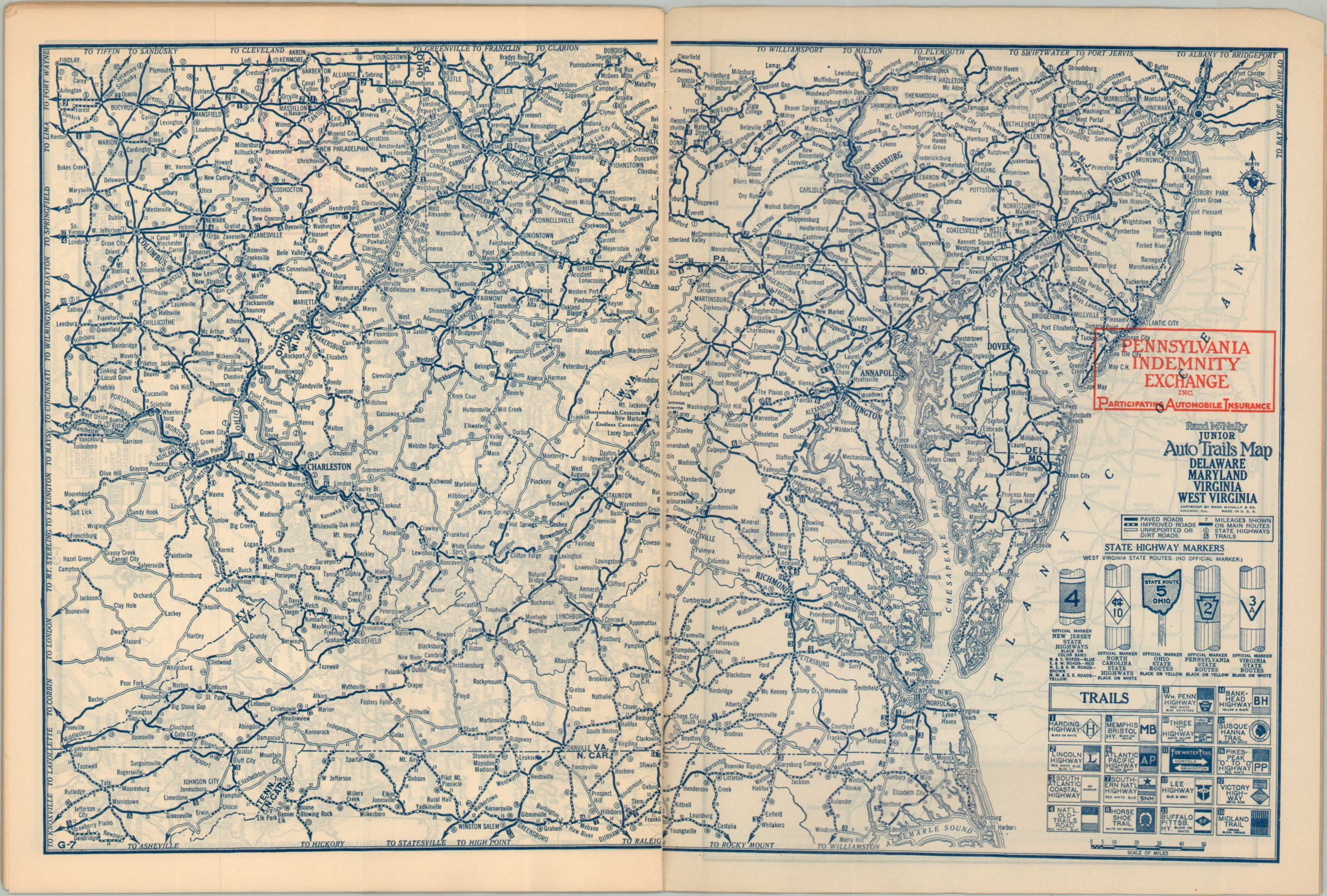
This handy little road atlas from the mid-1920s was issued compliments of the Pennsylvania Indemnity Exchange, a major regional provider of automobile insurance with assets of over 1.4 million dollars (according to the promotional text). A series of maps by the Rand McNally Company outlines the primary roads across the northeastern United States.
The first few pages are filled with inset plans of major urban areas that contain branch offices of the aforementioned sponsor – Philadelphia, Pittsburgh, Washington D.C., Baltimore, and several others. This is followed by a general Auto Trails Map of the United States and state maps showing Ohio, Pennsylvania, New Jersey, New York, Massachusetts/Connecticut/Rhode Island, New Hampshire/Vermont, Maine, and Delaware/Maryland/Virginia/West Virginia. Each double-page road guide notes distances between points, important markers (highways and auto trails), and local geographic features.
Map Details
Publication Date: 1925
Author: Rand McNally
Sheet Width (in): 9.10
Sheet Height (in): 12.20
Condition: A-
Condition Description: 24 pp. atlas with stapled binding and original paper wraps. Old owner's inscription on the front cover and a small split in the top of the spine. Two small chips in the back cover. Very good condition overall.
$95.00
1 in stock