
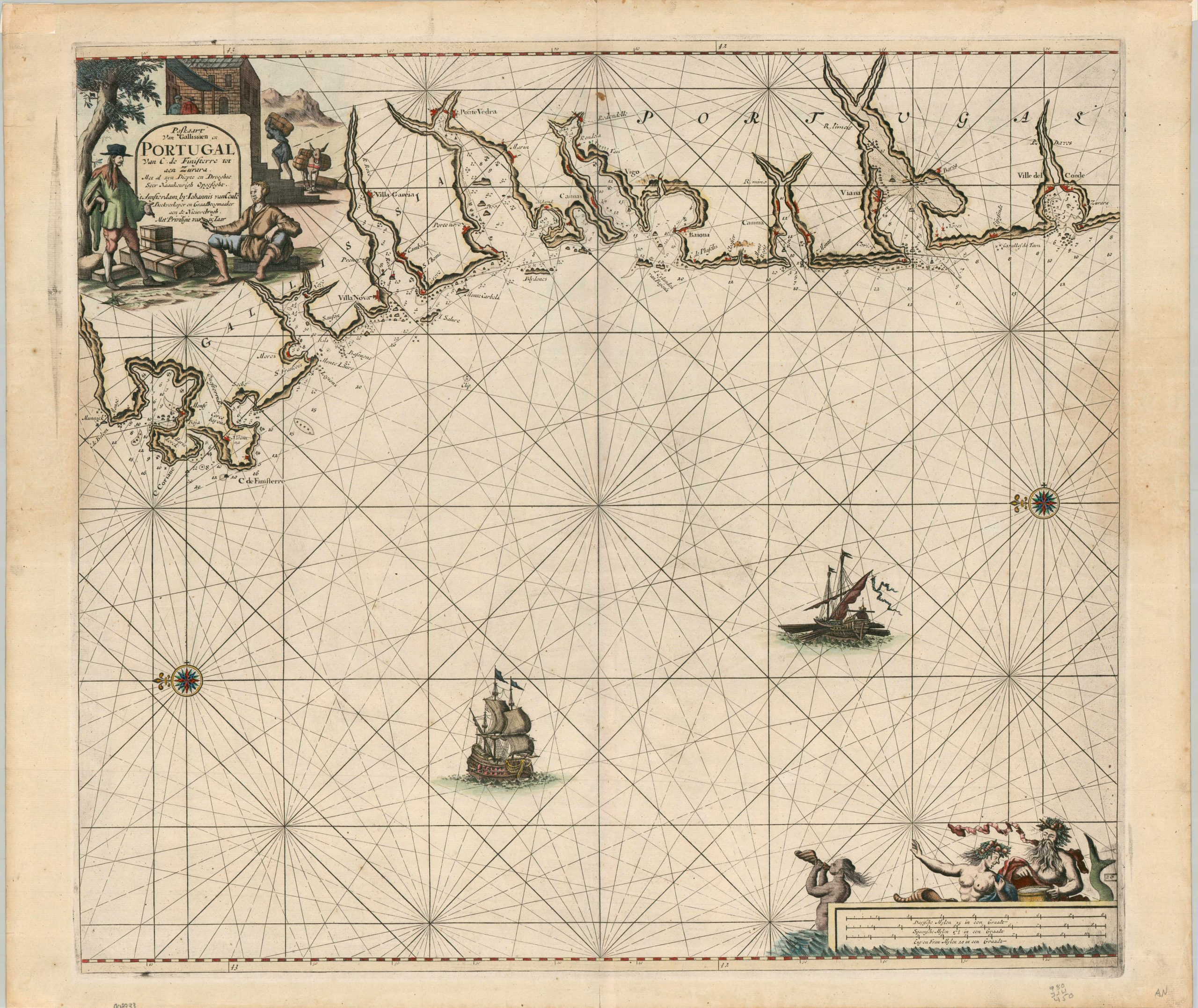
Paskaart von Gallissien ou Portugal Van C. de Finisterre totaen Zurara
$900.00
A coastal chart of the ‘End of the Earth’ (in the Roman Era).
1 in stock
Description
This uncommon sea chart, oriented with east at the top, offers a detailed outline of the Spanish and Portuguese coastline between Cape Finisterre (left) and the Ville del Conde (right). The former is derived from the Latin finis terrae, meaning ‘end of the earth’ – a name it earned in the Classical Era as the jutting headland was considered by some to be just that. As one looks south, the coastal waters are filled with depth soundings and hazards are carefully marked.
Various settlements and geographic features, both of which function as important landmarks and safe havens, are labeled throughout. Of particular interest is the harbor at Vigo (a favored port for Spanish treasure galleons), the Minho River (the border between Spain and Portugal), and Ville de Conde (an important shipbuilding site). The two decorative cartouches reflect the abundance of maritime commerce that took place along the route, especially as ships traveled from Northern Europe into the Mediterranean. Two vessels are shown in the Atlantic, though, oddly, one is a galley and would have been ill-suited to the rough waters.
The map was published in Amsterdam around 1689 as part of Johannes Van Keulen’s Zee-Fakkel (Sea-Torch). About 10 years earlier, van Keulen had received a license for exclusive publication of maritime charts in Holland, which led him to start his own firm, In de Gekroonde Lootsman (“In the Crowned Pilot”), and acquire the stock of Hendrik Doncker. His resulting work, which contained approximately 130 nautical charts, was intended as a practical navigation aid and proved immensely popular. It was updated and re-issued in several editions by van Keulen’s successors, with the final printing taking place in 1803!
Source: David Rumsey Map Collection
Map Details
Publication Date: c. 1689
Author: Johannes van Keulen
Sheet Width (in): 24.60
Sheet Height (in): 21.10
Condition: A-
Condition Description: Copperplate engraved sheet on a slightly wavy sheet with minor marginal wear. A small surface spot in the upper center and a few other faint areas of light discoloration. Small pieces of hinge tape on the verso. Good to very good condition overall.
$900.00
1 in stock