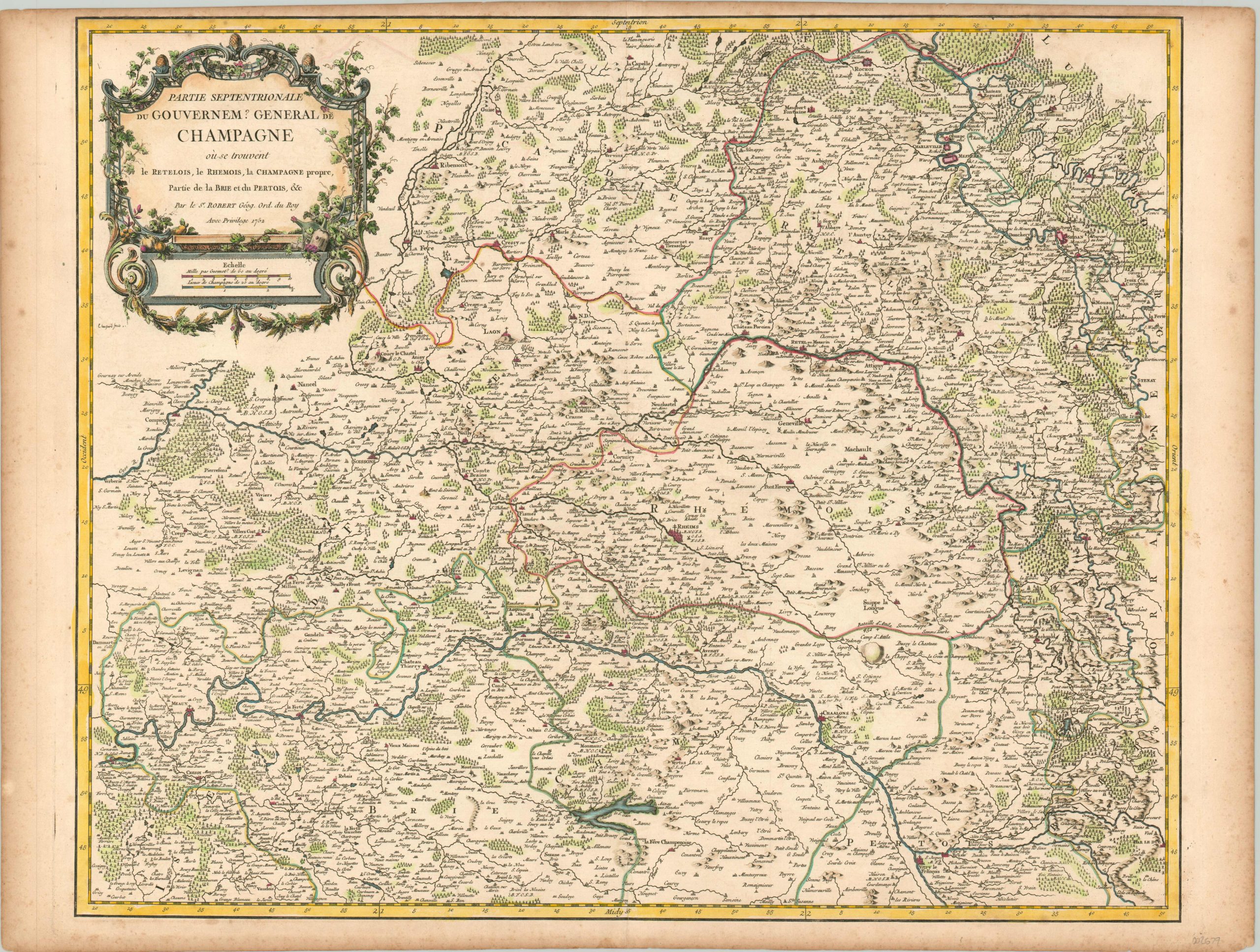
Partie Septentrionale du Gouvernem? General de Champagne
A cartographic ‘toast’ to the Champagne region of France.
Out of stock
Description
Romans cultivated the region of Champagne with grape vines since at least the 5th century, and possibly even earlier. Pale, pinkish wines produced from the pinot noir grape became featured at coronation ceremonies of French monarchs at Reims (see center of map) beginning in the 10th century, and an ongoing rivalry with Burgundians to the south led to a fierce pride in the wines of Champagne. Cold temperatures halted fermentation in the winter, and the dormant yeast reactivated in the spring. A byproduct of this process was the buildup of carbon dioxide gas, wreaking havoc in cellars by bursting the bottles. Those that survived were found to contain bubbles, which horrified local wine makers. Even the famous Benedictine Monk Dom Pérignon originally tried to get rid of the bubbles in his wine! However, in the early 18th century the aristocracy began to develop a taste for sparkling wines, and the rest is history.
This map of the northern part of the Champagne region was published in Paris by Robert de Vaugondy in 1752 – just as the preference was shifting. Apart from showing a wealth of fascinating geographic information, the image also includes a number of locations that remain famous for their Champagne today. Apart from the aforementioned Reims, the map includes the cities of Epernay (home to Moet & Chandon) and Ay (Gossett, the oldest Champagne house in France).
Acronyms next to these, and other locations, reflect the presence of religious orders – some of the primary producers of the region’s distinctive wines. Monasteries of the Order of St. Benedict (of which Dom Perignon was a member) are labeled O.S.B., as an example. Even the decorative cartouche, wrapped in grape fines and featuring corked bottles, reflects the relationship between Champagne (the wine) and Champagne (the region).
Source: Pedley, 125
Map Details
Publication Date: 1752
Author: Robert de Vaugondy
Sheet Width (in): 26.4
Sheet Height (in): 19.9
Condition: A-
Condition Description: Moderate soiling and spotting visible in the margins and a bit of faint wear along the vertical centerfold. Very good overall, with attractive hand color.
Out of stock

