
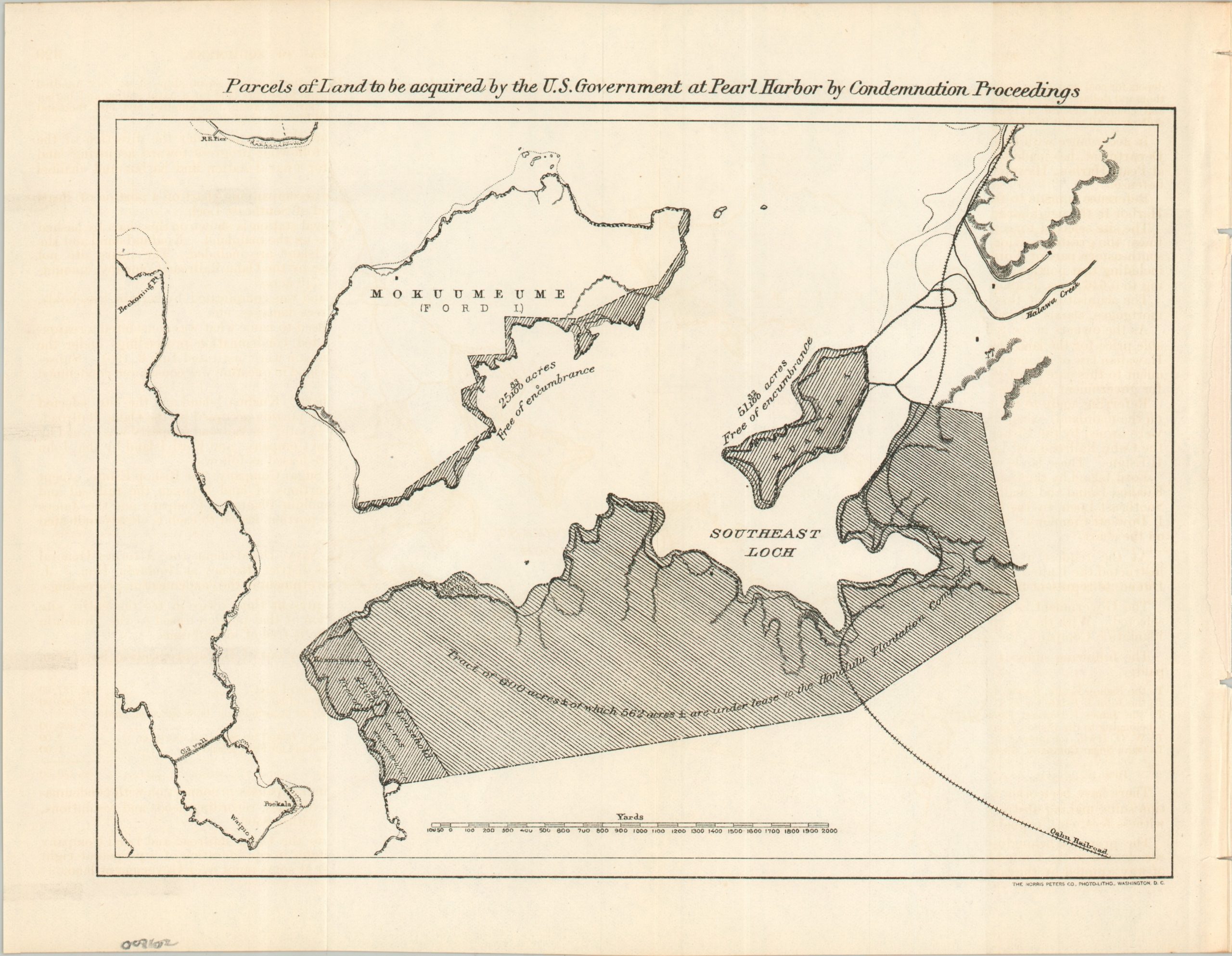
Parcels of Land to be acquired by the U.S. Government at Pearl Harbor by Condemnation Proceedings
$350.00
The federal government’s first material efforts to establish Pearl Harbor.
1 in stock
Description
Following the U.S. annexation of Hawaii in 1898, Congress passed the Naval Appropriation Act of March 3, 1901, authorizing the Navy to acquire land surrounding Pearl Harbor and begin dredging the entrance channel. Some local property owners refused to sell, so eminent domain proceedings took place and facilitated the acquisition of approximately 700 acres of land, which included the future Pearl Harbor Navy Yard, Kauhua Island, and a strip along the southeast coast of Ford Island.
This map, published as part of the 1902 Annual Report of the Secretary of the Navy, shades the newly obtained territory and notes the sizes of the various parcels. Much of the land was leased to the Honolulu Plantation Company. The Oahu Railroad (another prominent landowner) is also labeled. Accompanying text offers further details about the condemnation proceedings, with overall expenditures totaling about $58,000.
Map Details
Publication Date: 1902
Author: The Norris-Peters Company
Sheet Width (in): 11.60
Sheet Height (in): 9.00
Condition: A-
Condition Description: Single-sided sheet, creased along old folds and affixed to a single sheet of printed text. Torn along the spine from where roughly extracted from the volume. Very good condition overall.
$350.00
1 in stock