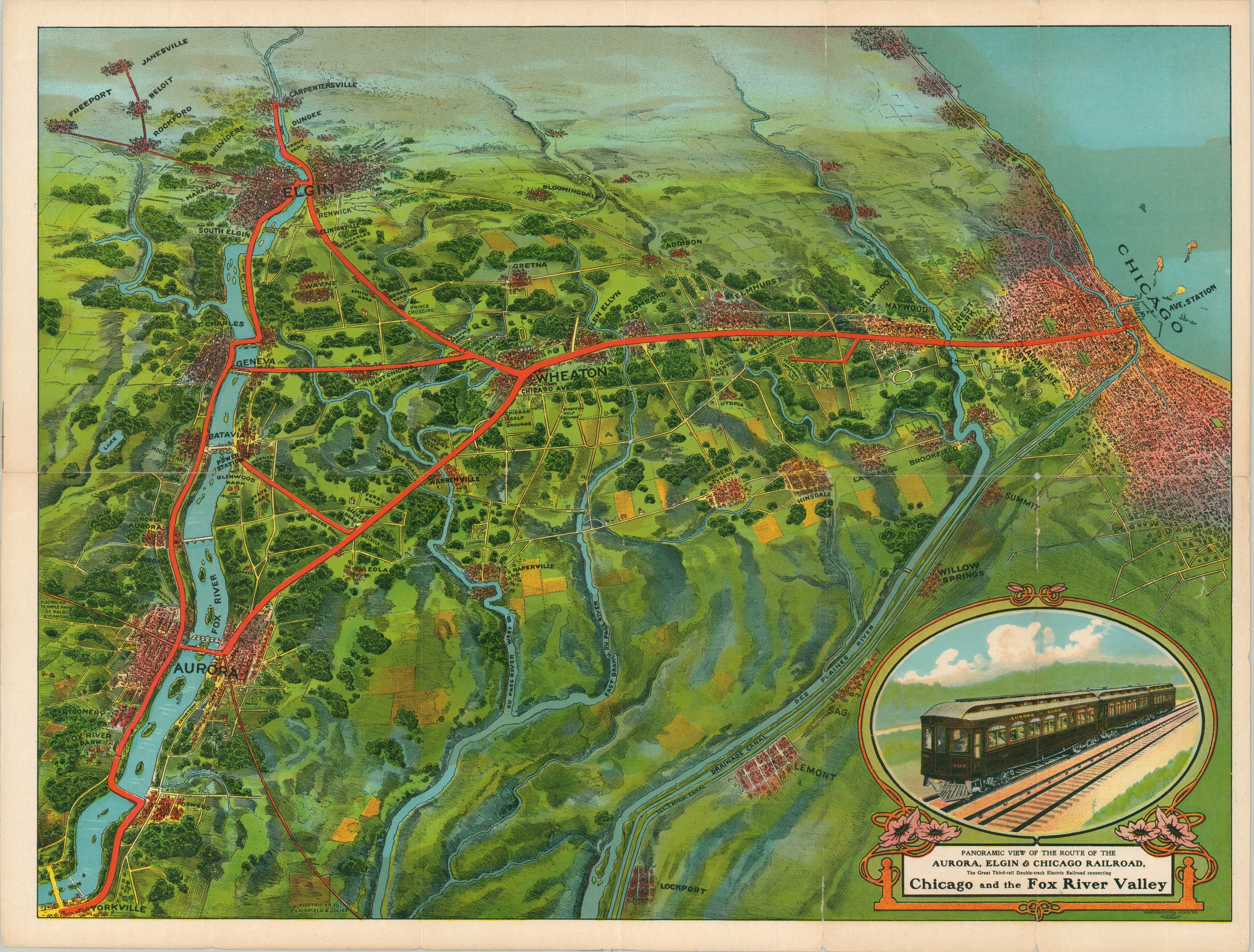
Panoramic View of the Route of the Aurora, Elgin, & Chicago Railroad
Beautiful map of the Fox River Valley Route between Chicago, Aurora, and Elgin.
Out of stock
Description
This wonderful chromolithographed view was produced by the Northwestern Lithographic Company around 1911 to highlight the interurban lines in operation by the Aurora, Elgin, and Chicago Railroad. The network is presented on a heavily distorted view that highlights the routes in red, running between a bright blue Lake Michigan and Fox River.
Urban areas are generalized with dense, but indistinguishable, buildings and are separated by rolling hills, forests, and farmland. Recreational opportunities like golf courses, parks, and race tracks are identified throughout the image. The Chicago, Aurora, and Elgin was an electrified passenger railroad that operated between 1899 (consolidated in 1901) and 1961. Some of the CAE services were subsumed into the municipal “L” system that remains in operation today.
There are at least three editions of the map, first issued by Rand McNally in 1909 in conjunction with the Grand Army of the Republic Meeting in Aurora. Subsequent iterations show various extensions to the north, eventually extending to Madison (this example ends at Janesville).
Map Details
Publication Date: c. 1911
Author: Northwestern Lithographic Company
Sheet Width (in): 23
Sheet Height (in): 17.4
Condition: B+
Condition Description: Several clean separations on the right side of the sheet have been repaired on the verso with archival tape. Soft creasing on old fold lines and a bit of light toning. Good to very good overall.
Out of stock