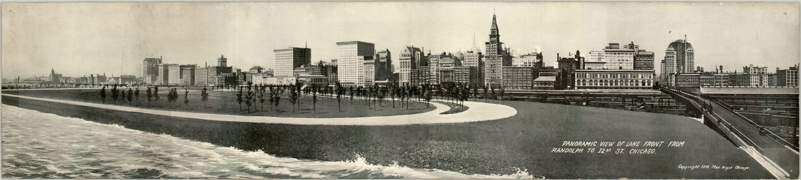
Panoramic View of Lake Front from Randolph to 12th Street Chicago.
$150.00
Early 20th century postcard view of Chicago’s Lake Front and South Loop.
Description
This is a heavily “touched up” photograph showing Chicago’s lake front and South Loop areas in the first decade of the 20th century. It’s a fascinating snapshot of the architectural foundations of the city, with several of its first skyscrapers visible along Michigan Avenue.
The Chicago Cultural Center can be seen adjacent to the walkway, and was constructed in 1897 to serve as the city’s first public library. Grant Park looks fresh and new, having been created as a result of the debris pushed into Lake Michigan from the Great Fire in 1873. Many of the buildings are still standing today, but the skyline and lake front have changed dramatically since 1909, making this photo an interesting reminder of the city’s historic roots.
Map Details
Publication Date: 1909
Author: Max Rigot
Sheet Width (in): 24.25
Sheet Height (in): 5.25
Condition: B
Condition Description: Pinholes in the upper corners and moderate soiling visible in the skyline. A few small chips and some wear along the outer edges, and age discoloration on the verso.
$150.00