
Panoramic Perspective of the Area Adjacent to Hoover Dam and Lake Mead Recreational Area
$150.00
An postwar edition of Eddy’s panoramic overview of the Lake Mead Recreational Area.
1 in stock
Description
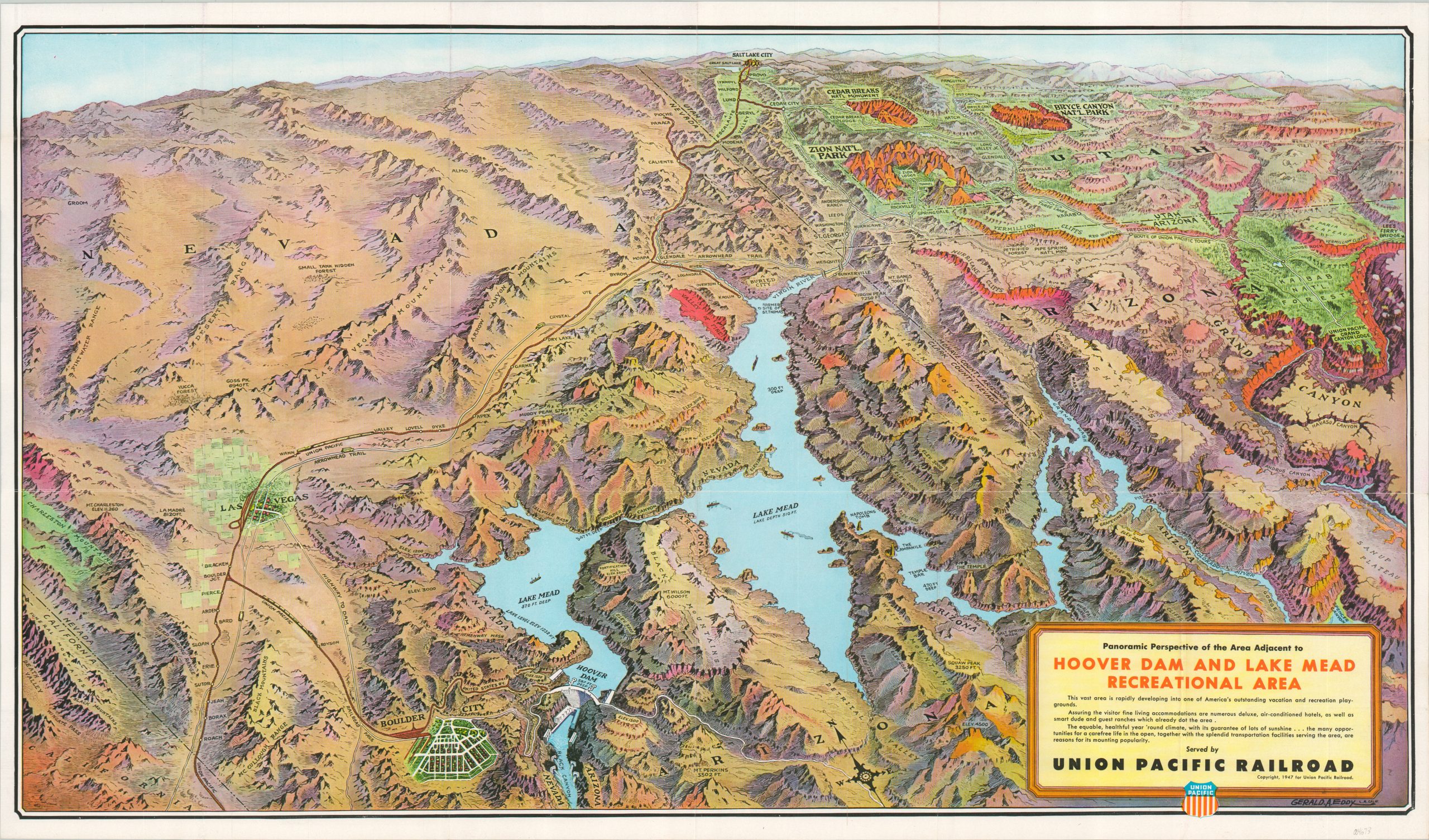
This is one of numerous panoramic views covering portions of Nevada, Arizona and Utah that were drawn by Gerald Eddy and issued by the Union Pacific Railroad over several decades of the 20th century. Surging development, infrastructure updates, and new transportation routes across the region necessitated rapid updates from the first edition, published in 1931. Boulder Dam was renamed to Hoover Dam in 1947, which was perhaps the prompt behind this particular update.
The image presented is one that focuses heavily on the appeal of the region’s natural beauty, boldly showcasing several National Parks (note the verdant green), the Grand Canyon, and the rugged topography around Lake Mead. Large shipping vessels are prominently shown in the body of water, with a recorded depth of over 500 feet. Today, that number is closer to 175 feet. Boulder City is shown prominently as the largest urban area. Later editions will feature Las Vegas more heavily, but in 1947 it remained a small town operated largely by the Mafia.
Map Details
Publication Date: 1947
Author: Gerald Eddy
Sheet Width (in): 30.5
Sheet Height (in): 18
Condition: A
Condition Description: Creasing along originally issued fold lines and some abrasion on the verso that does not affect the image. Very good to near fine overall.
$150.00
1 in stock