
Panorama of Yellowstone National Park and Adjacent Territory
Original price was: $195.00.$150.00Current price is: $150.00.
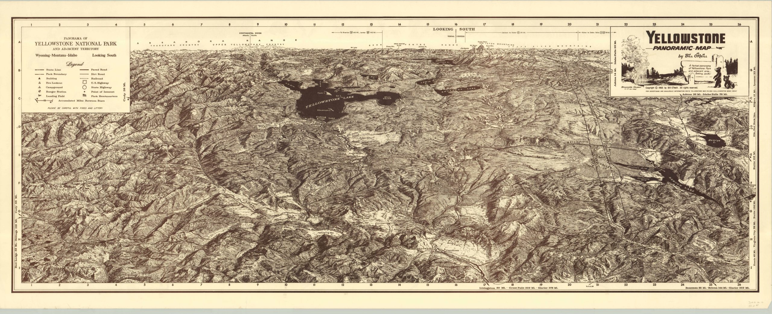
Fantastic pictorial panoramic view of Yellowstone National Park from the perspective of the north entrance.
Description
This densely illustrated panoramic view of Yellowstone is less than practical for navigational purposes, although the image does include roads (dirt & paved), railroads and highway markers. Directional aids and mileage markers can also be seen in the map’s margins. However, it’s real charm is the relief depiction of the park’s incredible topographical features. Low valleys punctured by steep hilly ridges weave around ink dark lakes and several rivers that meander through the park. Locations of interest, including mountains, creeks, campsites, ranger stations, and springs highlight the breadth of beauty and recreational opportunity available at the first National Park in the world.
The artist, Bill O’Neill, was born “within earshot of the Rapids of the Yellowstone.” Prior to his career in commercial illustration, he was a tour guide in the park. He said a frequent request from his guests was a panorama of the entire park, so they could, in effect, take it all home. With an artist’s eye and a geologist’s mind, O’Neill drew the park from the perspective looking south, since the glaciers cut the north facing sides of the mountains in a much more dramatic fashion.
Map Details
Publication Date: 1965
Author: Bill O'Neil
Sheet Width (in): 19.00
Sheet Height (in): 47.50
Condition: A-
Condition Description: The map is in very good condition, with full margins exhibiting some wear along the outer edges. Otherwise fine.
Original price was: $195.00.$150.00Current price is: $150.00.