Panorama of the Canadian Rockies
$75.00
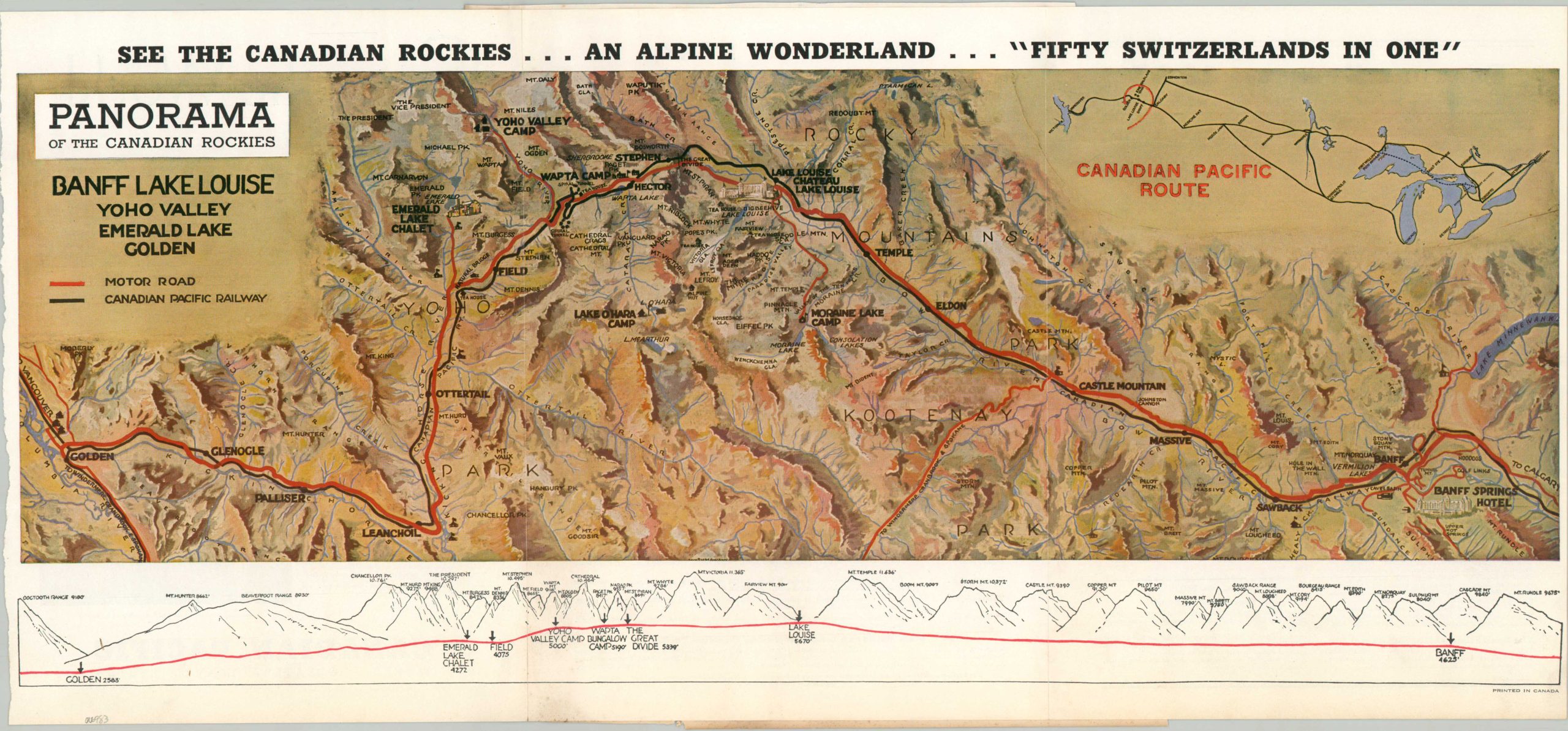
See The Canadian Rockies…An Alpine Wonderland…”Fifty Switzerlands in One”
1 in stock
Description
This lovely map of the Canadian Rockies shows the beautiful tourist region between Banff and Golden in British Columbia. It was published by the Canadian Pacific Railways to promote tourism during the 1937 season, as the Great Depression continued to affect passenger traffic on railroads across North America.
The central image shows a colorful overview of the regional topography, noting luxurious grand railway hotels, modest hunting and fishing lodges, and other locations of interest. A profile of the mountain peaks can be seen immediately below, though the apparently modest elevation changes are in reality quite significant!
Map Details
Publication Date: 1937
Author: Canadian Pacific Railway
Sheet Width (in): 22.5
Sheet Height (in): 10.4
Condition: B
Condition Description: Trip panel folding brochure mounted to a scrapbook, with a portion of the page adhered to the verso. Light waviness throughout the sheet (creased twice) and a ragged left edge, presumably where disbound from an earlier travel guide. About good condition overall.
$75.00
1 in stock