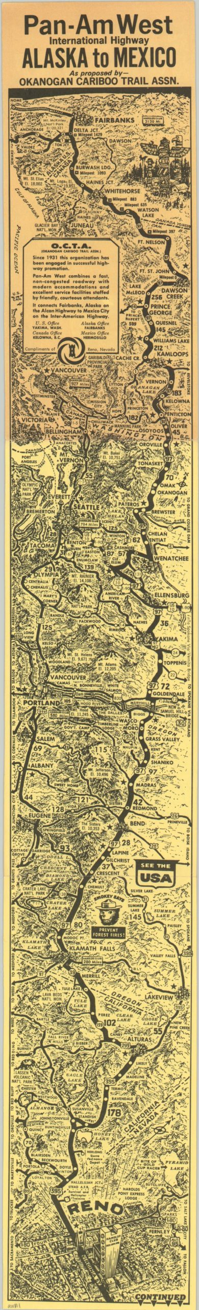
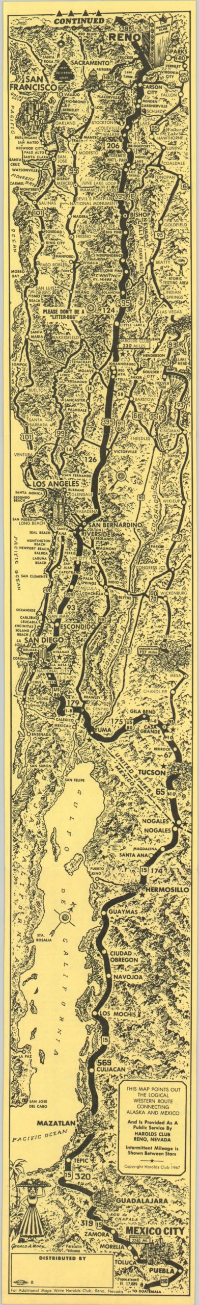
Pan-Am West International Highway
Strip map of a proposed Pan-Am West International Highway, sponsored by a Reno casino.
Out of stock
Description
The Pan American Highway stretches from Alaska to Chile and comprises a network of over 19,000 miles of connected roads and highways. The North American sections runs from Fairbanks to Mexico City, but is not the route displayed on this strip map. Instead, this map shows a more westerly alternative to the famed road running from north to south – the Pan-Am West International Highway.
Rather than traversing through the center of the country, Pan-Am West follows a course closer to the Pacific coast, through Canada, Washington, Oregon, California, Nevada and Arizona before culminating in Mexico City. The title gives credit to the Okanogan Cariboo Trail Association as the official organization promoting the route and claims it to be a “fast, non-congested roadway with modern accommodations and excellent service facilities staffed by friendly, courteous attendants.”
The map itself depicts the route boldly atop illustrated topographical detail and major natural and man-made features. The title side shows the highway from Fairbanks to Reno, which includes a prominent outline of Harold’s Casino, the map’s sponsor. Pan-Am West continues from Reno to Mexico City on the verso, which also features the signature of the artist, Gerald Eddy.
Map Details
Publication Date: 1967
Author: Gerald Eddy
Sheet Width (in): 4.00
Sheet Height (in): 27.00
Condition: B
Condition Description: Minor wear along fold lines and moderate discoloration from sun exposure on the first panel, but very good overall.
Out of stock