Palestine
$75.00
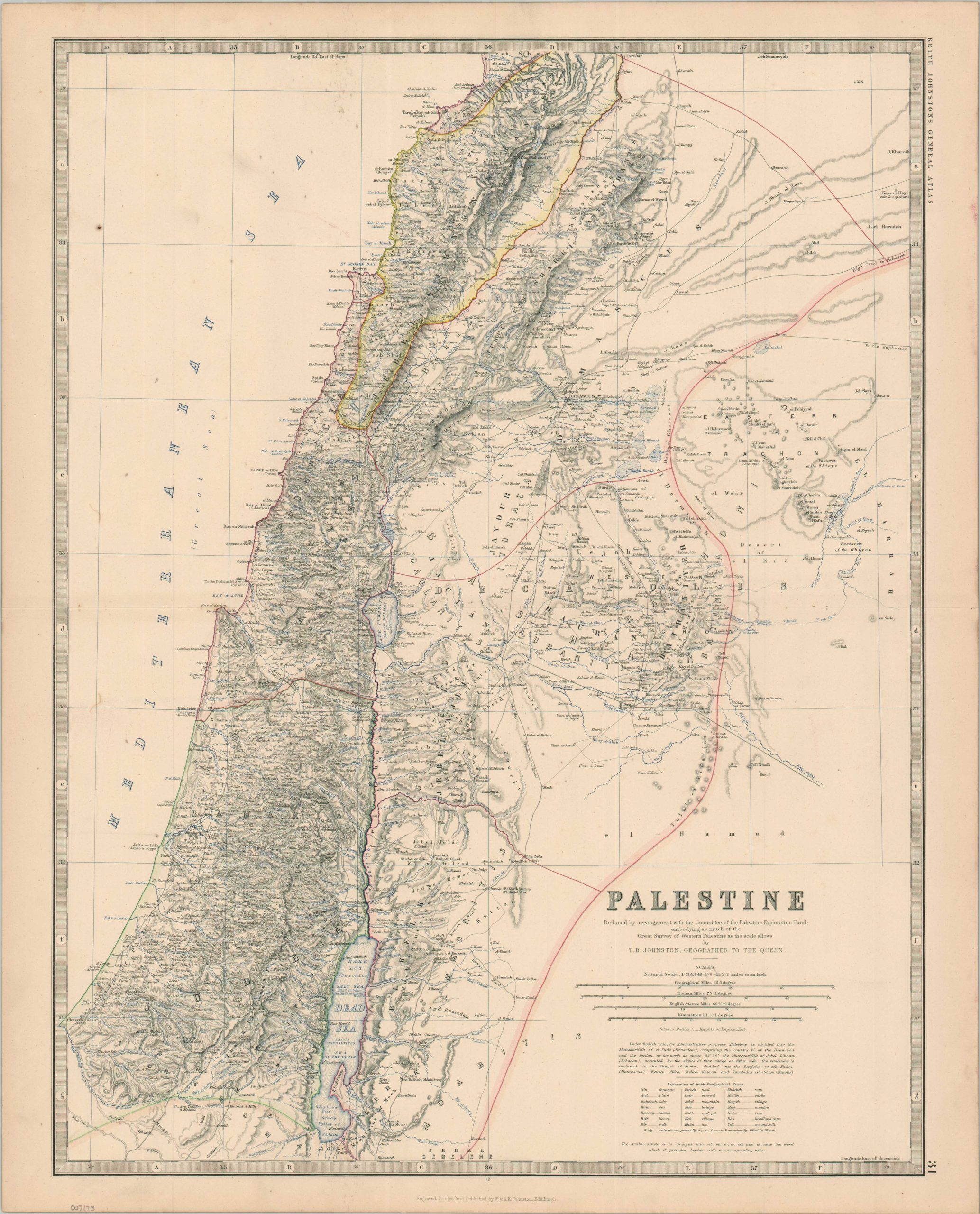
Detailed British overview of Ottoman Palestine.
1 in stock
Description
This finely detailed map of the historic territory of Palestine was created by T.B. (Thomas Brumby) Johnston and published in Edinburgh as part of brother Keith Johnston’s General Atlas. Hachured relief gives a nice overview of the region’s rugged topography while scores of toponyms identify Biblical sites, Ottoman villages, Crusader outposts, and much more. Battle sites are noted with crossed swords.
A note in the lower right indicates the image incorporates information from the Great Survey of Western Palestine, undertaken from 1872-79. Immediately below are several distance scales and an explanation of Arabic geographical terms.
Map Details
Publication Date: c. 1885
Author: T.B. Johnston
Sheet Width (in): 19.4
Sheet Height (in): 23.9
Condition: B+
Condition Description: Original color on a strong sheet with a horizontal centerfold. Light wear and toning visible in the margins. Scattered surface spotting and soiling visible within the image, most evident in the upper left corner. Good condition overall.
$75.00
1 in stock