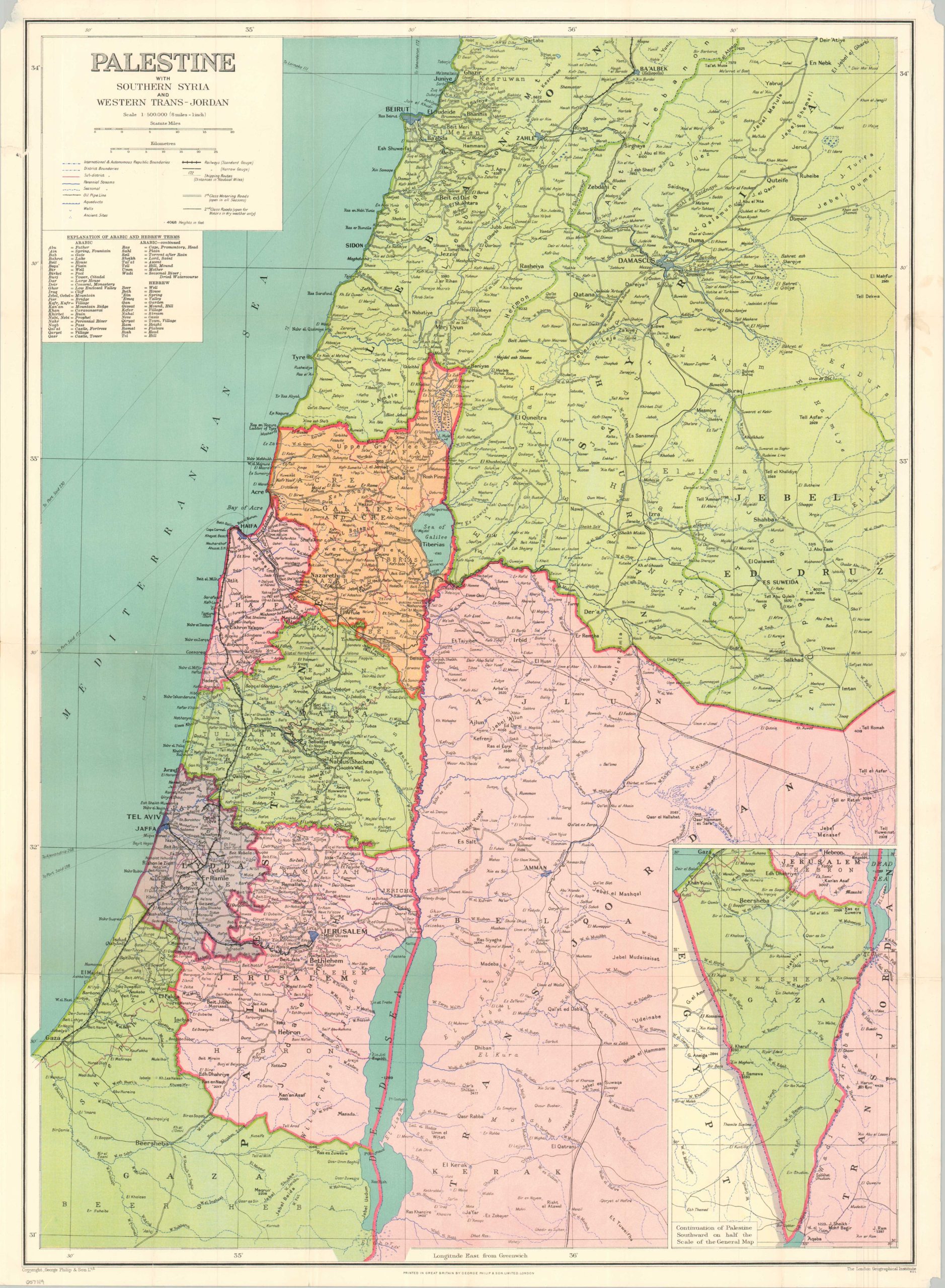
Palestine with Southern Syria and Western Trans-Jordan
Mapping Britain’s Mandate for Palestine.
Out of stock

Description
This brightly colored political map of the Levant provides a detailed overview of the French and British mandates across Syria, Lebanon, Palestine, and Jordan. Organizational districts are outlined and labeled, along with a variety of settlements, infrastructure elements (including oil pipelines), historic sites, and geographic features.
Two classes of roadways, shipping routes, and narrow/regular gauge railroads are among the transportation options shown throughout the image. The remnants of the famous Ottoman Hejaz Railway, connecting Damascus to Medina, contrast sharply with the more modern network along the Mediterranean coast.
Though undated, the political boundaries and transportation network indicate the map was issued in the late 1930s – possibly during the period of heightened public interest around the Great Palestinian Revolt. Published in London by George Philip & Son, Ltd.
Map Details
Publication Date: c. 1935
Author: George Philip & Son, Ltd.
Sheet Width (in): 21.25
Sheet Height (in): 28.9
Condition: A-
Condition Description: Color lithograph map on a single-sided sheet, folded into 25 segments and affixed to original stiff paper wraps. Creasing along folds and some wear in the margins, including chipped corners and a few spots of soiling. Rand McNally seller's stamp on the front cover. Good to very good condition overall.
Out of stock