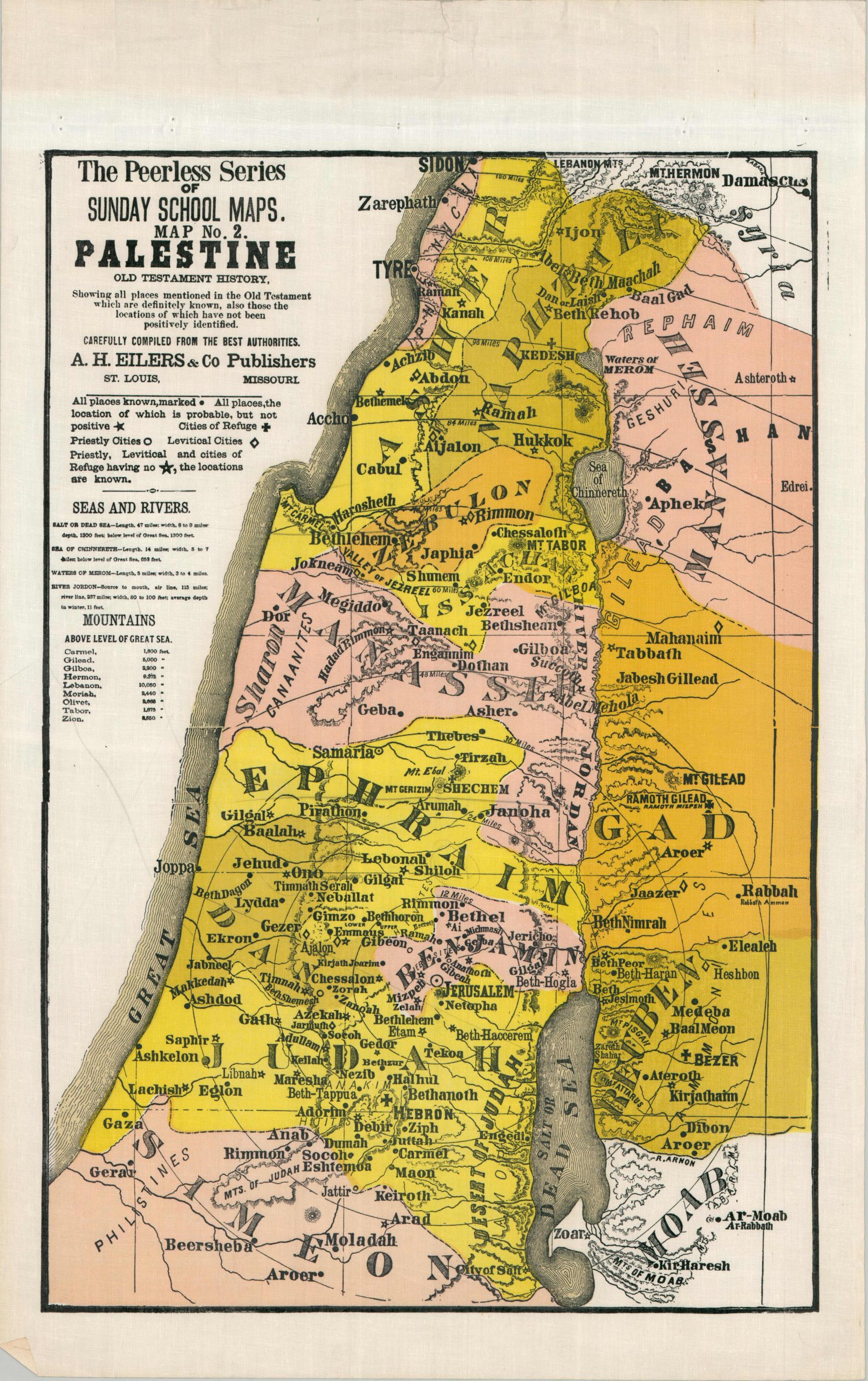
Palestine Old Testament History
The Old Testament history of the Holy Land.
Out of stock
Description
This colorful wall map presents the geography of the Holy Land according to Biblical history. It purports to show “all places mentioned in the Old Testament which are definitely known, also those locations which have not been positively identified”, according to text in the upper left. An accompanying legend outlines the various symbols employed within the image and prominent geographic features are listed.
The sheet was published in the early 1900s by A.H. Eilers & Co. as Map No. 2 in the Peerless Series of Sunday School Maps. The company was originally established in St. Louis during the early 1870s as a bookseller and stationer, but soon transitioned to the production of material related to Sunday School education in the United States. Eilers produced a number of religiously themed materials, including collection envelopes, marriage certificates, ledgers, and wall maps in a variety of sizes and formats.
Map Details
Publication Date: c. 1910
Author: A.H. Eilers
Sheet Width (in): 18
Sheet Height (in): 28.75
Condition: A-
Condition Description: Color printed map (possibly silkscreen) on a sheet of waxed cloth. Formerly attached to a wooden roller, with creasing and holes along the upper margin as a result. Minor wear elsewhere in the margins, including creasing and light soiling, consistent with age and use. Several light pencil marks within the image. Very good overall
Out of stock