Palestine in the Time of Christ
$89.00
An in-depth look at ancient Judea under Roman authority.
1 in stock


Description
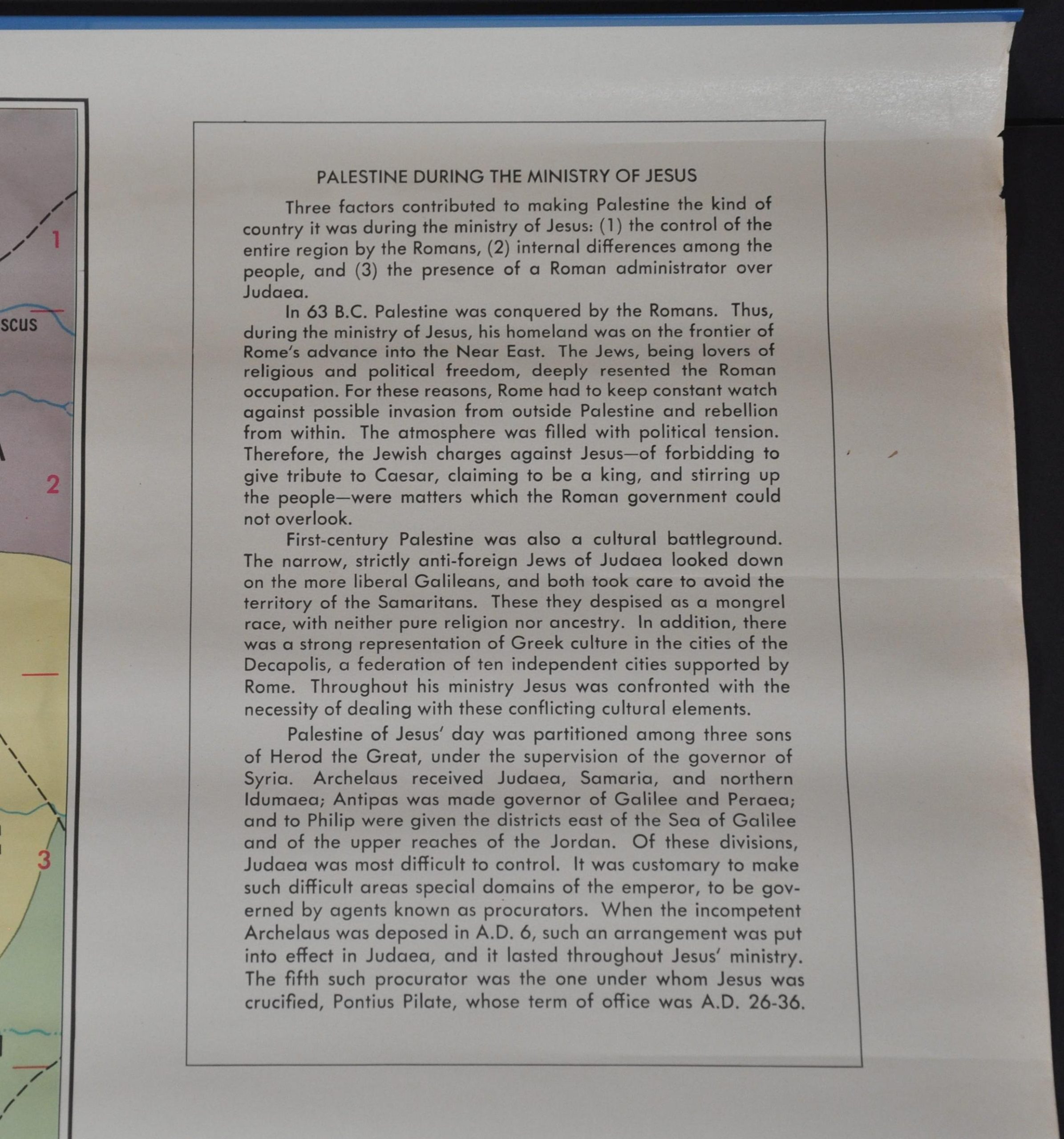
This informational wall map provides a wealth of historical context about the political conditions in which Jesus Christ would have allegedly lived. The primary image presents the divisions of Roman authority across the region in brightly colored hues. A variety of toponyms and annotations identify various places encountered in the New Testament, as well as other relevant locations.
A second map presents a large-scale outline of Jerusalem about 40 years prior to the five-month Roman siege that would see much of the city destroyed. Surprisingly frank text situated immediately above provides additional details about the antagonism between the Romans and local populace.
Maps designed by C.S. Hammond & Company of New York. Published in the mid-20th century by Broadman Publishing Supplies of Nashville, Tennessee.
Map Details
Publication Date: c. 1950s
Author: C.S. Hammond & Co.
Sheet Width (in): 25
Sheet Height (in): 24
Condition: A-
Condition Description: Large map printed on thick paper and affixed to thin blue metal rods at the top and bottom (designed for hanging). Faint toning and very light edge wear, plus some wrinkling where previously rolled. Very good overall.
$89.00
1 in stock