Paint-Brush Map of Wyoming
“Cowpoke and tool-pusher rub shoulders with Southerner and New Yorker in this most cosmopolitan of cities.” [Verso]
Out of stock
Description
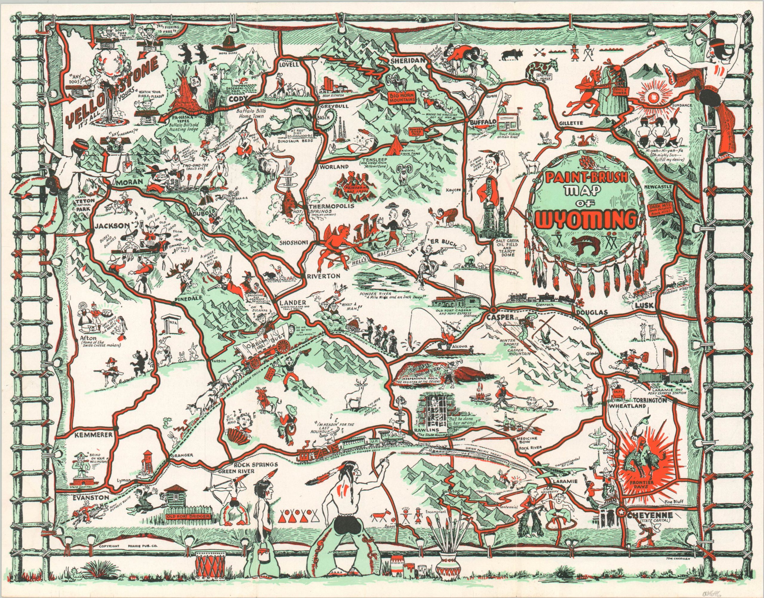
This colorful cartoon map of Wyoming was illustrated by Tom Carrigen and published in Casper by the Prairie Publishing Company in 1949, according to statistics on the verso. Humorous tongue-in-cheek vignettes highlight many regional attractions, historic sites, and cultural icons. Examples include Devil’s Tower, the Shoshoni Dam, and inspiration from polygamy along the Mormon Trail.
Native Americans are depicted in a contemporary stereotypical fashion, though those posing around the frame are technically credited as the ‘painters’ of the roads that connect the state. Descriptive text on the verso, provided by the Casper Chambers of Commerce, highlights the many charms of the ‘Gateway to the Last Frontier.’
“This early trading post with its cracker-barrel stores catering to the saddle-spring fraternity has catapulted phonominally from cow-town to metropolis. The pulse and impact of today’s business makes it the acknowledged industrial city of Wyoming, and yet, Casper is still as freshly Western and “first name” as in the two-gun days.”
Map Details
Publication Date: 1949
Author: Tom Carrigen
Sheet Width (in): 11.7
Sheet Height (in): 9
Condition: A
Condition Description: Tri-panel folding brochure with light wear from age and use. Near fine.
Out of stock