Page’s Map of Dakota, 1885
$150.00
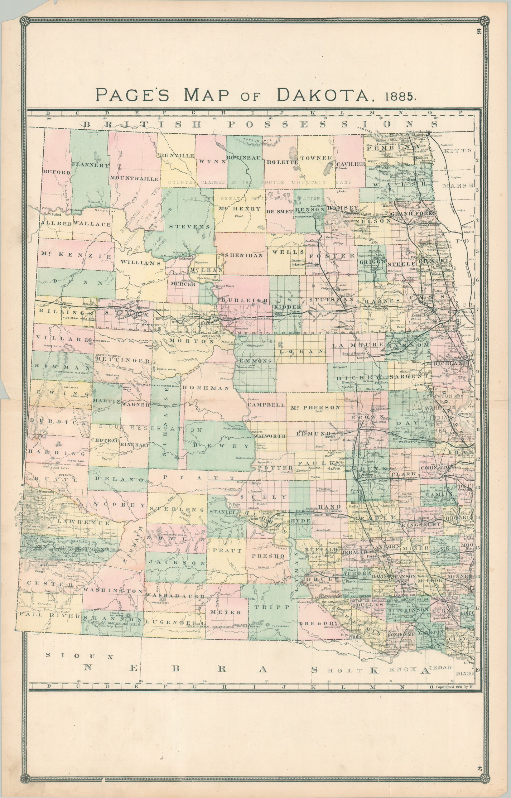
Page’s map of the Dakota Territory, published four years before statehood.
1 in stock
Description
The appetite for white settlement in the Dakota Territory was relatively muted until the early 1870s, as the local Sioux Indians fiercely defended their ancestral homeland against the relentless encroachment of invaders from the east. But the discovery of gold in the Black Hills by George Armstrong Custer in 1874 changed the equation, and soon the territory was flooded with settlers, fur traders, prospectors, and ranchers closely following the rapidly expanding rail network. Further conflict would erupt with the Great Sioux War in 1876, which saw the death of Custer and Crazy Horse, and ultimately led to the forced relocation of numerous local tribes onto reservations. Several such Native American sequestrations can be seen on this map, concentrated in the northern and southwestern areas of the territory.
Topography is depicted in hachure and numerous geographic features like buttes and mountain peaks are labeled. Elsewhere, one can see a fascinating variety of place names that reflects frontier settlements, fortifications, Native American villages, trading posts, and more. Railroad routes are boldly outlined, notably the critically important Northern Pacific Railroad – the fifth American transcontinental line, completed in 1883. The map was published two years later, in 1885, by H.R. Page & Co. in Chicago.
Map Details
Publication Date: 1885
Author: H.R. Page & Co.
Sheet Width (in): 17.25
Sheet Height (in): 27.25
Condition: A-
Condition Description: Scattered soiling visible in the large blank spaces at the top and bottom of the sheet, as well as in the margins. The upper left corner is chipped and there are a few other small tears around the outer edges of the sheet, away from the image. Very good condition overall.
$150.00
1 in stock