Pacific Northwest
Lovely illustrated map of the Pacific Northwest coast of the United States.
Out of stock

Description
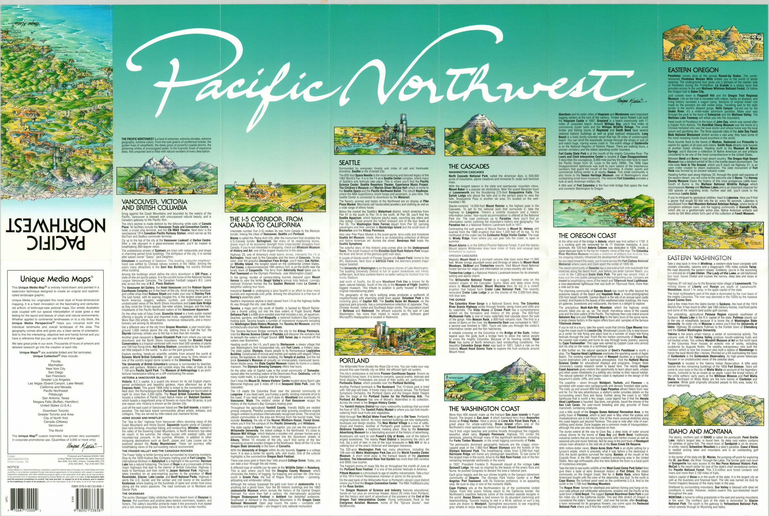
This charming cartoon map of the Pacific Northwest was published by Unique Media in 2009 and shows a lovely panorama of Washington, Oregon, and Idaho looking towards the northeast. Finely detailed depictions of major landmarks, locations of interest, and local businesses can be seen interspersed between labeled transportation routes and pictorial geographic features.
The last are especially emphasized, with pictorial topography and bright colors highlighting the varied regional geography. Many mountain peaks are named with height provided in feet. Other items of interest include Olympic National Park, Puget Sound, Seattle, Vancouver, and the Oregon Trail. The verso of the sheet includes extensive tourist information on the notable regions covered throughout the image.
The distinctive cartoon style is a hallmark of the Ontario, Canada based Unique Media, Inc. Starting in the late 1970’s, the company created a number of maps with a similar aesthetic of locations across the United States and continue to do so today.
Map Details
Publication Date: 2009
Author: Unique Media
Sheet Width (in): 27.00
Sheet Height (in): 17.75
Condition: A
Condition Description: Near fine condition, with light creasing and faint wear along originally issued fold lines.
Out of stock