Pacific Arena
$145.00
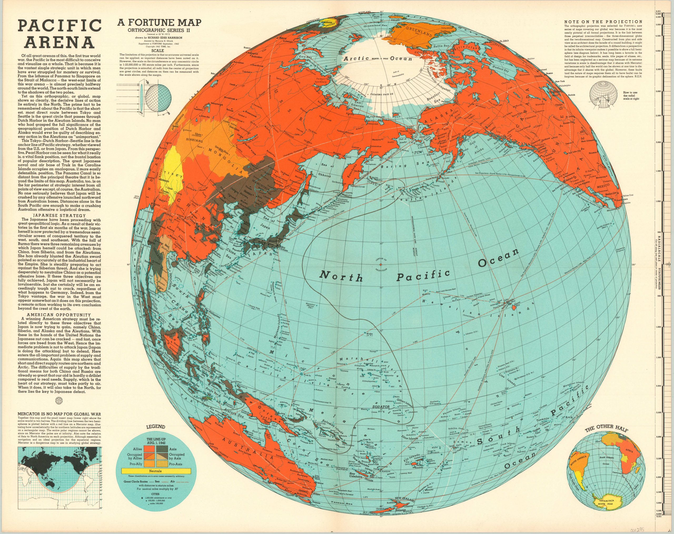
World War II map focused on the Pacific Theater, published as a supplement to Fortune Magazine with the intent to educate the American public.
1 in stock
Description
Richard Edes Harrison published a series of maps for Fortune Magazine using unique projections designed to convey the immense scale of the war to readers in the United States. This orthographic projection is detailed in a text box in the upper right-hand corner, and comes with instructions on how to use the removable scale on the right side. In a separate section, Harrison explains the deficiencies of the Mercator projection – still the most commonly used projection today.
The map allows its audience to understand the staggering distances between American home ports and the corresponding operations in the Pacific Ocean and South China Seas. Furthermore, the author specifically points out the closest point between America and Tokyo is not through the Hawaiian Islands, but rather through Dutch harbors in the Aleutian Islands.
Allied countries, shaded in orange, have a dominant visual presence on the map, but Japan’s early successes can be found in the dark regions dominating China and Indonesia. Published in New York in 1942 as a supplement to Fortune Magazine.
Map Details
Publication Date: 1942
Author: Richard Edes Harrison
Sheet Width (in): 26.75
Sheet Height (in): 21.25
Condition: A
Condition Description: Originally folded into 4 panels. Some faint discoloration along the outer edge of the sheet from age, but in fine shape overall.
$145.00
1 in stock

