Oxford
A comprehensive pictorial overview of Oxford’s rich history, especially in education.
Out of stock
Description
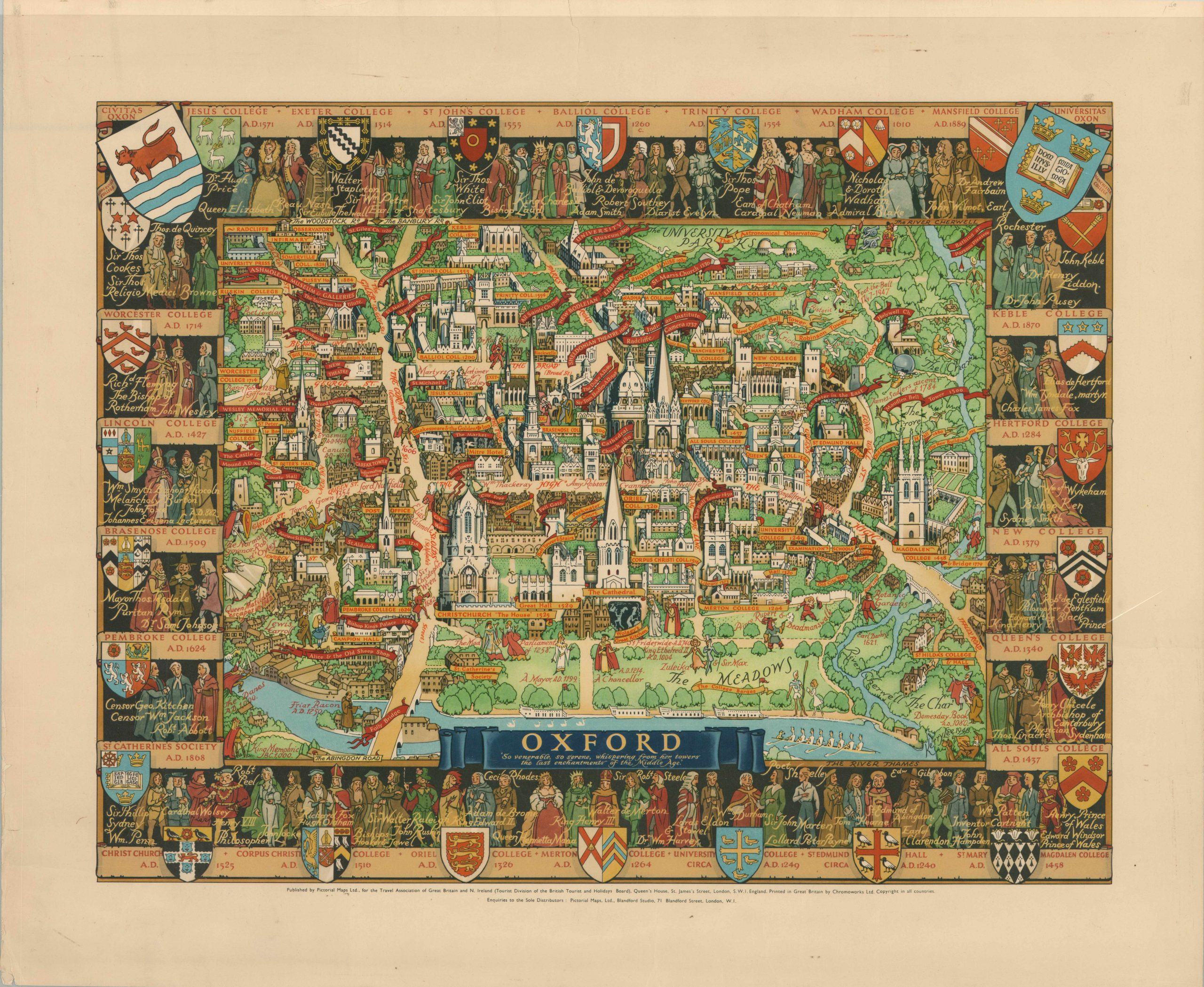
This image of Oxford is one of several pictorial maps Kerry Lee created to promote tourism in the United Kingdom after WWII. During the war, Lee was assigned to the Air Ministry, where he made drawing of German fighter aircraft to aid in development of strategy. That attention to detail would serve him well when he created this map of Oxford in 1948.
Published by Pictorial Maps Ltd. and printed by Chromoworks, this map was sponsored by the short-lived Travel Association of Great Britain and Northern Ireland (1947 – 1950). It depicts the city pictorially with the River Thames in the foreground. The two major elements within the image, unsurprisingly, are architecture and education.
As the location of the oldest university in the English speaking world, as well as the host of every type of English architecture, these are fitting themes for the map. Surrounding the city is a decorative border containing the educational history of the city, with the schools, coat of arms, and influential alumni all expertly illustrated.
Map Details
Publication Date: 1948
Author: Kerry Lee
Sheet Width (in): 27
Sheet Height (in): 22.25
Condition: A-
Condition Description: Moderate wear in the margins, including a few small tears, creasing, and wrinkling. But the image itself is in near fine condition. Bright color on a slightly toned sheet.
Out of stock

