
Overseas Highway
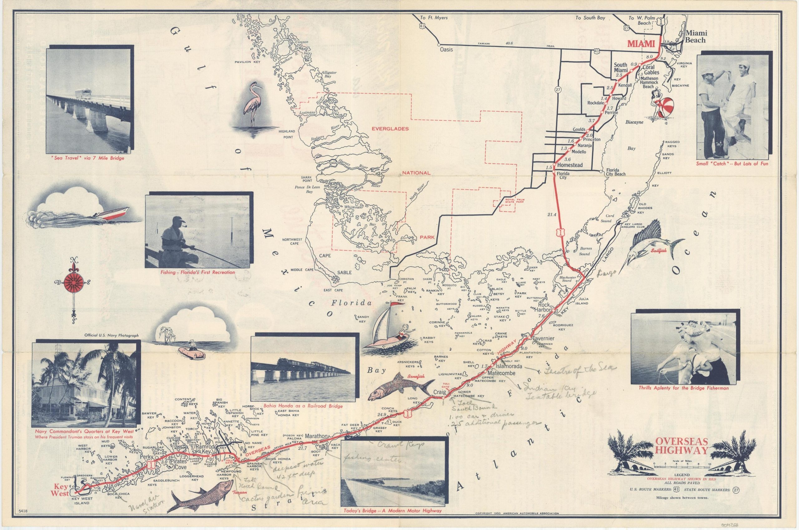
Lighthearted map of the Overseas Highway connecting Miami to Key West.
Out of stock
Description
Note that no scale is provided on this map, which uses a cleverly distorted perspective to “shorten” the distance between Miami and the Florida Keys. Such tricks were not uncommon in promotional maps like this one, issued by the American Automobile Association in 1950.
Drawings and photographs were also used regularly on maps to draw interest from tourists, though usually with more subtlety than the one here captioned “Thrills aplenty for the Bridge Fisherman.” Manuscript annotations in pencil identify many local attractions.
Map Details
Publication Date: 1950
Author: American Automobile Association
Sheet Width (in): 18
Sheet Height (in): 12
Condition: B+
Condition Description: Creased and faintly toned along originally issued fold lines. Manuscript annotations in pencil throughout.
Out of stock