
Our Flying Ambassadors and Their Routes
Using America’s aviation prowess for political advantage during the late 1920s.
Out of stock
Description
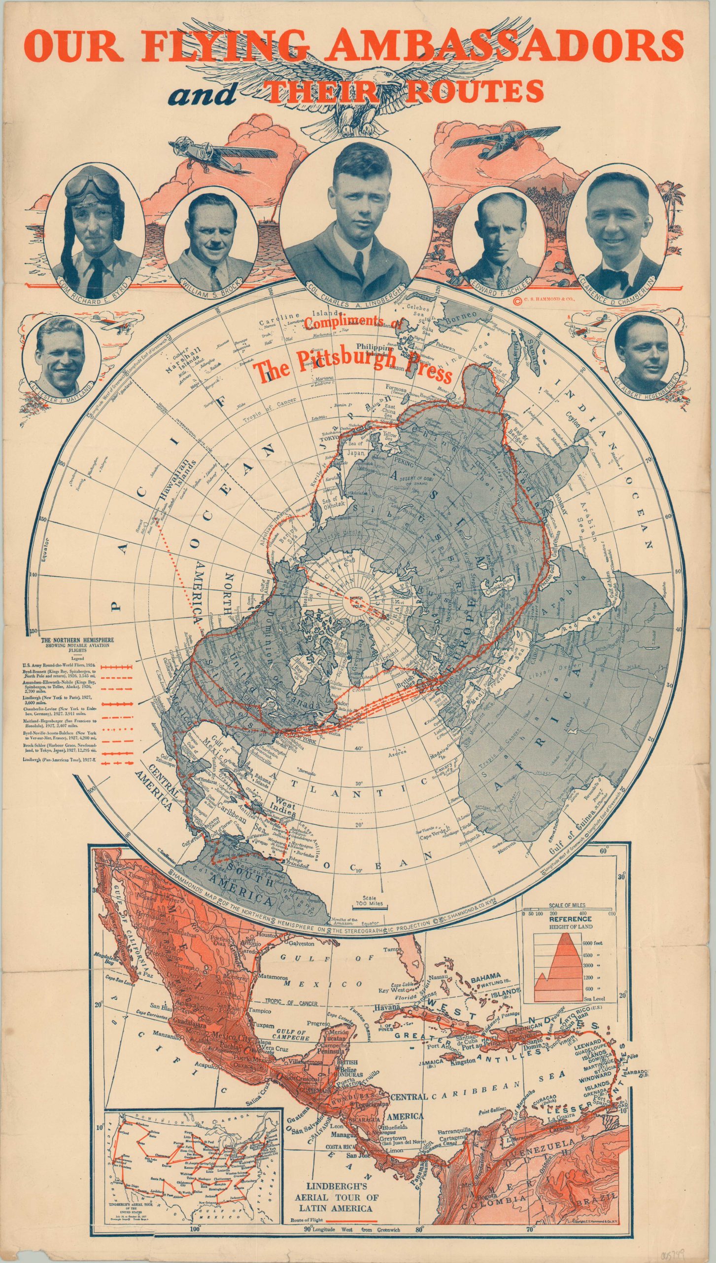
This eye-catching celebration of America’s aviators was published in New York by C.S. Hammond & Co. in 1928 or early in 1929. A central map of the Northern Hemisphere on a circumpolar projection highlights the aerial routes of several recent pilot teams, including the U.S. Army Round-the-World Fliers (1924), the Byrd-Bennett Trip to the North Pole (1926) and Charles Lindbergh’s Pan-American Tour in 1927-28. Photos of the dashing airmen can be seen at the top of the page.
The title referring to the pilots as ‘flying ambassadors’ could be taken quite literally. The aviation industry was marked by rapid developments during the 1920s, and the American government sought to capitalize on global public interest. Several well-publicized trips were sponsored throughout the decade, including Lindbergh’s ‘Goodwill Tour’ across Latin America seen in an inset at the bottom of the page.
Map Details
Publication Date: 1928
Author: C.S. Hammond & Co.
Sheet Width (in): 12.75
Sheet Height (in): 22.75
Condition: B+
Condition Description: Soft creasing and several spots of separation along old fold lines, with about 4" of closed tears repaired on the verso with archival tape (no image loss). Some scattered discoloration visible along the outer edges of the sheet, most evident in the upper left. An irregular tear in the lower left has also been repaired on the verso, with a small chip in the margin nearby. Good to very good condition overall.
Out of stock