Ost-Europa U. Vorder-Asien
$85.00
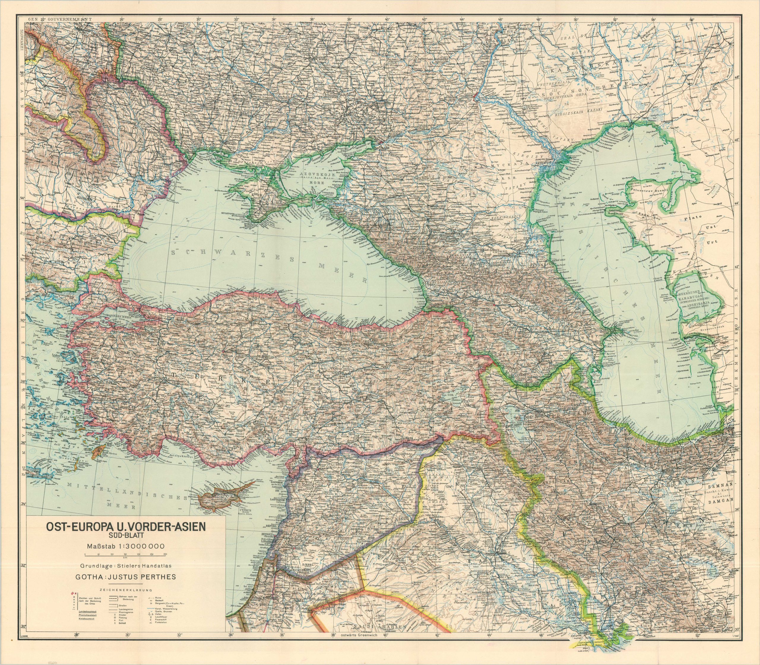
A detailed German map of southeastern Europe and the Caucasus published during World War II.
1 in stock
Description
This tremendously detailed map covers a large area across Central Asia and Eastern Europe from the Eastern Mediterranean to the Caspian Sea. It was published by the firm of Justus Perthes in Gotha, probably around 1940 based on the labeling of the German occupational government in Poland (upper left).
The legend (lower left) identifies the various symbols used for prominent transportation routes, relevant infrastructure, fortifications, and different landmarks. The vast region includes several strategic considerations for Germany during the war; including the protection of the oilfields at Ploesti, managing British influence in Iraq/Iran, and recent devastating military setbacks across the Soviet Union.
Map Details
Publication Date: c. 1940
Author: Justus Perthes
Sheet Width (in): 36.5
Sheet Height (in): 32
Condition: A-
Condition Description: Color lithographed map on a single-sided sheet (southern sheet only). Sharply creased along old folds and a few closed tears along the outer edges. Very good condition overall.
$85.00
1 in stock