
Oranienburg
$350.00
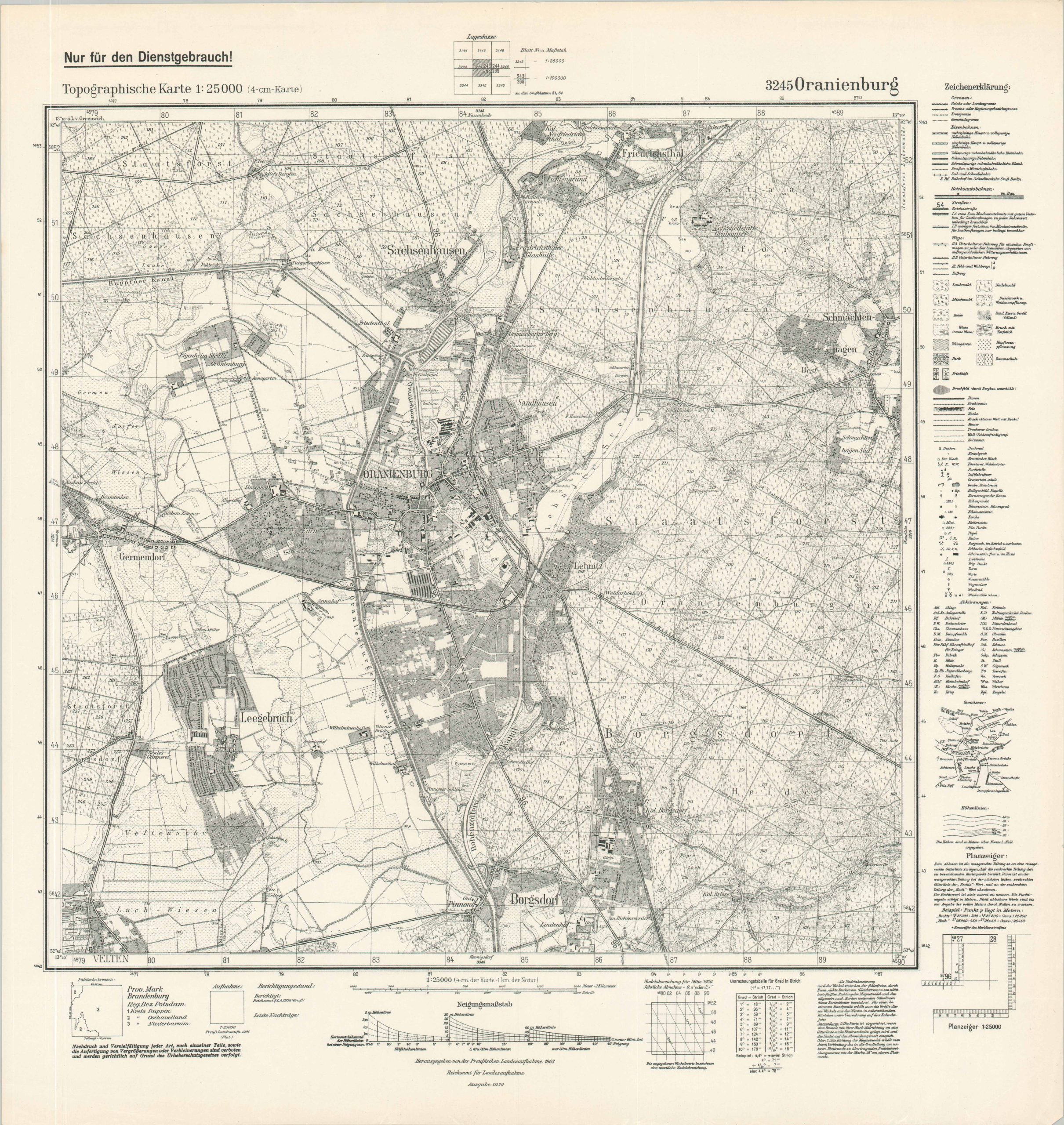
1939 German map of Oranienburg, home to the notorious Sachsenhausen concentration camp.
1 in stock
Description
This detailed topographic map, marked (in German) ‘For Official Use Only’, was published in 1939 by the Reichsampt fur Landesaufnahme (Office of State Surveys) in Berlin. An incredible wealth of information is transmitted through the use of finely engraved symbols, letters, and numbers described in several marginal legends. The transportation network, physical landscape, notable infrastructure, and building outlines are all depicted – although the accuracy may be considered somewhat suspect for purposes of military strategy.
In particular, it appears that the cartographer may have obfuscated the scope of the local concentration camp system. In 1933, the first Oranienberg camp was opened on the grounds of a disused brewery south of the city center. While it was a relatively modest affair compared to later sites, it still housed over a thousand internees during its operational period of less than a year. One brewery, Schiffbauerei, is mentioned, but the outline of the facility is otherwise omitted from the image. More significantly, Sauchsenhausen concentration camp was established in 1936 as a much larger and deadlier facility for political prisoners and enemies of the Third Reich. While the nearby transit stop is labeled, the distinctive triangular outline of the camp, still visible today, is notably absent.
Sources: United States Holocaust Museum; Sauchsenhausen Concentration Camp;
Map Details
Publication Date: 1939
Author: Reichsampt fur Landesaufnahme [Office of State Surveys]
Sheet Width (in): 22.5
Sheet Height (in): 23.4
Condition: A
Condition Description: Single-sided sheet with light wear along the outer edges. Near fine condition overall.
$350.00
1 in stock