Operations of the 100th Infantry Division in the European Theater of Operations
A complete set of five maps showcasing the WWII campaign of the 100th Infantry Division.
Out of stock

Description
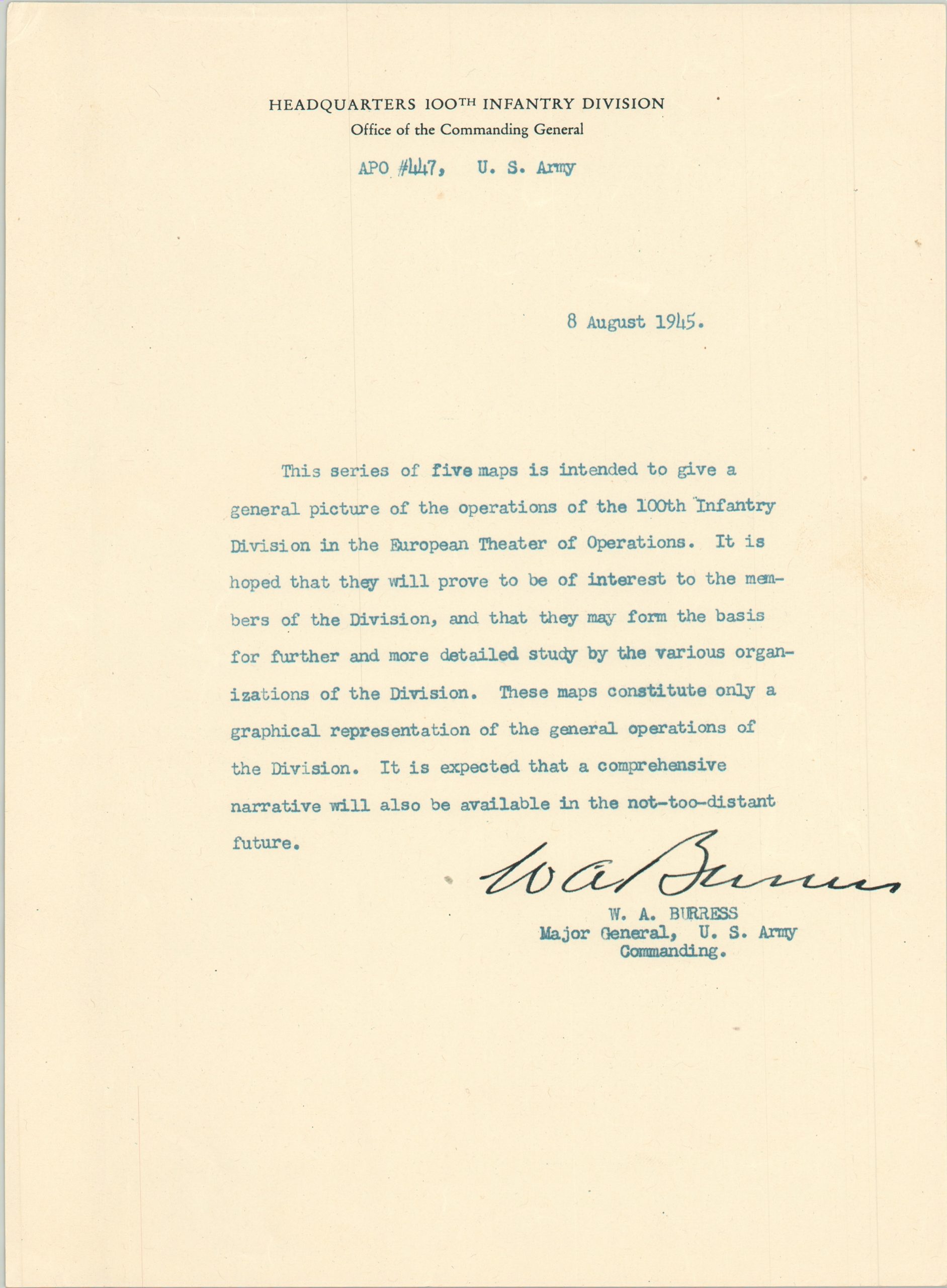
This is an engaging set of five maps commemorating the efforts of the 100th Infantry Division during the Second World War. All except one was published by the divisional support section, G-3, likely in Germany during the unit’s postwar occupation. According to the letter accompanying the maps, issued by Commanding General Major W.A. Burress and included with the set:
“this series of five maps is intended to give a general picture of the operations of the 100th Infantry Division in the European Theater of Operations. It is hoped that they will prove to be of interest to the members of the Division, and that they may form the basis for further and more detailed study by various organizations of the Division.These maps constitute only a graphical representation of the general operations of the Division.”
This last sentence is an understatement, as the maps are a wild simplification of the complex maneuvers undertaken by the division and the many units attached. The collection also includes the original mailing envelope, postmarked June 1945 from T/5 Armando Chiuchiolo to (presumably) his mother in Massachusetts.
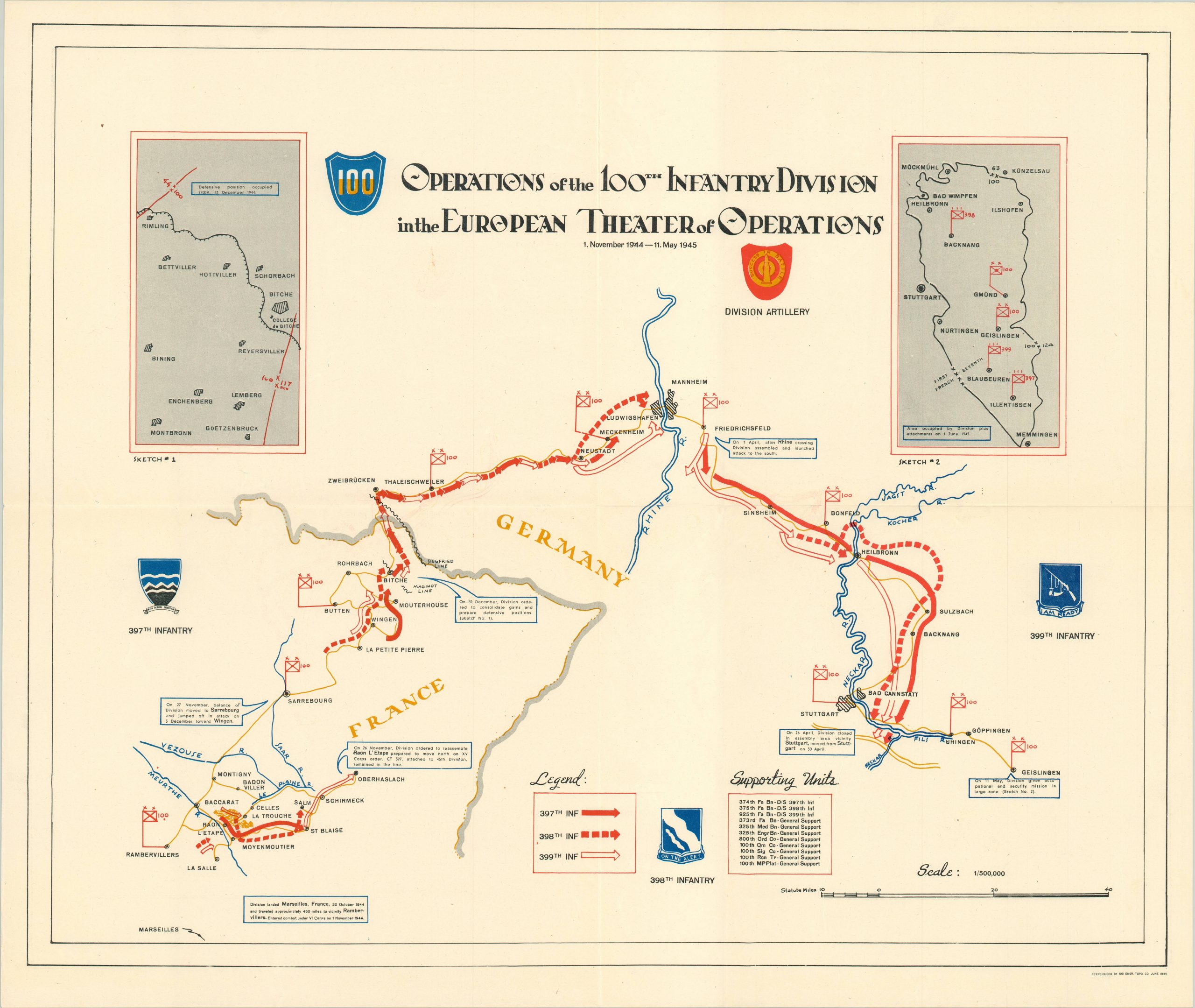
Operations of the 100th Infantry Division in the European Theater of Operations – The last map to be printed, and the only one that was not produced by the divisional support section. Rather, this sheet was published in June of 1945 by the 661st Engineer Topographic Company. Shows the route through France and Germany from the first day of combat near Rambervillers to V-E Day + 3, when the unit was assigned its occupational orders near Geislingen. Includes inset maps of the action around Bitche and the divisional occupation zone in Germany.
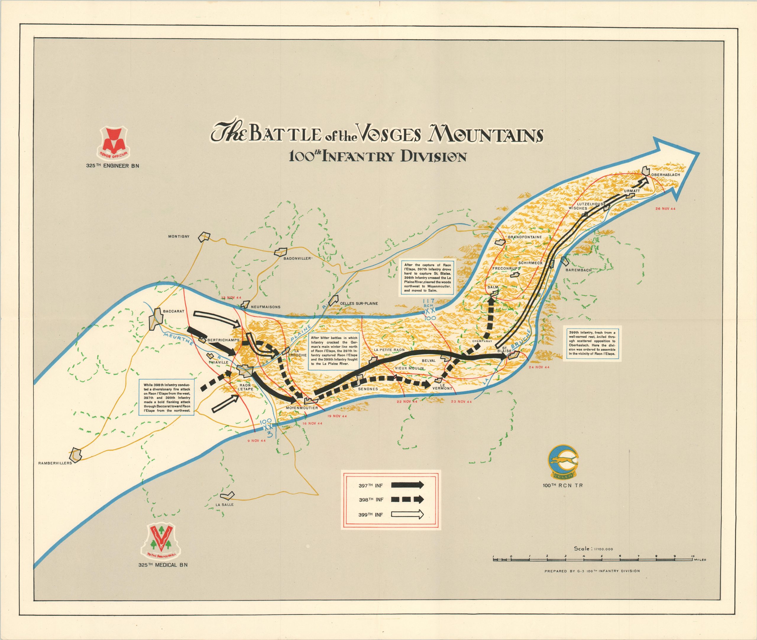
The Battle of the Vosges Mountains – This sheet covers the divisions first combat in France, outside the town of Rambervillers, between November 11 and November 26, 1944. Here, the 100th cracked the primary German winter defensive line in the Vosges Mountains and carried the advance to the town of Oberhalasch.
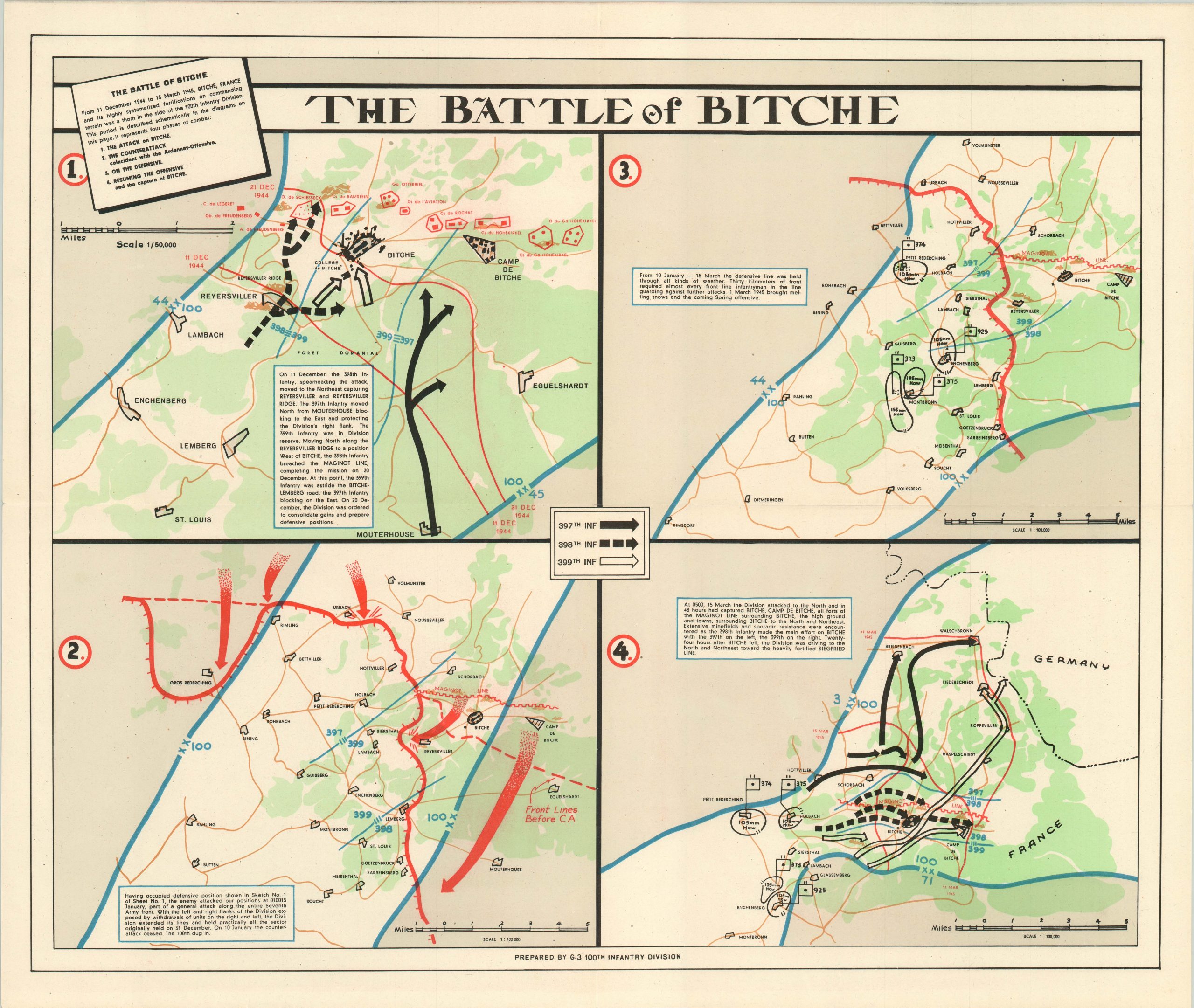
The Battle of Bitche – A four panel map detailing the action of the Battle of Bitche, from December 11, 1944 to March 15, 1945. Coverage includes the primary attack on the city, the German counterattack as part of the larger “Battle of the Bulge, defensive positions outside the city, and the ultimate resumption of the offensive and capture of Bitche. Each panel includes an accompanying narrative and outlines the routes of the 397th, 398th and 399th Infantry Regiments.
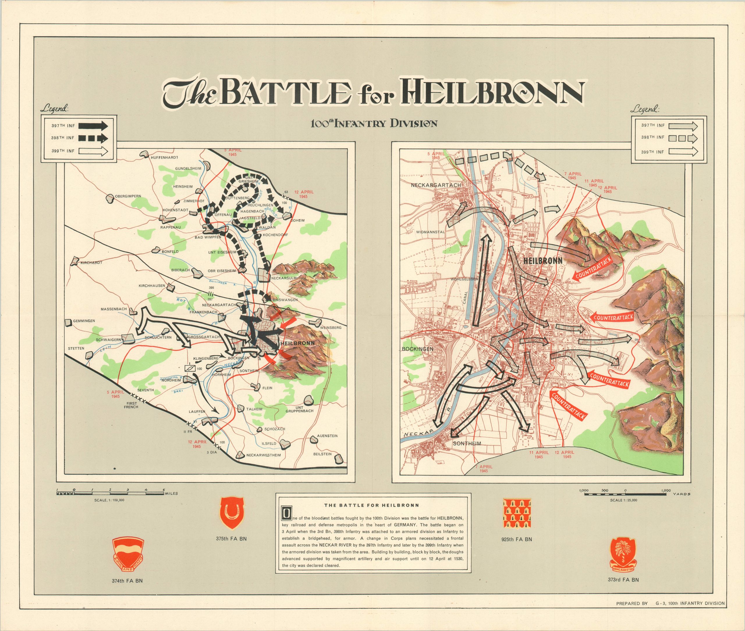
The Battle for Heilbronn – This dual composition shows both the initial troop build up and ultimate invasion of the city of Heilbronn, in the heart of Germany. The three infantry regiments engaged in vicious hand to hand fighting in a frontal assault supported by artillery and air power. After a nine day attack, the city was declared cleared on April 12, 1945.
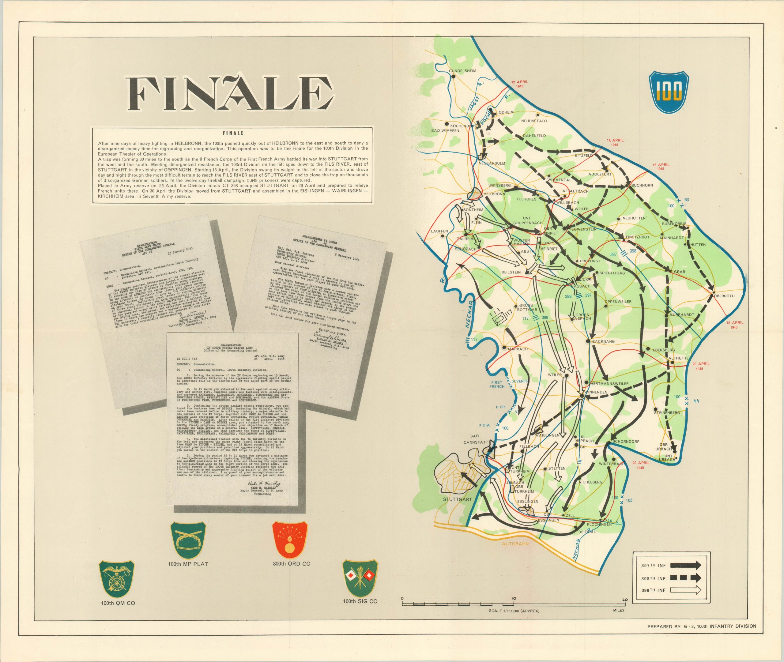
Finale – Covers the remaining action in Europe after the Battle of Heilbronn, including linking up with the First French Army outside of Stuttgart. Identifies the routes taken by three separate infantry regiments and includes several unit insignia as well as copies of the commendation letters written about the division.
Map Details
Publication Date: 1945
Author: G-3 Section of 100th Inf Div.
Sheet Width (in): 26
Sheet Height (in): 22
Condition: A-
Condition Description: A set of five lithographed maps, plus an introductory letter by the commanding general and the original postmarked mailing envelope. The maps are in excellent condition, folded twice with creasing along fold lines, but otherwise fine. The envelope is in two pieces, but is legible.
Out of stock