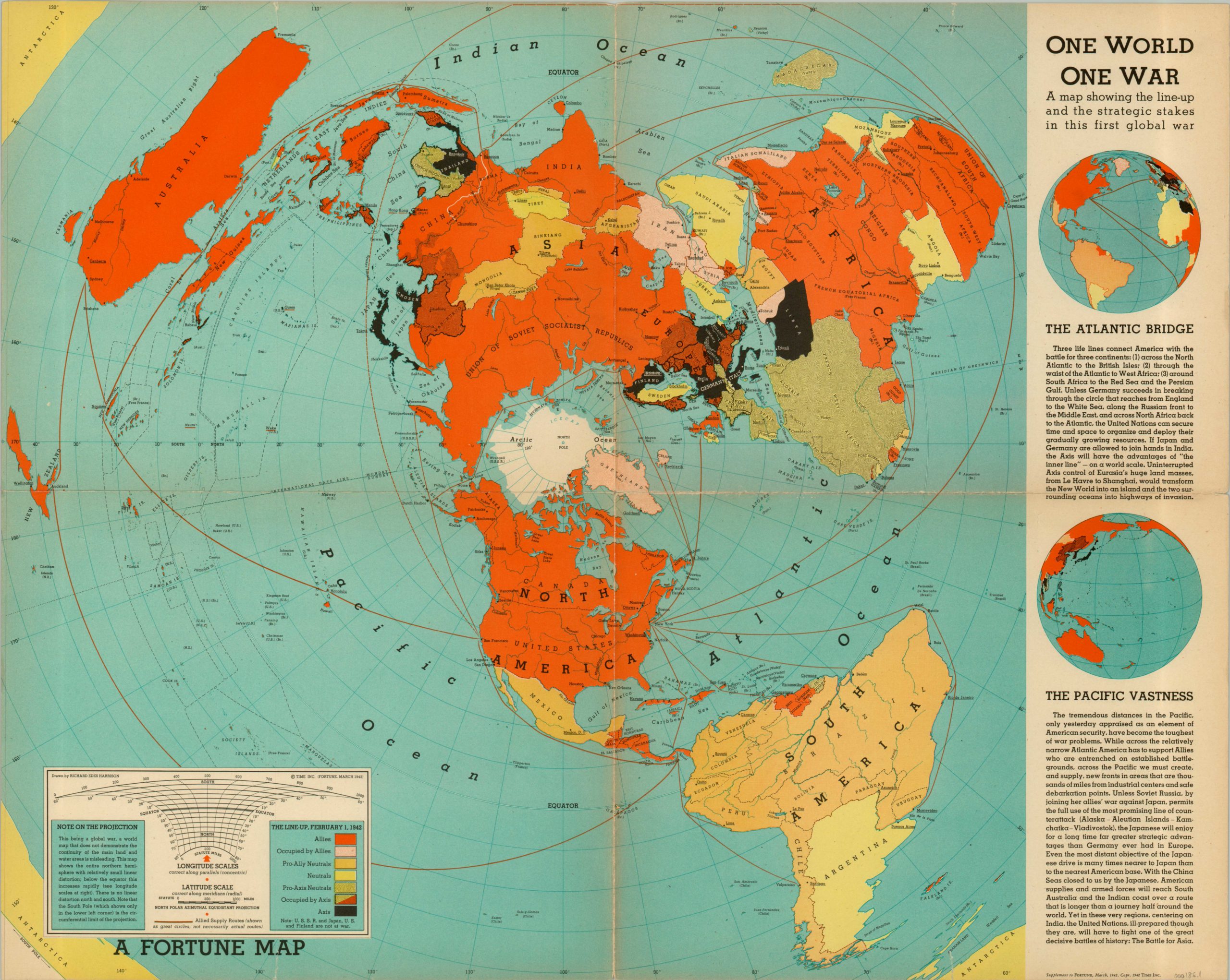
One World One War
A map published as a supplement to the March 1942 issue of Fortune Magazine displaying the world in an azimuthal projection.
Out of stock
Description
Designed to influence the perception of the American public during the war, this map highlights the extensive distances of U.S. supply lines in the European and Pacific theaters. Color is used to dramatic effect to show the superiority of the Allies in landmass and the disparate nature of Axis power throughout the globe. This advantage in distributed geography did not immediately translate to military success – the outcome of the war was still very much in doubt in early 1942. However, Germany’s failure to completely overwhelm Russia in the east and the U.S. military industrialization and advance in the Pacific would soon turn the tides.
This map is one of several designed in the 1930’s and 1940’s by Richard Edes Harrison, who used a new projection to better reflect distances between countries in the age of air transportation and warfare. His revolutionary maps aided greatly in the American public’s geographic comprehension of events during World War II. An explanation of this projection, along with a key showing Axis/Allied occupations, is available in the legend in the lower left.
Map Details
Publication Date: 1942
Author: Richard Edes Harrison
Sheet Width (in): 26.75
Sheet Height (in): 21
Condition: B
Condition Description: The map is in decent condition, with the most obvious defect being the wear and discoloration along the fold lines. One complete separation has been repaired and reinforced on verso, as have several smaller edge tears.
Out of stock