
One World One War
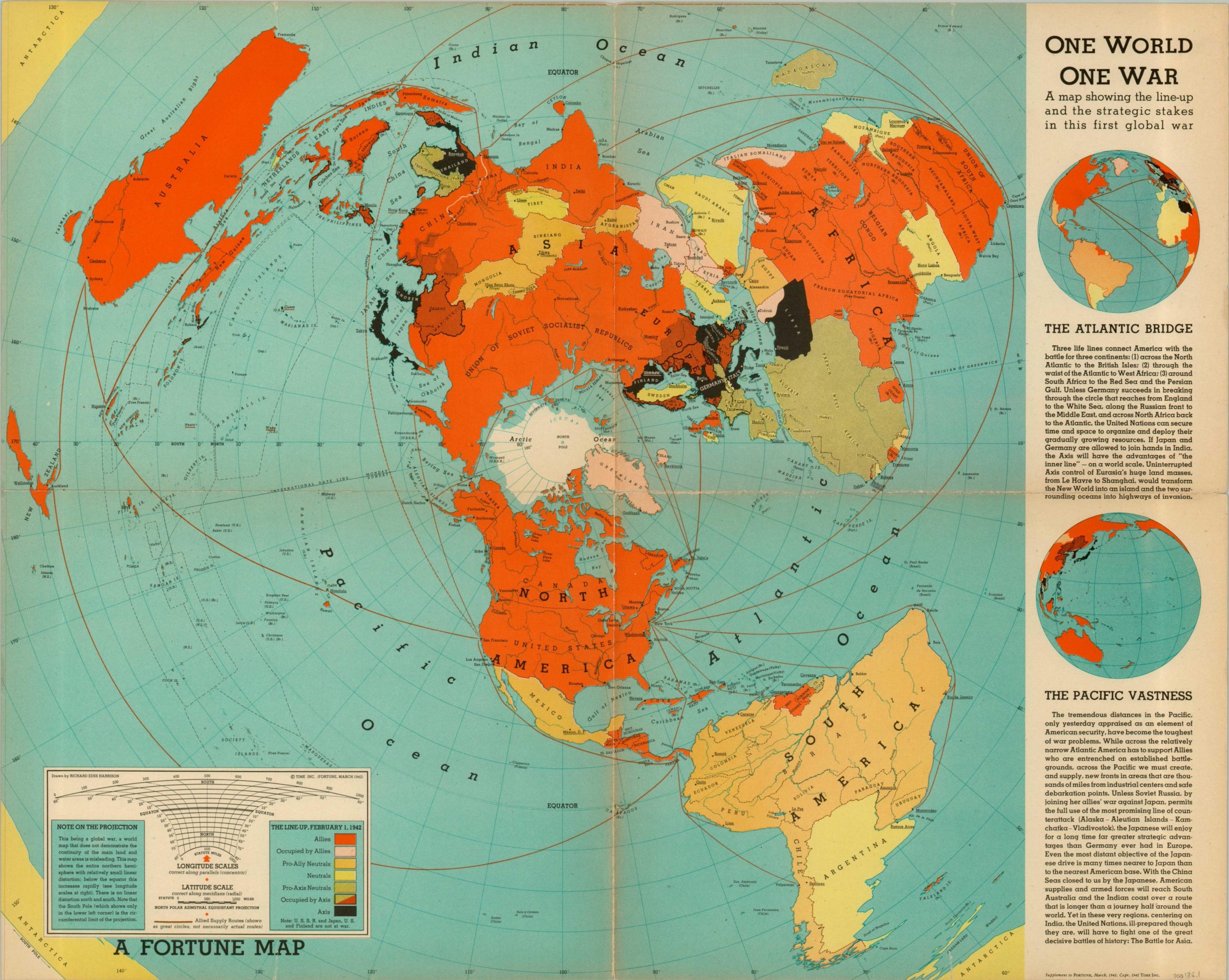
A map published as a supplement to the March 1942 issue of Fortune Magazine displaying the world in an azimuthal projection.
Out of stock
Description
Designed to influence the perception of the American public during the war, this map highlights the extensive distances of U.S. supply lines in the European and Pacific theaters. Color is used to dramatic effect to show the superiority of the Allies in landmass and the disparate nature of Axis power throughout the globe.
Designed by Richard Edes Harrison and published as a supplement in a 1942 edition of Fortune Magazine.
Map Details
Publication Date: 1942
Author: Richard Edes Harrison
Sheet Width (in): 26.50
Sheet Height (in): 21.25
Condition: A
Condition Description: The map is in very good condition, with slight fading along the edges and original fold lines.
Out of stock