Old Oregon Trail
Original price was: $150.00.$95.00Current price is: $95.00.
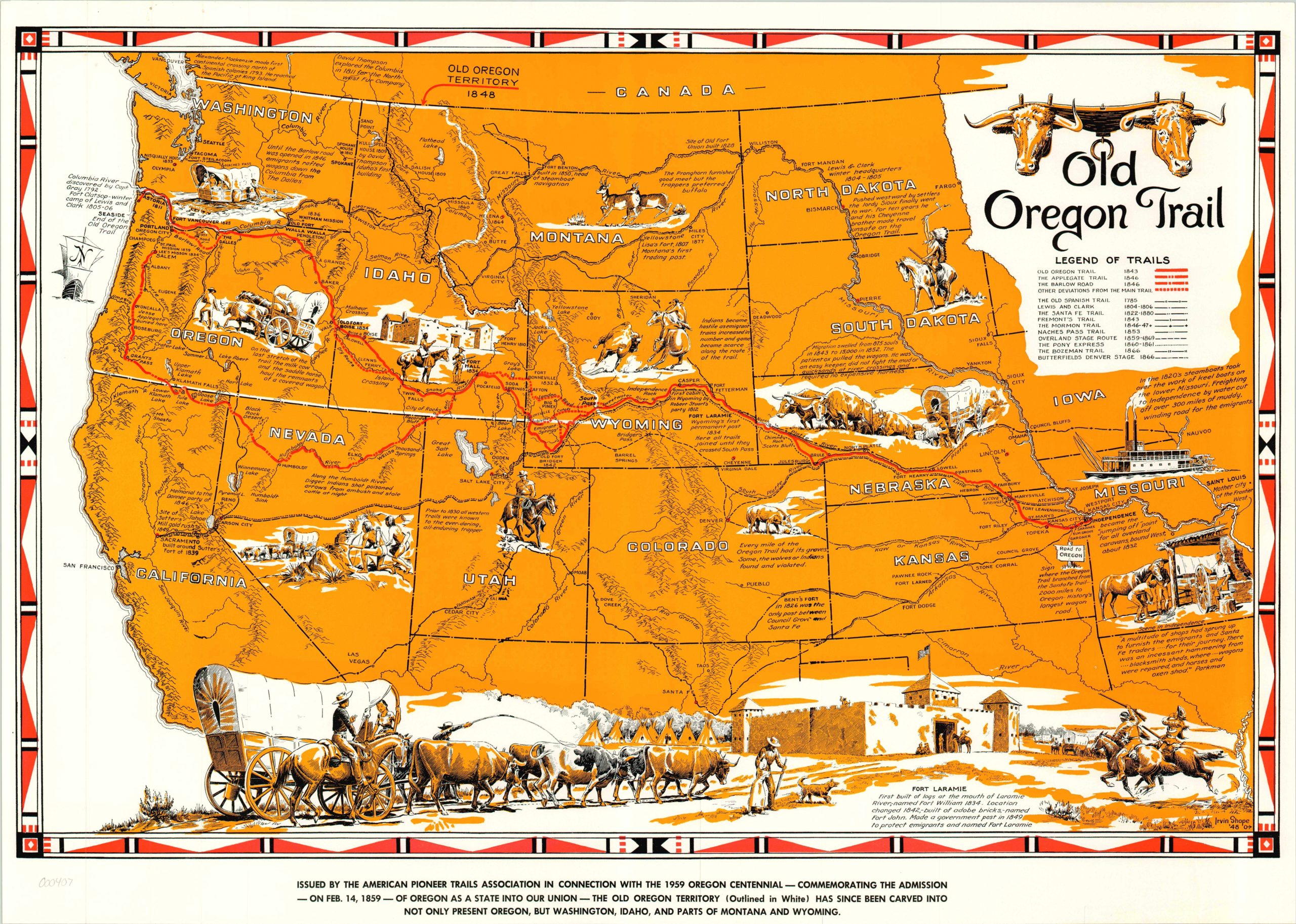
A bright pictorial map created by Irvin Shope to commemorate the 100th anniversary of the admission of the Oregon Territory into the United States, published by the Pioneer Trails Association.
Description
Covering the area from Saint Louis to the Pacific Ocean, this map displays the routes of 14 separate trails used by pioneers, cowboys, missionaries, and mountain men during the period of great westward expansion in the middle of the 19th century. Text detailing notable locations, events, and features of the trails are present throughout, alongside charming vignettes of the same. A view of Fort Laramie, complete with a wagon train, Indian encampment and riders can be seen on the bottom edge.
Irvine “Shorty” Shope worked as a cowboy in Montana prior to starting his career as an artist in the West. A member of the Cowboy Artists of America, Shope painted portraits of the men and women of the region, in addition to designing maps, books and calendars. This map was sponsored by the Pioneer Trails Association to commemorate the 100th anniversary of the establishment of the Oregon Territory.
Map Details
Publication Date: 1948
Author: Irvin Shope
Sheet Width (in): 25
Sheet Height (in): 17
Condition: A-
Condition Description: The map is in very good condition, with minor soiling and wear associated with age.
Original price was: $150.00.$95.00Current price is: $95.00.