Old Jerusalem
Fascinating map of ancient Jerusalem from the early 18th century.
Out of stock
Description
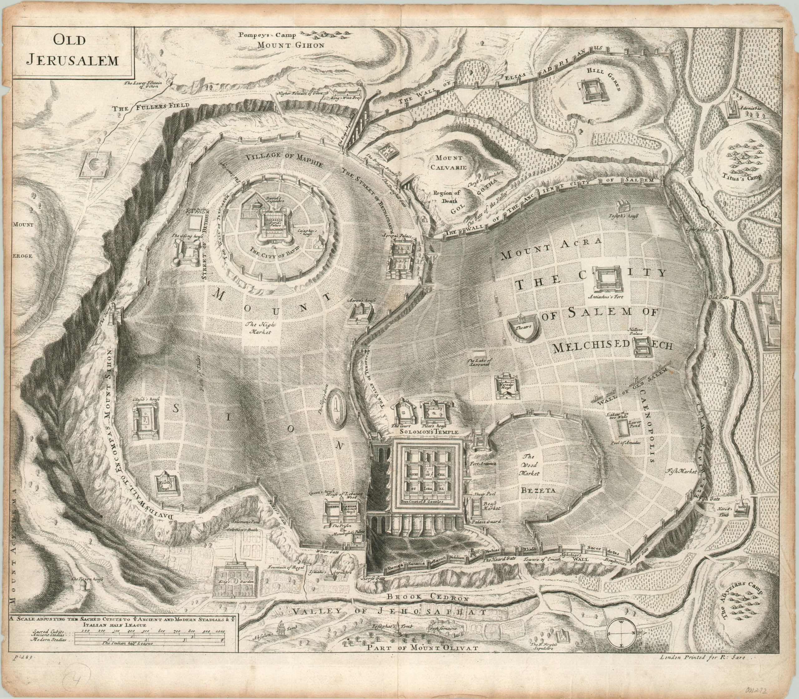
Though the cartography of Jerusalem has a rich history and numerous early examples, the distinction between historical reality and religious iconography is not always made clear.
Numerous locations from both Old and New Testaments are shown; such as Herod’s Temple and Christ’s Sepulchre. Many of the buildings presented within the image date to the first century BC, but the walls, Solomon’s Temple, and David’s Palace are all shown reflecting a much older period from ancient Jerusalem. Camps surrounding the city reflect a diverse array of historical sieges; the Assyrians around 700 BC, Pompey the Great in 63 BC, and the Roman Emperor Titus in 70 CE.
This copperplate engraving was published in London by Richard Sare for his 1702 edition of “The Works of Flavius Josephus”, translated by Sir Roger L’Estrange.
Map Details
Publication Date: 1702
Author: Richard Sare
Sheet Width (in): 17.6
Sheet Height (in): 15.4
Condition: B
Condition Description: Narrowed margins which show moderate discoloration and wear. In a few places, the tears and/or toning enters the plateline, but overall the image is clean and crisp. Issued on thin paper exhibiting minor waviness and one crease on the right side which was present at printing.
Out of stock