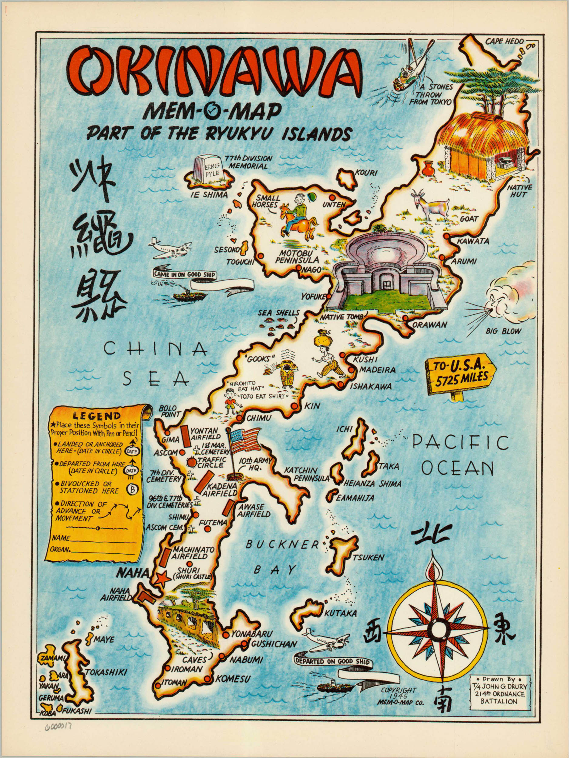
Okinawa Mem-O-Map
Pictorial map of the Japanese island of Okinawa, designed as a tool for servicemen to revisit their experiences in World War Two.
Out of stock
Description
The racist map makes light of the horrible fighting and devastation wrought on the island, where over 90% of buildings were destroyed and Japanese and Allied casualties topped 150,000. The reader is encouraged, through the legend, to mark their landing location, movement and departure point. Geographic features, native Okinawan architecture, and relevant military locations are depicted alongside 5 cemeteries – a somber reminder of the lives lost taking the island.
John Drury was a technician in the Army for two years in the Pacific Theater, and made a series of five Mem-O-Maps that replaced the reality of war with colorful and humorous illustrations aimed at veterans. To learn more about John Drury’s Mem-O-Maps, check out my blog post here.
Map Details
Publication Date: 1945
Author: John Drury
Sheet Width (in): 10.5
Sheet Height (in): 14
Condition: A+
Condition Description: The map is in A+ condition, with bright color and no visible defects.
Out of stock