Oil in America
Cartographic proof of the close relationship between the oil industry and the United States.
Out of stock
Description
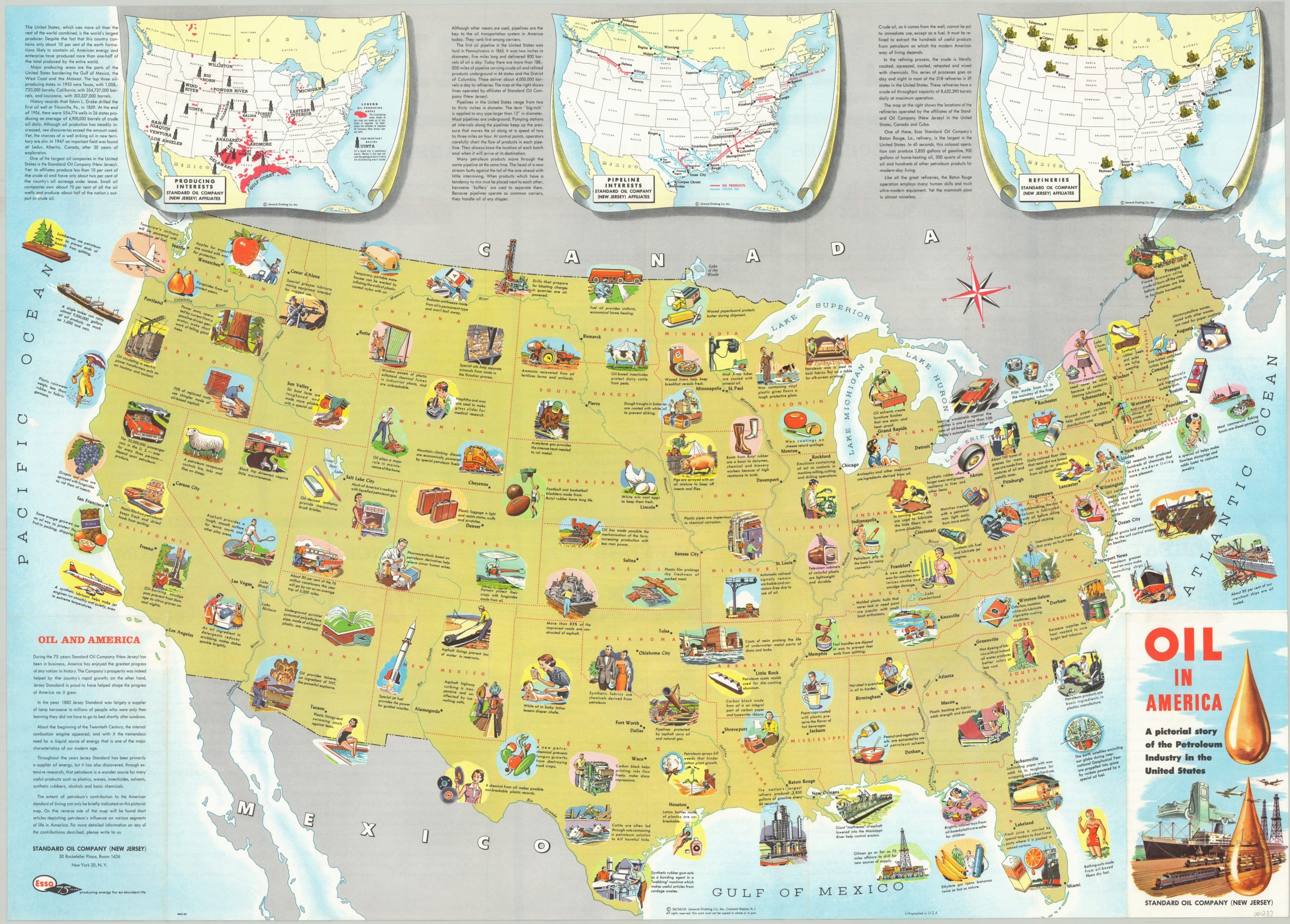
This charming pictorial map was designed by the General Drafting Company and published by Standard Oil in 1957. It highlights the vast impact of the petroleum industry in the United States, and includes illustrations in nearly every state showing just how important Standard Oil operations are to the prosperity of the nation. Or, at least that’s the impression they want the audience to get!
Inset maps along the top of the image show the locations of refineries, pipelines, and producing interests of the Standard Oil Company. Accompanying text throughout the image and the verso heaps additional praise on the petroleum juggernaut, which was forced to split into a number of different companies as a result of an anti-trust lawsuit in 1911.
Two of these companies were Standard Oil of New Jersey (Esso, and the publisher of this map), which eventually became Exxon, and Standard Oil of New York (Socony), which eventually became Mobil; those two companies later merged into ExxonMobil.
Map Details
Publication Date: 1957
Author: General Drafting Company
Sheet Width (in): 33.30
Sheet Height (in): 23.90
Condition: A
Condition Description: Originally folded into a double sided 24 panel brochure. Creasing along original fold lines and very faint discoloration on the front panel (visible lower right). Near fine condition overall.
Out of stock