Oil and Gas Map of New Mexico
$150.00
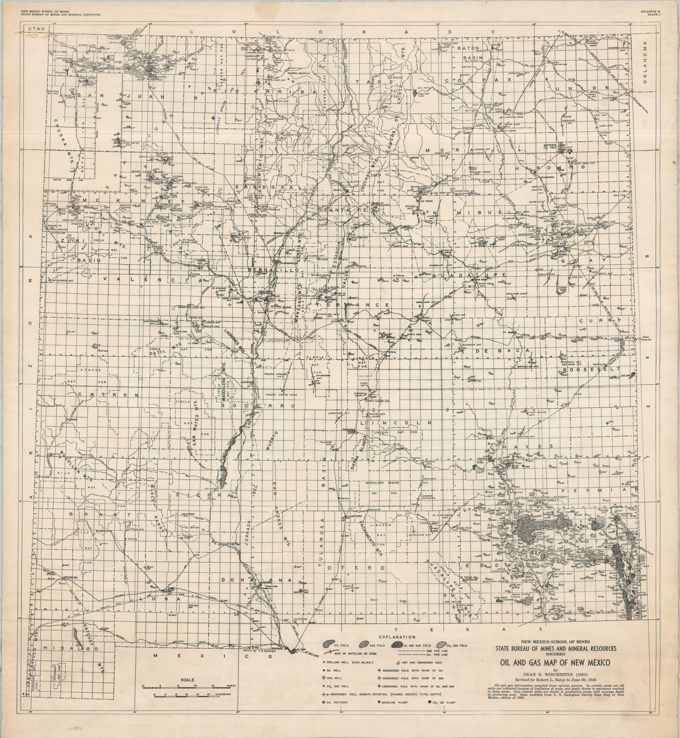
New Mexico’s strategic resources during World War II.
1 in stock
Description
This densely packed map of New Mexico’s Oil and Gas fields was compiled by Robert L. Bates in 1942 and published in Bulletin 15 by the New Mexico School of Mines (Socorro). Fields, pipelines, and wells (active and abandoned) are among the various features identified throughout the image. Refineries and gasoline plants are noted, highlighting how production capacity can be localized.
Also of interest are carbon dioxide fields and the dry ice plants that process the captured gas. This was a relatively innovative process introduced in the early 1930s that helped introduce greater means of refrigeration, especially for perishable foods.
Map Details
Publication Date: 1942
Author: Robert L. Bates
Sheet Width (in): 24.9
Sheet Height (in): 27.25
Condition: B+
Condition Description: Single sheet mounted onto old linen, a bit raggedy along the outer edges. Scattered wrinkling and creasing, plus a small quarter-sized damp stain in the upper margin. Some surface soiling in the upper left and lower right corners. Good condition overall.
$150.00
1 in stock