Ohio The Buckeye State
$125.00
Colorful map of Ohio designed to celebrate its 150th anniversary as a state.
1 in stock


Description
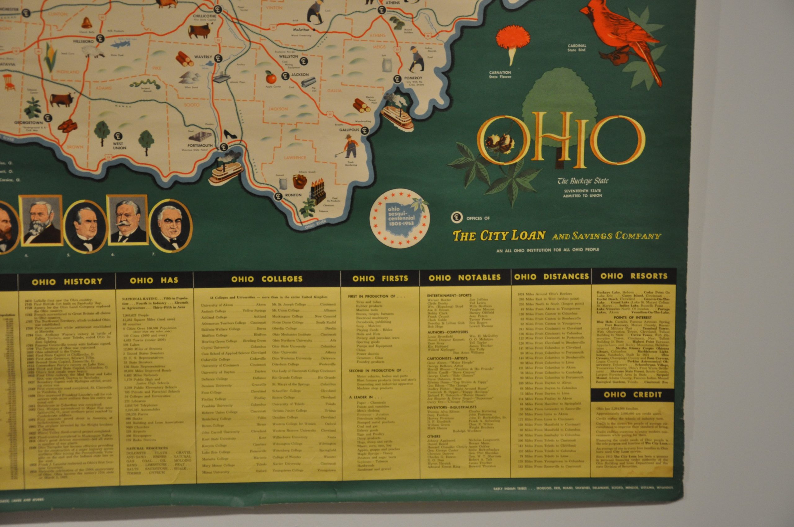
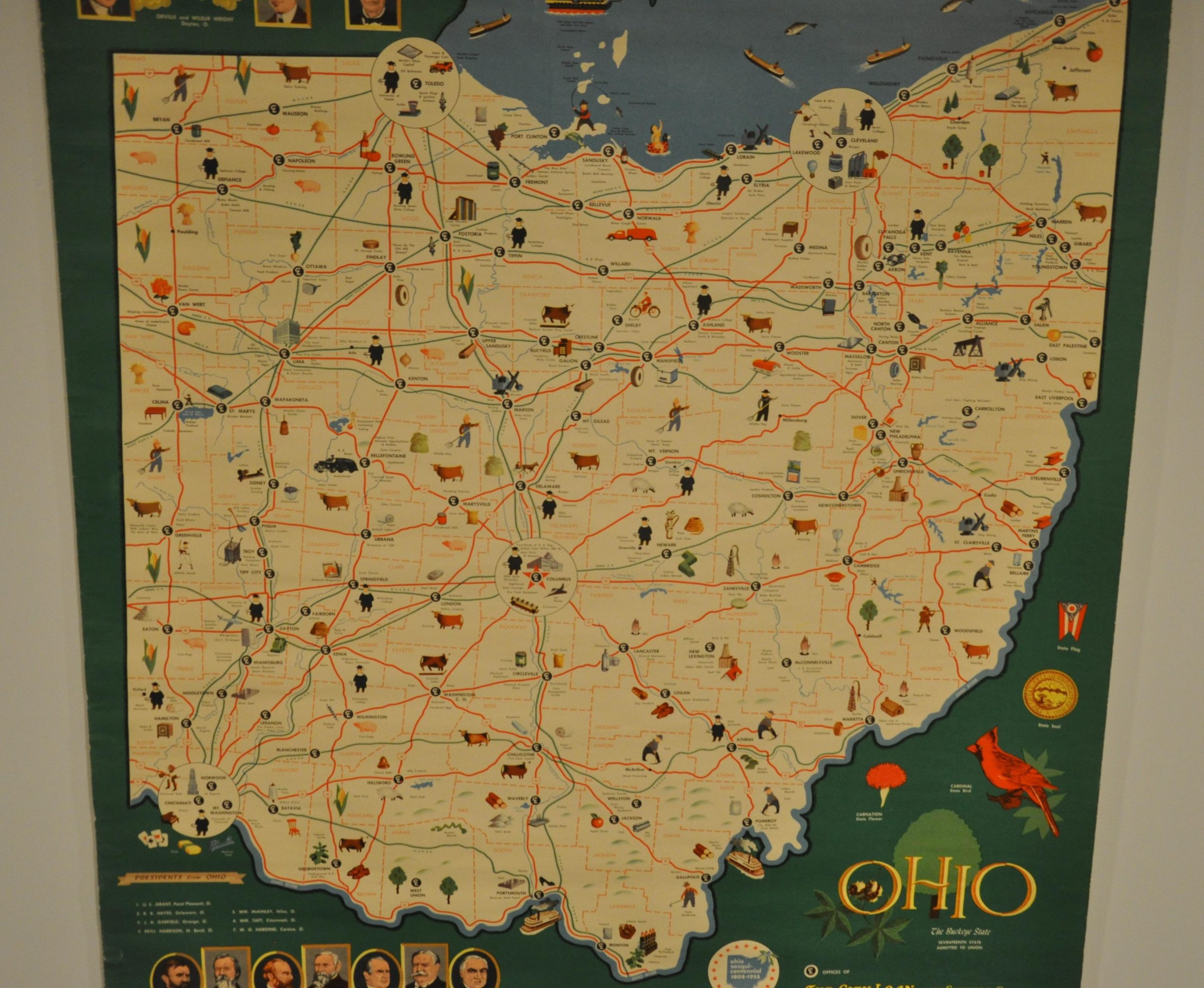
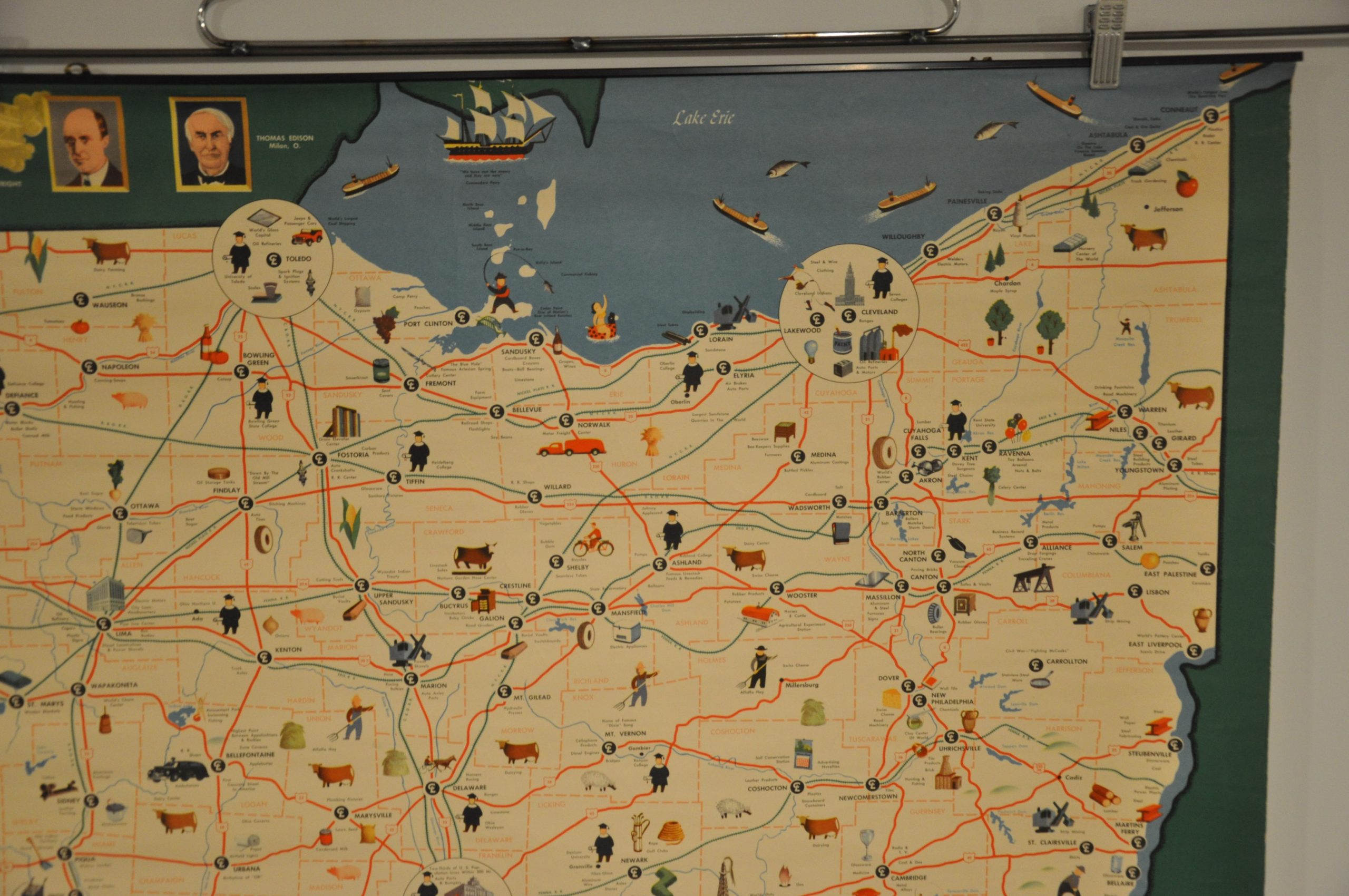
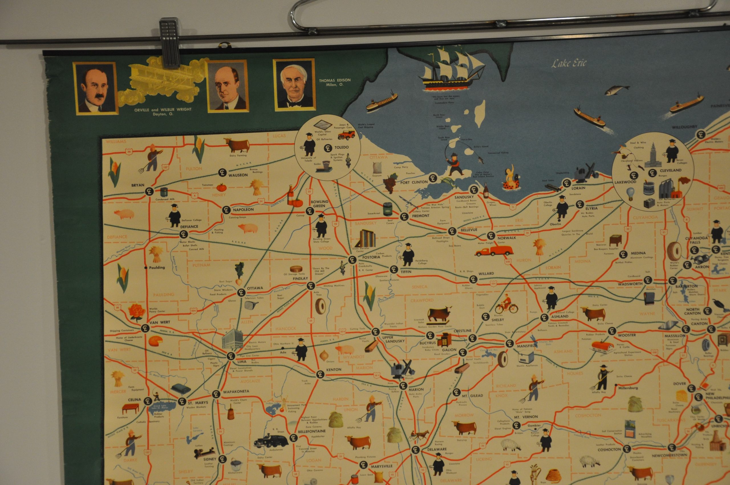
Admitted as the seventeenth state of the Union in 1803, Ohio has a long, rich history in the development of the United States. Portraits of seven presidents that call the Buckeye State home can be seen in the lower left; while additional famous Ohioans, the Wright Brothers and Thomas Edison, are illustrated at the top of the sheet.
The map highlights local transportation routes and includes a variety of vignettes that identify the local industries, recreational opportunities, and historic sites across the state. Small symbols also show the location of offices of the City Savings and Loan Company, the map’s sponsor.
It was published in 1953 to celebrate Ohio’s sesqui-centennial, and includes a large table of statistics, places of interest, and more at the bottom of the page.
Map Details
Publication Date: 1953
Author: City Loan and Savings Company
Sheet Width (in): 33.75
Sheet Height (in): 45.60
Condition: B+
Condition Description: Wall map affixed to a top metal roller. Moderate wear and extraneous wrinkling along the edges from where the map was previously rolled. Faint stains visible in several areas, notably the lower right corner, near the portraits of the presidents, and in the upper left corner. Remains in very good condition - the sheet is totally intact and retains vibrant color.
$125.00
1 in stock