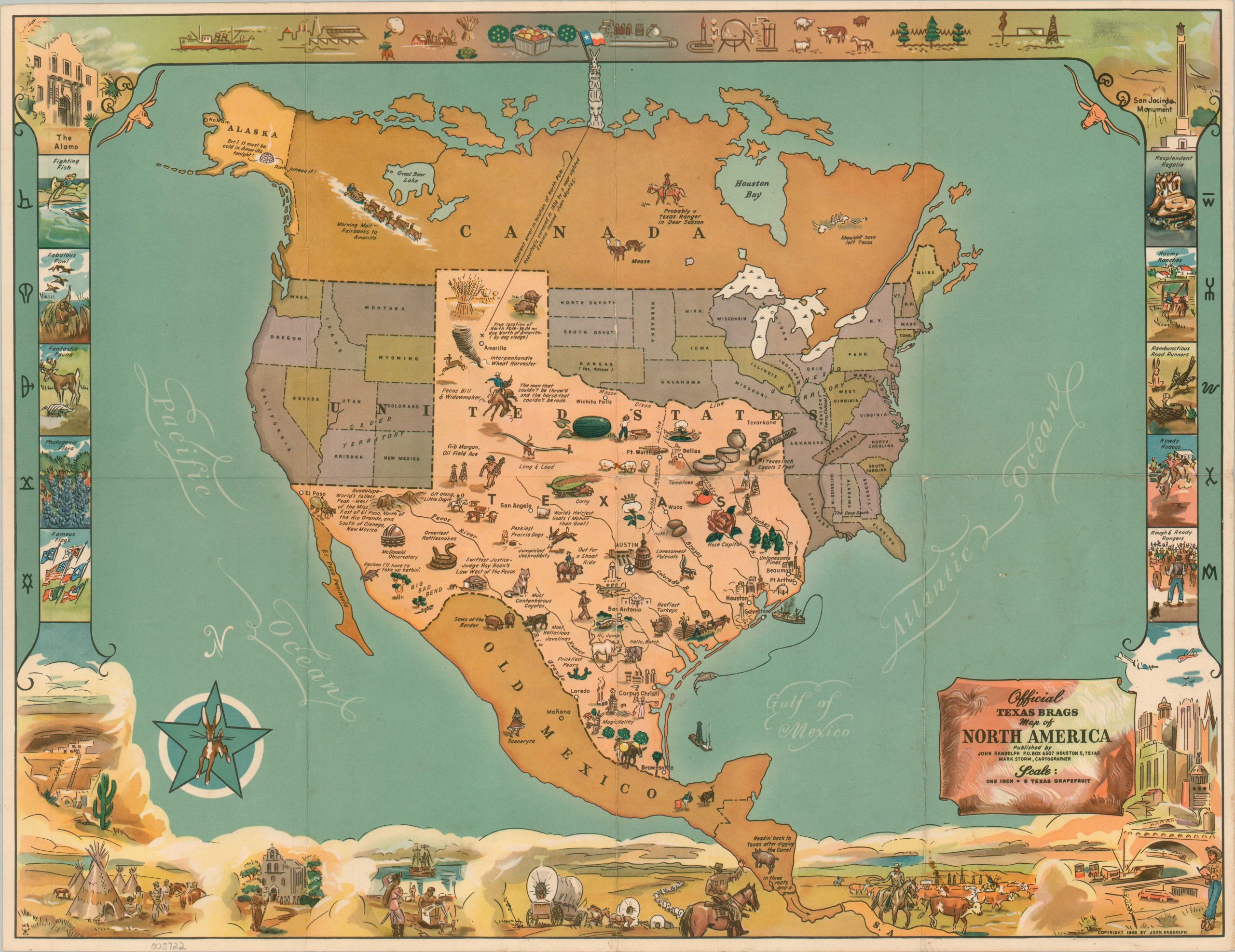
Official Texas Brags Map of North America
$425.00
Postwar pictorial that places Texas as the center of the continent.
1 in stock
Description
This uncommon pictorial map makes a valiant attempt to validate the assertion that ‘Everything is Bigger in Texas.’ The borders are shown extending from Old Mexico across the Canadian international boundary, with the rest of the United States pushed irreverently to the sides. Determining actual distances is impossible, as shown by the scale of one inch = 6 Texas grapefruit.
A host of superlatives describe the flora and fauna of the Lonestar State; home to the orneriest rattlesnakes, most hellacious javelinas, and the prickliest pears. Other vignettes celebrate iconic elements of the Wild West, geographic features, and major industries. The illustrated border presents several scenes that reflect the diverse history and cultural heritage of Texas. Alliterated captions and a variety of cattle brands add to the fun and whimsical nature of the map.
The first edition map was drawn by Mark Storm and published in Houston by John Randolph in 1948. A later example was also re-issued in 1967. Both are scarce on the market and represented in less than 10 institutions in OCLC.
Map Details
Publication Date: 1948
Author: Mark Storm
Sheet Width (in): 22.3
Sheet Height (in): 17.2
Condition: A-
Condition Description: Moderate creasing and wear along old fold lines, with a bit of extraneous wrinkling in the lower right. Scattered soiling visible in a few areas, most visible in the margins and near the title cartouche. Very good condition overall.
$425.00
1 in stock

