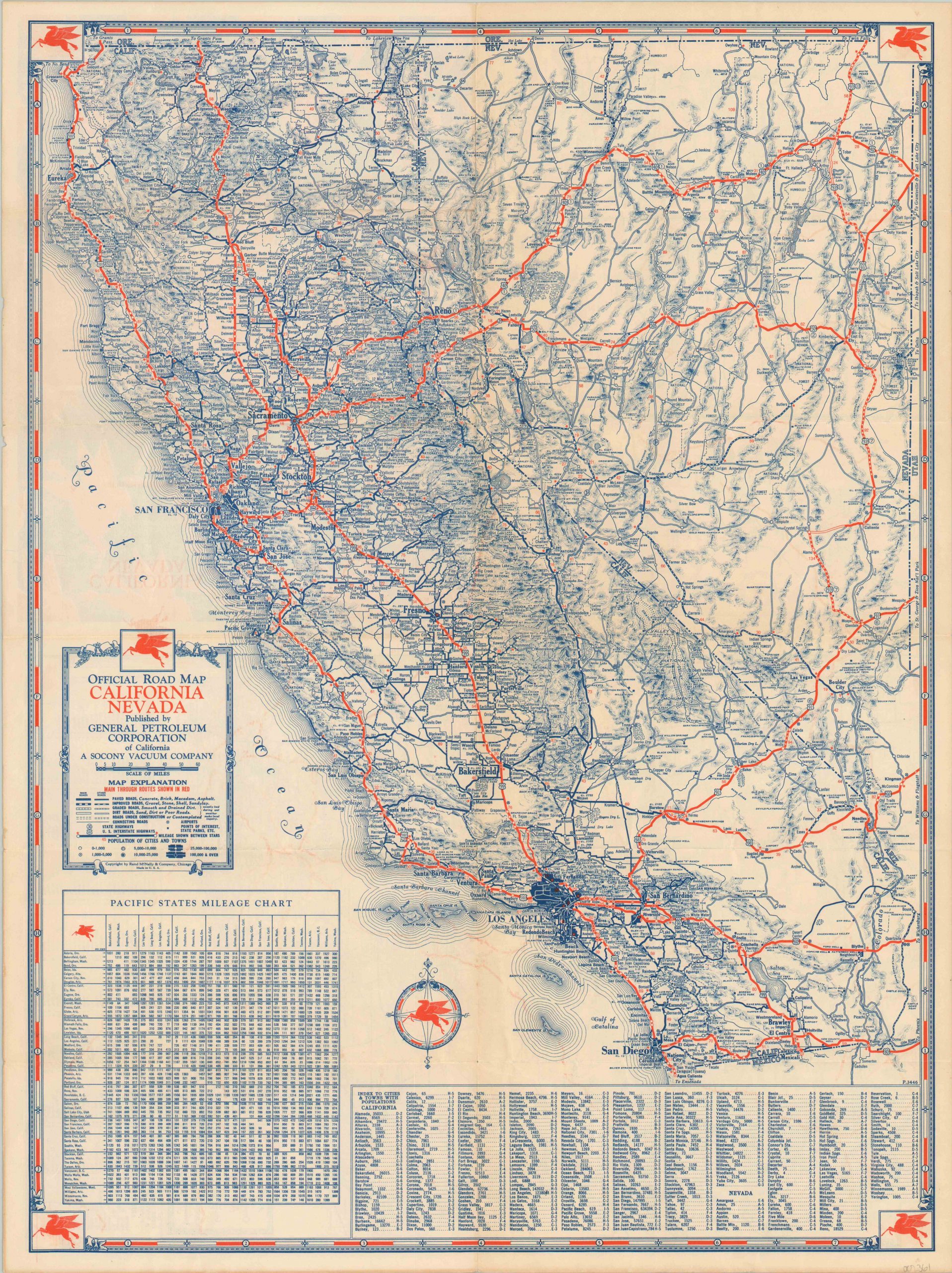
Official Road Map California Nevada [and Arizona]
$50.00
Attractive road map of California, Nevada, and Arizona from 1934.
1 in stock
Description
With a clear economic incentive to get motorists on the roads, oil companies were major producers of road maps from the earliest days of the automobile. This example covering three western states – California, Nevada, and Arizona – was issued by General Petroleum, a division of Socony Vacuum and producer of Mobilegas. (The distinctive Pegasus icon can be seen in each corner and within the compass rose).
The image highlights main routes in red, with lesser degrees of paved, unpaved, or dirt roads also shown according to the accompanying legend. Many points of interest are named, and a mileage chart of Pacific states and index to towns and cities are provided at the bottom of the sheet.
The verso shows a similar outline of the state of Arizona, plus three strip maps showing the route of the Pacific Coast Highway between Vancouver, British Columbia to Agua Caliente, Mexico. Published in Chicago by Rand McNally in 1934.
Map Details
Publication Date: 1934
Author: Rand McNally
Sheet Width (in): 17.75
Sheet Height (in): 23.75
Condition: B+
Condition Description: The sheet is slightly toned from age and has a bit of discoloration around the outer edges. Light wear and creasing along originally issued fold lines.
$50.00
1 in stock


