Official Map of the Union Pacific Railway
$450.00
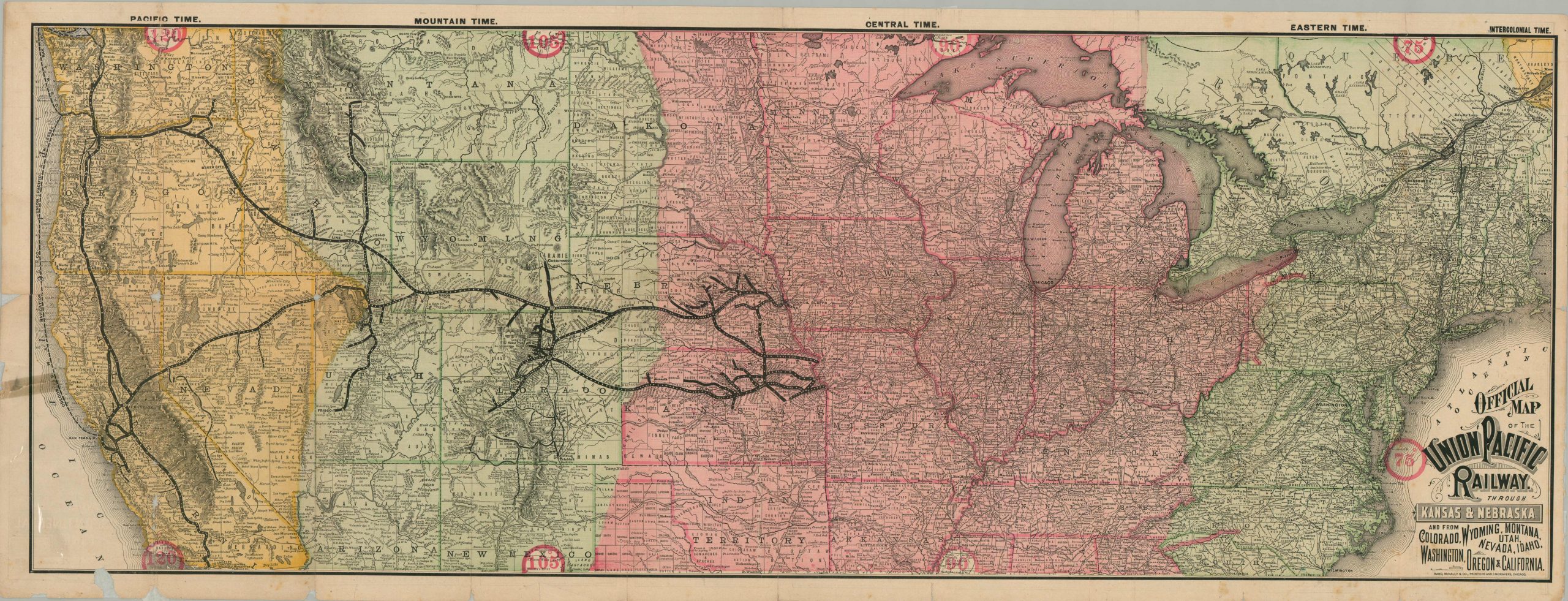
A magnificent railroad map of the United States promoting the lines of the Union Pacific Railway.
1 in stock
Description
Founded in 1862, the original Union Pacific Railroad was organized to construct the eastern portion of the First Transcontinental Railroad, completed in 1869. The company was rocked by the Credit Mobilier scandal in 1872 and the financial panic the following year, and in 1880 was purchased by Jay Gould, who merged the line with his existing Kansas Pacific railway and reorganized both into the Union Pacific Railway.
The resulting iteration of the Union Pacific (still in operation today after several more restructings) is what can be seen boldly presented on this map, published by Rand McNally in 1887. Lines of the UP and subsidiary railroads like the Oregon Short Line are shown in heavy black, along with a few limited selections from competitors like the Central Pacific, presumably to highlight the accessibility to certain regions further west. The underlying base map shows the rest of the United States rail system as a thick web growing steadily west. This does not reflect an absence of detail, however, as the western states are filled with interesting place names, landmarks, and hachure relief.
The country is colored according to time zones, which are labeled across the top of the sheet. This was a relatively novel development, only officially adopted by U.S. and Canadian rail companies in 1883. Intercolonial Time, upper right, was proposed to benefit the Intercolonial Railway in eastern Canada, but instead the railroad adopted Central Time. Standard time zones would not been enacted by U.S. law until 1918!
Map Details
Publication Date: 1887
Author: Rand McNally
Sheet Width (in): 44.50
Sheet Height (in): 17.00
Condition: B
Condition Description: Originally issued folded into a 20 panel brochure. Heavy wear along the fold lines and outer edges has been repaired and reinforced extensively on the verso. Other tears within the image have also been repaired using archival tape. Minor image loss in the margins, with a quarter section missing in the lower left corner. Image loss is also present at a few of the fold intersections, most notably in California. One old tape repair on the far left side of the sheet. Despite the issues, the map remains almost entirely intact, with vibrant stenciled color and a bold overall look. Very presentable.
$450.00
1 in stock