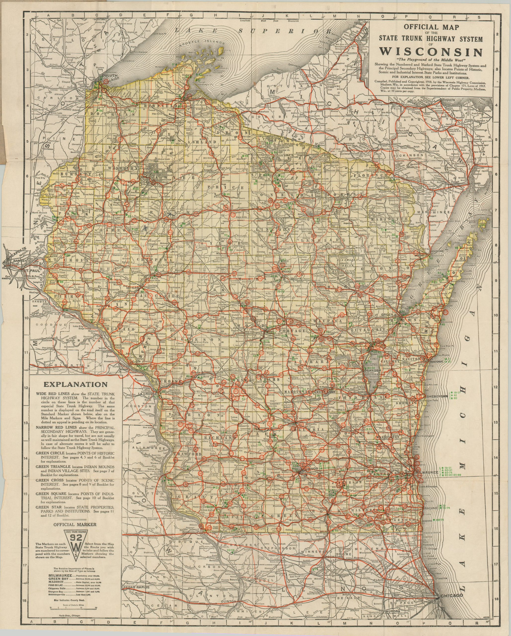
Official Map of the State Trunk Highway System in Wisconsin
$225.00
Roads of ‘The Playground of the Middle West’
1 in stock
Description
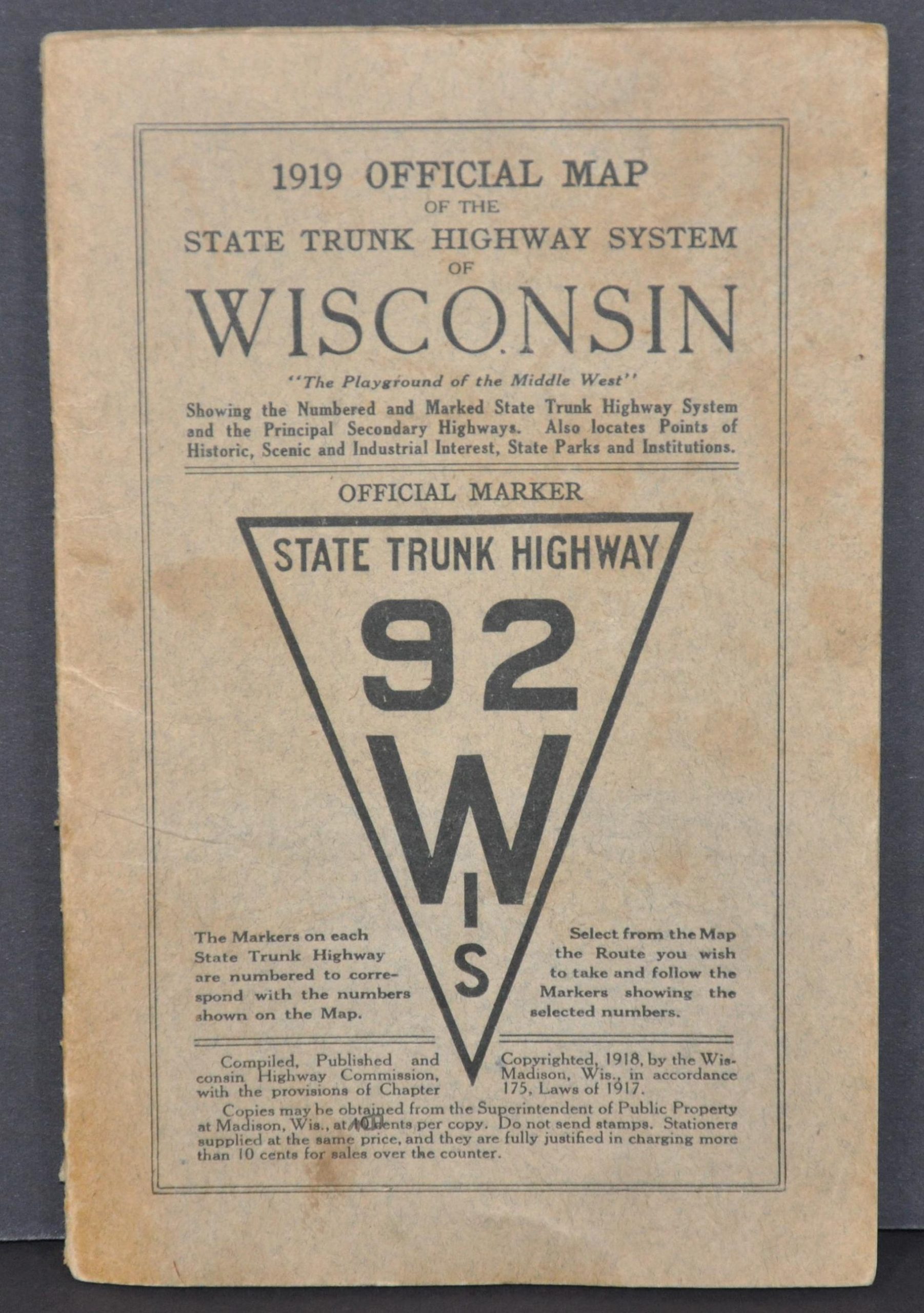
This detailed road map of Wisconsin shows the comprehensive network of state trunk highways introduced by the legislature in 1917 – the first state in the U.S. to do so. An image of the signage used to distinguish the trunk lines can be seen in the lower left. These newly numbered routes are identified with wide red lines, while secondary highways are shown with a narrower gauge.
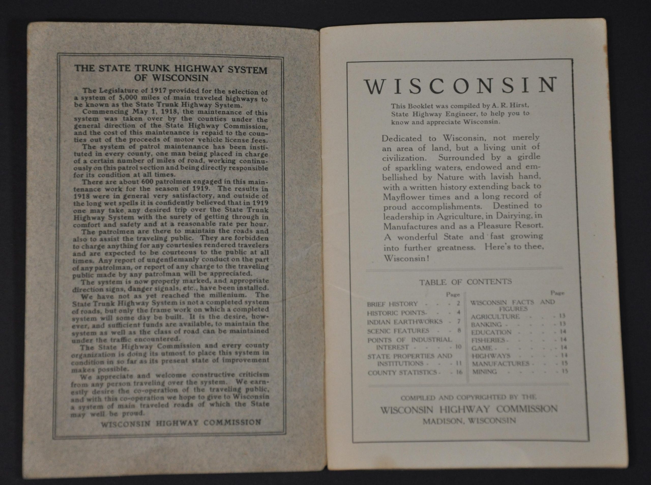
A variety of green symbols outlined in the legend (lower left) pinpoint the location of Indian Mounts, Points of Historic Interest, Points of Industrial Interest, State Properties, and Points of Scenic Interest. Place names are labeled in size in accordance with their ‘relative importance.’ The map is affixed to a 16-page booklet, compiled by A.R. Hirst, that provides further details on the locations of interest, regional economy, recreational opportunities, and transportation network of Wisconsin – ‘a wonderful state and fast growing into further greatness.”
A fascinating and ephemeral map that reflects the rapidly developing infrastructure across America immediately after World War I. According to Christopher Bessert of WisconsinHighways.org;
“Today, we take for granted the various systems of numbered highways across the country and around the world. But, as with anything, it all had to start somewhere, and that somewhere was Wisconsin when it comes to numbered highway systems. By the mid-1910s, the proliferation of “marked” highways was reaching crisis proportions. Countless automobile clubs, tire companies, oil companies and tourist associations erected signs along randomly-chosen routes. Sometimes these routes would veer far from the best or most direct path only to pass through a city which paid a fee to have the marked route run though the center of town. Wisconsin was home to many of these so-called “auto trails.”
In 1917, the Wisconsin State Legislature enacted a law which prohibited the marking and posting of any “trails” within the state without prior authorization from the state. By 1919, there was only one such “trail,” the Yellowstone Trail, marked within the state. (Various “auto trails” existed in other parts of the country through the mid-1920s, however.) As a replacement for the multitude of marked auto trails, the Wisconsin legislature, under Chapter 175, Laws of 1917, authorized the creation and signing of a numbered highway system, with the State Highway Commission as the overseeing agency.
By late 1917, with all surveys and field reconnaissance completed, the State Highway Commission laid out a system of 5,000 miles of numbered state highways on paper. During one week in May of 1918, all route designation signage was erected and Wisconsin became the first in the world with a signed system of route-numbered highways. Michigan, Wisconsin’s neighbor to the east, adopted a similar highway signing plan later in 1918. Since then, every state in the U.S., each Canadian province and almost every foreign nation around the world has laid out similar systems of numbered highways.
Source: Wisconsin Highways
Map Details
Publication Date: 1919
Author: Wisconsin Highway Commission
Sheet Width (in): 20
Sheet Height (in): 25
Condition: B+
Condition Description: Pocket map folded into 24 segments and affixed to original stiff gray paper wraps. Covers are moderately soiled and show some wear, but the map is in very good condition. A few separations along the fold lines have been repaired and reinforced on the verso and there are a few tiny edge tears.
$225.00
1 in stock