
Official Map of Cuba
$325.00
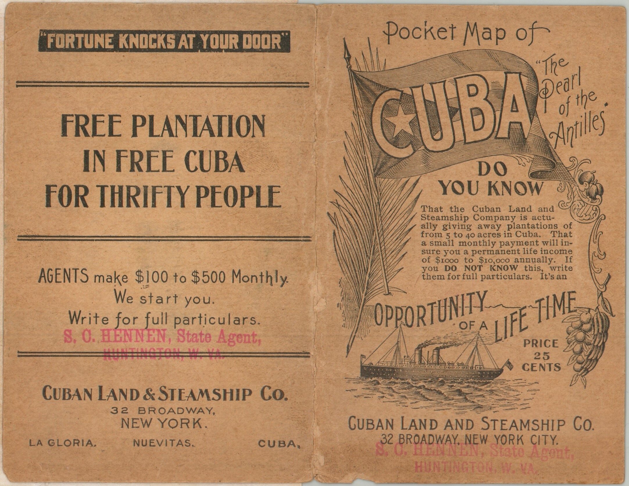
FREE PLANTATION IN FREE CUBA FOR THRIFTY PEOPLE
1 in stock


Description
This uncommon pocket map of Cuba, billed as the “Pearl of the Antilles,” was issued to promote the ambitious schemes of the Cuban Land & Steamship Company in the aftermath of the Spanish-American War. With the former Spanish colony under U.S. military occupation and its political and economic future still uncertain, American investors and entrepreneurs rushed to capitalize on new opportunities. The map provides a detailed overview of the island, identifying railroad lines, settlements, and prominent geographic features, with topography rendered in hachure to emphasize the rugged interior. Bright red lines highlight steamship routes to New Orleans, Miami, and New York, while red dots pinpoint properties owned by the Cuban Land & Steamship Company.
An inset in the upper right presents a street plan of La Gloria, a planned settlement on Cuba’s north coast. Founded in New York in 1899, the company acquired land along the island’s northern and southern coasts and promoted small agricultural holdings to prospective American settlers. The first major group arrived at La Gloria in January 1900, attracted by promises of affordable land, a favorable climate, and agricultural opportunity. The reality proved far more difficult than the promotional material suggested: settlers encountered a muddy, undeveloped landscape with limited provisions and infrastructure. Although many struggled or abandoned their plans, a community took root and survived for decades. La Gloria was one of nearly three dozen American colonization projects attempted in Cuba between the end of the Spanish-American War and 1903, when the U.S. military occupation ended and Cuban independence was established.
The map was engraved in New York by Bormay & Company and published in 1899 by the Cuban Land & Steamship Company. A rubber stamp on the front cover identifies State Agent S. O. Hennen of Huntington, West Virginia, offering a small but useful clue to the company’s nationwide promotional network. Further text reads, “DO YOU KNOW…That a small monthly payment will insure you a permanent life income of $1,000 to $10,000 annually” – an excellent example of the misleading language used to lure potential settlers.
Map Details
Publication Date: 1899
Author: Bormay & Company
Sheet Width (in): 20.60
Sheet Height (in): 13.90
Condition: B-
Condition Description: Color printed map on a single-sided sheet, folded and affixed to original stiff paper wraps. Heavy wear along folds, including numerous tears and splits, repaired on the verso with archival tape. Soiling and some paper discoloration in the center left, from the adhesive used on the sheet. Some transference in the corners as a result. Fair to good condition overall.
$325.00
1 in stock